Rail
 There are two famous tourist trains in Arizona.
The most famous is the
Grand Canyon Railway
from Williams, Arizona, to the south rim of the Grand Canyon.
I haven't taken that train, but it goes through
sixty miles (100 Km) of the most boring terrain in the state.
I'm told the best part is where they stage a fake train robbery
on the way back to Williams.
I tell myself I should get my own horses and ancient-style six-shooters
and rob the train for real about two miles north of the fake robbery.
Knowing they were going to be robbed as part of the show,
everybody would cheerfully give me
their money, credit-cards, and jewelry
before they found out that my robbery wasn't fake.
There are two famous tourist trains in Arizona.
The most famous is the
Grand Canyon Railway
from Williams, Arizona, to the south rim of the Grand Canyon.
I haven't taken that train, but it goes through
sixty miles (100 Km) of the most boring terrain in the state.
I'm told the best part is where they stage a fake train robbery
on the way back to Williams.
I tell myself I should get my own horses and ancient-style six-shooters
and rob the train for real about two miles north of the fake robbery.
Knowing they were going to be robbed as part of the show,
everybody would cheerfully give me
their money, credit-cards, and jewelry
before they found out that my robbery wasn't fake.
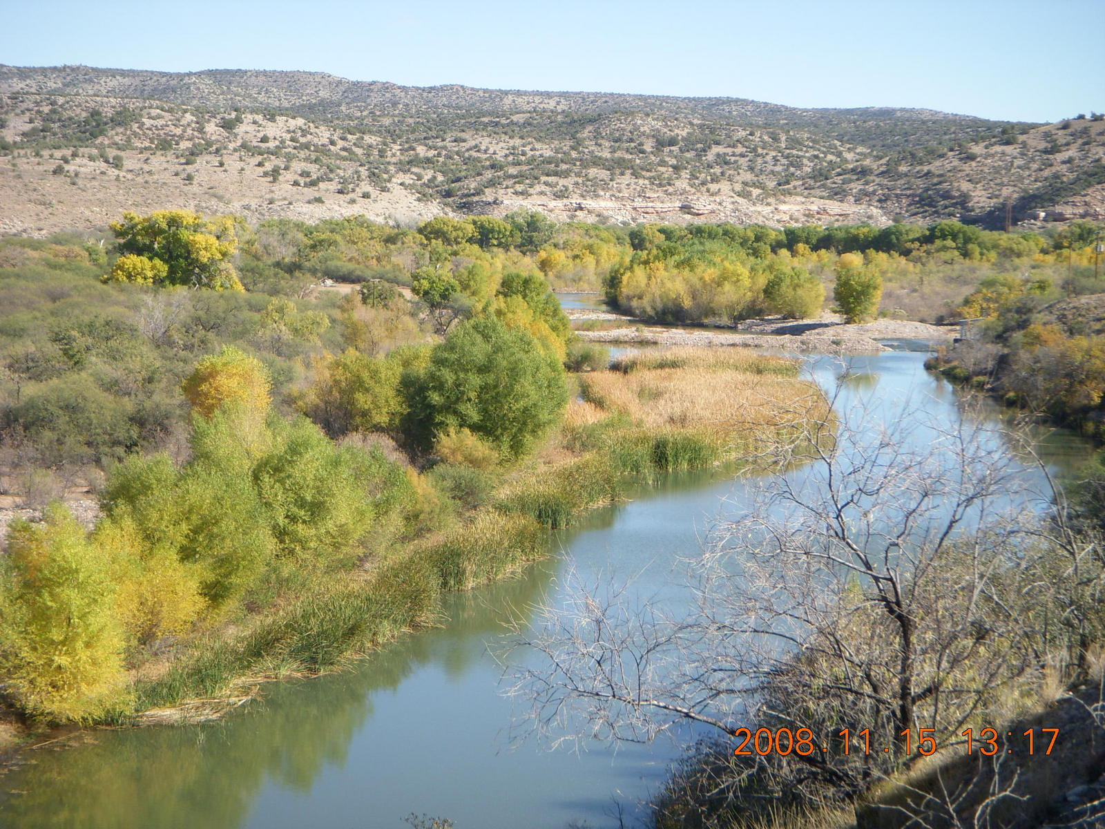
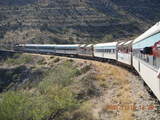
The other, less-famous train is the
Verde Canyon Railroad
that runs from Clarkdale, Arizona,
north to Pickensville, twenty miles and two hours north
in the canyon along the river.
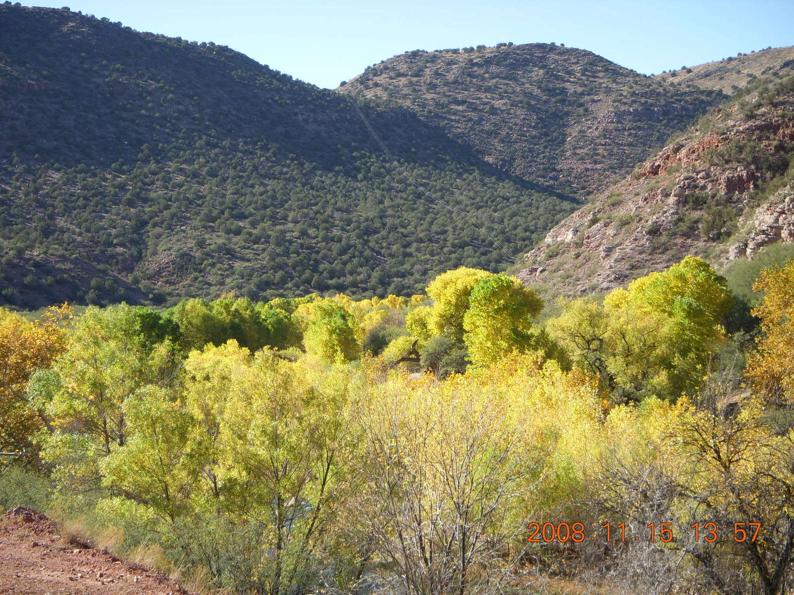
Peak foliage is still weeks away,
but the trees had lots of yellow amid the green.
When back-lit by the sun,
the yellow leaves seem to glow
sort-of the same way cholla cactus glow
in the low morning sun in the desert.
I took plenty of
pictures
from the train.
 Hey, I'm not a
foamer,
but I enjoy a train as much as the next person.
There's something relaxing about rolling on rails,
a feeling of a whole world in motion
that doesn't happen in a car or a small airplane
and there's an intimacy with the environment along the way
that doesn't happen in an airliner.
It's like that Steve Goodman song
City of New Orleans
made famous by
Arlo Guthrie.
I've taken trains in America, Europe, Australia, and Africa.
Hey, I'm not a
foamer,
but I enjoy a train as much as the next person.
There's something relaxing about rolling on rails,
a feeling of a whole world in motion
that doesn't happen in a car or a small airplane
and there's an intimacy with the environment along the way
that doesn't happen in an airliner.
It's like that Steve Goodman song
City of New Orleans
made famous by
Arlo Guthrie.
I've taken trains in America, Europe, Australia, and Africa.
The train boarded fifteen minutes before schedule departure
and left right on time.
There are open-air cars with seats in the middle
and viewing rails on the sides.
In the sun at 22°C (72°F) in the
10 miles per hour (16 Km/hour) train motion,
it was thoroughly pleasant outside
and the views were outstanding.
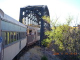
After the two hour north journey,
the engine is relocated to the south end of the train
and the journey is reversed.
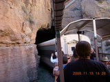 They also had people on the train
who knew all about the route.
Our guy on the open-air car was a locally-born, lifelong resident
named Fermin (on his badge).
He told us about ancient dwellings,
interesting rock formations,
and the mining enterprise that created the rail line.
The entire line is 38 miles (61 Km)
connecting to the main line of
the Burlington Northern Sante Fe (BNSF) Railway.
Fermin pointed out some bald-eagle nests and even a bald eagle
that was pretty hard to see with the rocks behind.
They also had people on the train
who knew all about the route.
Our guy on the open-air car was a locally-born, lifelong resident
named Fermin (on his badge).
He told us about ancient dwellings,
interesting rock formations,
and the mining enterprise that created the rail line.
The entire line is 38 miles (61 Km)
connecting to the main line of
the Burlington Northern Sante Fe (BNSF) Railway.
Fermin pointed out some bald-eagle nests and even a bald eagle
that was pretty hard to see with the rocks behind.
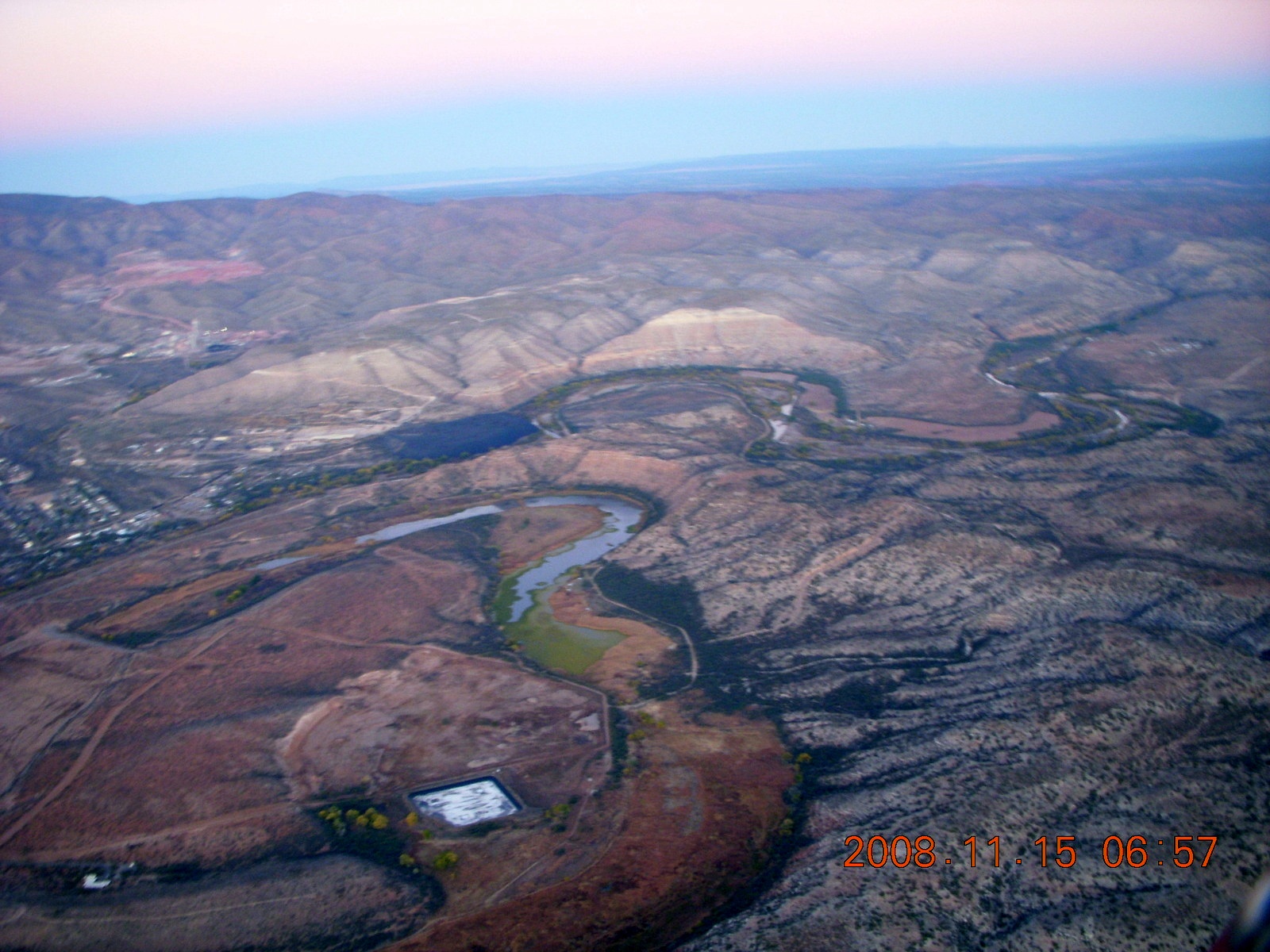
I got a ride back to Cottonwood Airport
(P52).
from a pilot friend,
Dave, who was taking the train the same day,
and then I flew back to Phoenix Deer Valley Airport
(DVT)
as the sun set.
They say an Englishman laughs at a joke three times,
once when he hears it,
once when it's explained to him,
and, finally, when he understands it.
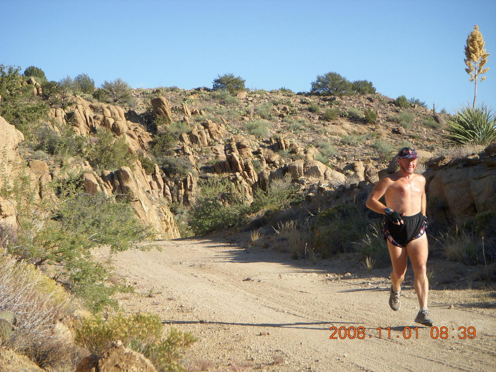
Well,
I got to experience the beautiful Verde River canyon
three times in one day,
once from the air,
once running along a dirt road,
and once from a train.
THE ADAM HOME PAGE
adam@the-adam.com
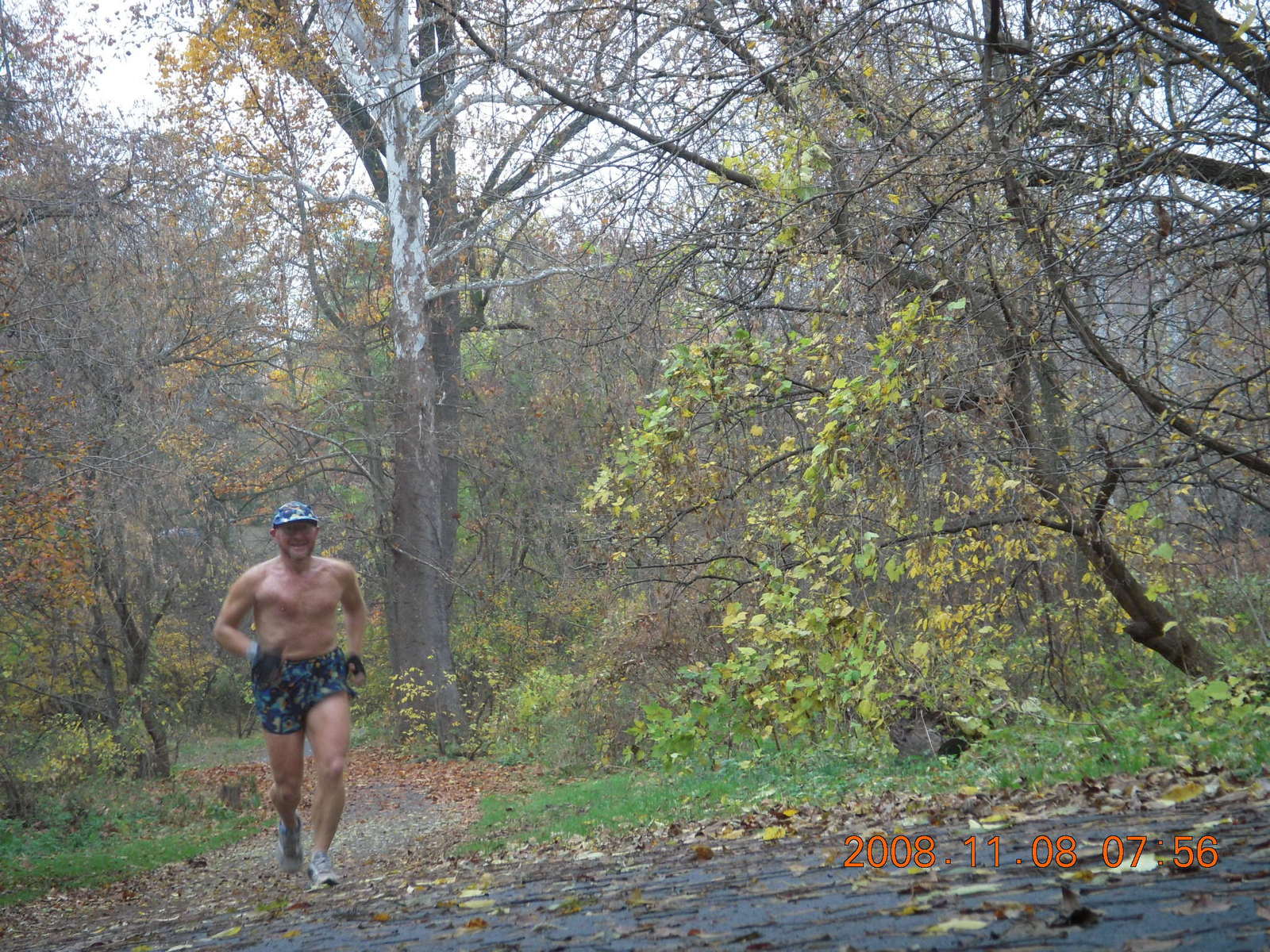
 As I said in
another web page,
I like to mix my aviation and aerobic hobbies
by replacing the
$100 hamburger
with a flight and a run.
I've done them in New Jersey,
Pennsylvania,
Minnesota,
New York State,
Wisconsin,
Florida,
Texas,
Oklahoma,
Georgia,
North Carolina,
Kentucky,
Arizona,
and California.
Just as the marathon wasn't enough for the extreme-sport runners
so they invented the Ironman triathlon,
I've extended the aviation-aerobic biathlon
one step further.
This is my aviation triathlon,
a fly-run-rail triple adventure.
As I said in
another web page,
I like to mix my aviation and aerobic hobbies
by replacing the
$100 hamburger
with a flight and a run.
I've done them in New Jersey,
Pennsylvania,
Minnesota,
New York State,
Wisconsin,
Florida,
Texas,
Oklahoma,
Georgia,
North Carolina,
Kentucky,
Arizona,
and California.
Just as the marathon wasn't enough for the extreme-sport runners
so they invented the Ironman triathlon,
I've extended the aviation-aerobic biathlon
one step further.
This is my aviation triathlon,
a fly-run-rail triple adventure.