|
|
|
|

|
|
|
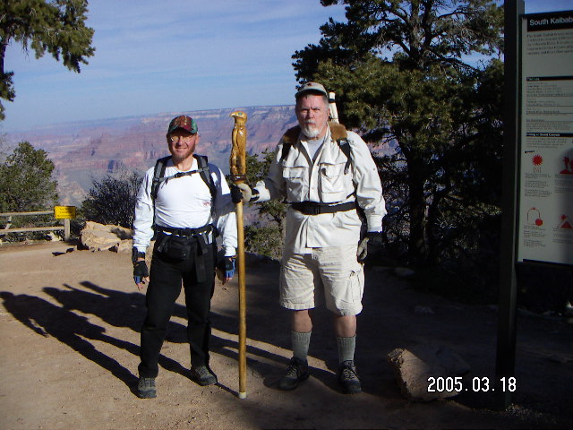
2005 March 18-19
|
|
|
|
|
|
|
|
|
 Let's be realistic.
Most people come to a web site on the
Grand Canyon
to look at the pictures, which are pretty nice,
rather than to read about the details of
a perfectly-usual two-day hiking experience.
On the other hand,
if you're one of those who has been to
Phantom Ranch,
the bed and board at the bottom,
or one of those planning to go,
then the text here might be a worthwhile read.
Let's be realistic.
Most people come to a web site on the
Grand Canyon
to look at the pictures, which are pretty nice,
rather than to read about the details of
a perfectly-usual two-day hiking experience.
On the other hand,
if you're one of those who has been to
Phantom Ranch,
the bed and board at the bottom,
or one of those planning to go,
then the text here might be a worthwhile read.
As I have said
before,
the
Grand Canyon
is about looking down,
Zion is about looking up,
and Bryce is about eye-to-eye intimacy.
Hiking the Canyon from top to bottom and back to the top
has increased my appreciation for the Canyon
and hasn't changed my opinion about looking down.
My eye is drawn downward flying over it and hiking it.
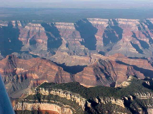
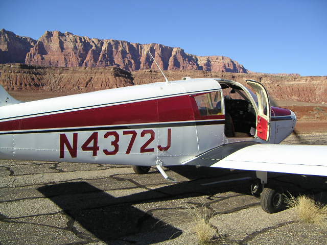
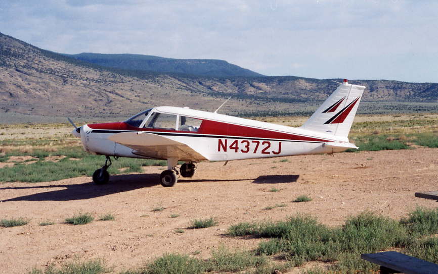
My first flight over the Grand Canyon was
a six-hour flying adventure from
Jefferson County Airport
(BJC)
as a newly-licensed private pilot with J.P. in 1988.
(It's hard to believe that was seventeen years ago.)
I have flown my own airplane over the Canyon a dozen times
(recalling my logbook and counting on my fingers)
starting the first weekend
after I moved to Scottsdale in 2003 October.
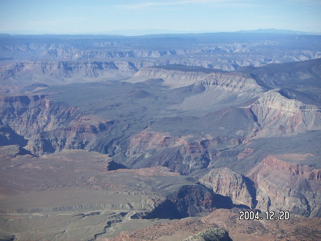
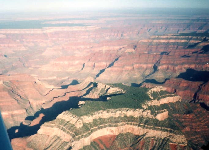
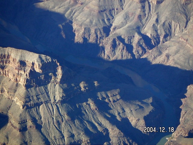
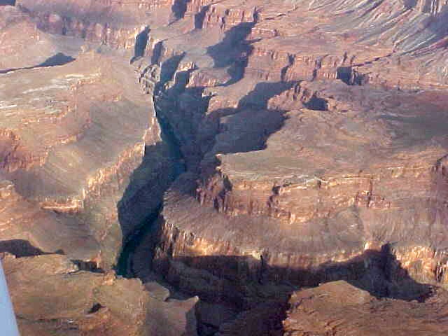
Seeing the Canyon from the air is
to experience its enormity and its detail.
Coming from the south,
from about fifty miles away
there is a growing gap in the ground ahead
and growing anticipation in the cockpit
that something special is out there.
The north rim starts to become clearer
to develop visible features,
and then the Canyon itself comes into view.
From rim to rim itself is just over five minutes,
but following side canyons prolongs the beauty
to fifteen unforgettable minutes in the air.
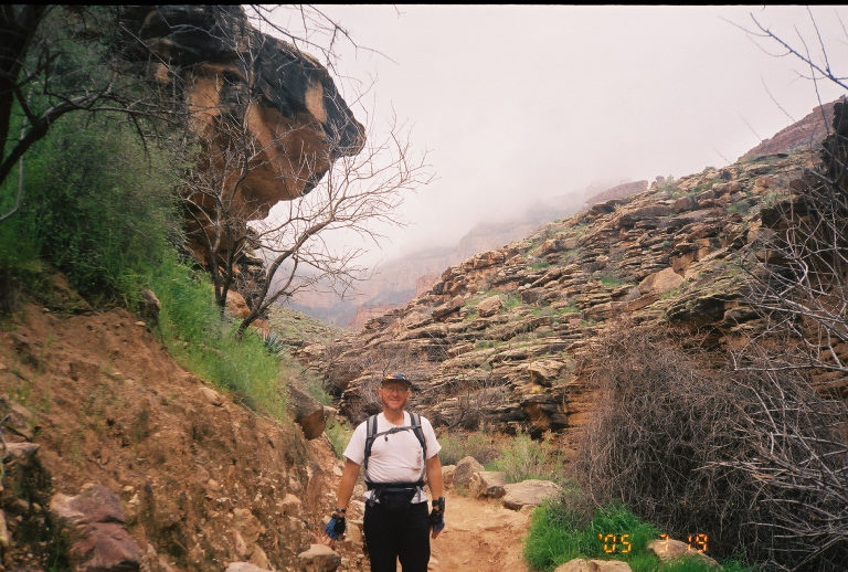
The itinerary is simple,
drive from Scottsdale early Friday morning,
hike down the South Kaibab trail on Friday,
spent the night at Phantom Ranch,
hike up Bright Angel trail Saturday,
and drive home.
The South Kaibab trail is also about
open space and lack of shade and water.
We went down South Kaibab for the views
and so we would have warm sunshine
during the colder morning.
We carried our own water,
a good idea on a long hike in a remote place,
and we drank it all on the way down.
Along the way down,
we ran into Betsy,
a ranger on her way to work.
You or I might complain about a 45-minute commute
while hers is four or five hours,
but she wasn't complaining about it.
The people who work there hike there
and working at the bottom means getting to the bottom and back.
I forget the exact numbers,
but her schedule was something like six days on the job
and four days off which she often spent traveling.
They have telephone, electricity, and water wired and piped in
at Phantom Ranch.
Everything else comes and goes carried by hikers or mules.
Water comes to Phantom Ranch from Roaring Springs
on the north rim and goes back up to the south rim.
I find it amazing the south rim pipes its water
down so far and up so far, but they do.
Night was ten people on bunk beds sharing a shower, sink, and stall.
Somehow we all managed to get some sleep, some more than others.
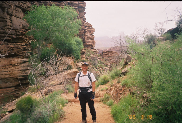
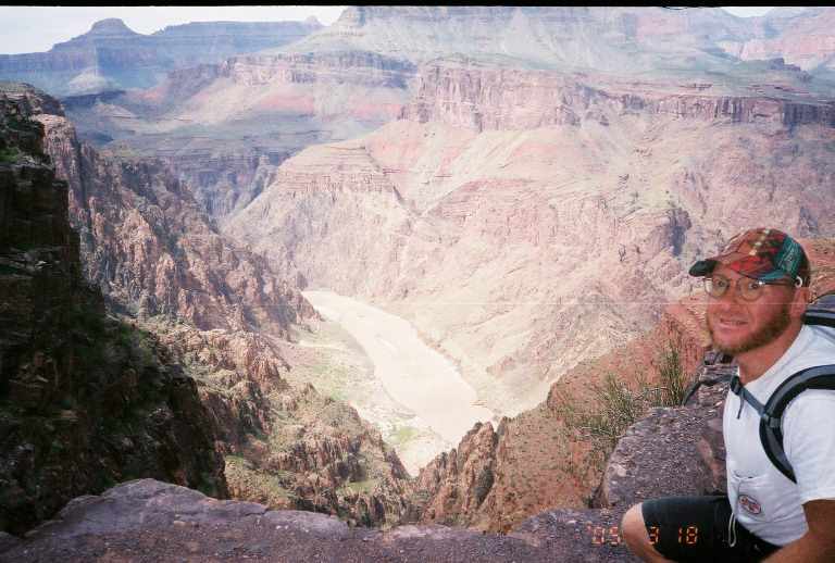
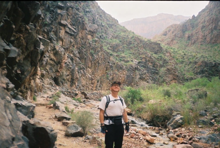
The Bright Angel trail goes along the river
for about a mile
and then begins its climb,
longer and gentler than Kaibab.
Greg chose our itinerary to favor
the South Kaibab views and sunshine on descent and
the Bright Angel shade and longer, less intense climb,
one shared by many other hikers as well.
The views from Bright Angel are narrower, less expansive
than those from South Kaibab
because the Bright Angel trail climbs
a narrow side canyon of its own.
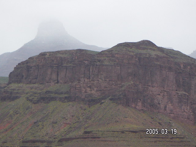
The views behind us to the inner canyon
became cloudy-gray and mysterious as we ascended
until, finally, Greg and I were in the clouds
ourselves [3].
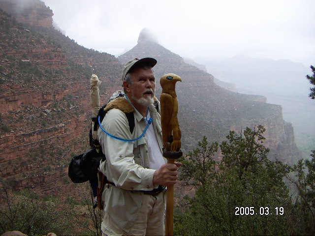
It was a great trip and I thank Greg for twisting my arm,
it didn't take much torque,
to getting me to take this trip.
I have friends who have taken the trip
down one day and back up the next,
but this is my first time.
Based on how sore I was the next few mornings,
I put the effort somewhere between a half-marathon race
and a full standard marathon race of 42.2 Km (26.2 miles).
The difference between the Grand Canyon ache
and a running-race ache
is that the muscles are sufficiently different
that I could run fairly easily two days later.
Three days later I did a short hike after work
a mile up Camelback here in Scottsdale
and the hike wasn't so hard, neither up nor down,
but the six-mile bicycle ride from Camelback to my home
was very long and tiring.
Now I'm thinking about my next Grand Canyon hike.
1.
I'm figuring that sold-out Phantom Ranch
has a capacity of not quite a hundred sleepovers,
some of those are the same people staying multiple nights,
around 30 thousand per year.
Double that figure to account for people camping
and we get about 60 thousand people going to the bottom.
This doesn't count day hikers whose risk
is substantially less than the overnight crowd,
although I wouldn't be surprised if
unprepared day-hikers constitute a significant fraction
of the 500 rescues each year.
2.

 This particular trip isn't a flying adventure per se.
My neighbor,
Greg,
drove us to
the Bright Angel trail head,
we took a shuttle bus to
the South Kaibab trail head,
we hiked in,
spent the night,
hiked out,
and drove home.
However, I'm going to include it in my list of flying adventures
since I have flown over the Canyon several times
going back as far as 1988 January
with J.P. Harrison,
the flight instructor I flew with in Denver back then,
whose wife Kulpana Chawla
was on the ill-fated Columbia space shuttle.
Since I have celebrated the grandeur of the Canyon from the air,
I consider my own association part of my aviation experience
and, therefore, hiking the Canyon part of my flying adventures.
The next time I fly over it I'll be looking for where I hiked.
This particular trip isn't a flying adventure per se.
My neighbor,
Greg,
drove us to
the Bright Angel trail head,
we took a shuttle bus to
the South Kaibab trail head,
we hiked in,
spent the night,
hiked out,
and drove home.
However, I'm going to include it in my list of flying adventures
since I have flown over the Canyon several times
going back as far as 1988 January
with J.P. Harrison,
the flight instructor I flew with in Denver back then,
whose wife Kulpana Chawla
was on the ill-fated Columbia space shuttle.
Since I have celebrated the grandeur of the Canyon from the air,
I consider my own association part of my aviation experience
and, therefore, hiking the Canyon part of my flying adventures.
The next time I fly over it I'll be looking for where I hiked.
 As of 2005,
the Grand Canyon is considered
special use airspace
up to 14500 feet (4400 meters, 600 millibars)
which is higher than my Piper Cherokee 140 likes to fly.
There are corridors
with a minimum altitude over the most spectacular views
of 10500 feet (3200 m, 690 mb) coming south
and 11500 feet (3500 m, 670 mb) going north,
a hefty climb for my bird.
As of 2005,
the Grand Canyon is considered
special use airspace
up to 14500 feet (4400 meters, 600 millibars)
which is higher than my Piper Cherokee 140 likes to fly.
There are corridors
with a minimum altitude over the most spectacular views
of 10500 feet (3200 m, 690 mb) coming south
and 11500 feet (3500 m, 670 mb) going north,
a hefty climb for my bird.
 I'm not normally a fatalist,
I usually insist on a hand in my own destiny,
and
I flew around Lake Michigan and the Gulf of Mexico
because I didn't want to get wet if my one-and-only engine
stopped running.
The Grand Canyon itself has few airplane-friendly landing spots
and there are a few minutes where all of them are out of reach
in the event of engine failure.
(Hey, I used to drive to work on the Long Island Expressway
where a car-motor failure would likely be just as fatal for me
as it was for Harry Chapin.)
The view is worth it, believe me,
or, better yet,
get in an airplane out here and see it for yourself.
The pictures never do it justice.
I'm not normally a fatalist,
I usually insist on a hand in my own destiny,
and
I flew around Lake Michigan and the Gulf of Mexico
because I didn't want to get wet if my one-and-only engine
stopped running.
The Grand Canyon itself has few airplane-friendly landing spots
and there are a few minutes where all of them are out of reach
in the event of engine failure.
(Hey, I used to drive to work on the Long Island Expressway
where a car-motor failure would likely be just as fatal for me
as it was for Harry Chapin.)
The view is worth it, believe me,
or, better yet,
get in an airplane out here and see it for yourself.
The pictures never do it justice.
 When we got back from
Zion,
Greg
and I decided we would do the Grand Canyon someday.
By 2004 December we decided that the next time
Greg could get two beds at the bottom
at Phantom Ranch,
the bed and board at the bottom,
I would take time off from work and we would go.
A few weeks ago Greg e-mailed me that
2005 March 18, Friday, was the day,
somebody's cancellation, two beds at the bottom,
no food unless we got lucky.
Two days before our trip,
somebody else must have canceled something
because we got reservations for dinner and breakfast.
When we got back from
Zion,
Greg
and I decided we would do the Grand Canyon someday.
By 2004 December we decided that the next time
Greg could get two beds at the bottom
at Phantom Ranch,
the bed and board at the bottom,
I would take time off from work and we would go.
A few weeks ago Greg e-mailed me that
2005 March 18, Friday, was the day,
somebody's cancellation, two beds at the bottom,
no food unless we got lucky.
Two days before our trip,
somebody else must have canceled something
because we got reservations for dinner and breakfast.
 The Grand Canyon is scary and dangerous.
I remember asking a ranger at Zion
how great the danger actually was
on all these scary-looking hikes
and he said (as I recall)
that they lost four people in six years
at 2.5 million people per year.
Grand Canyon rangers rescue about 500 people per year
out of tens of thousands [1],
maybe one percent.
This is Greg's twenty-eighth trip,
he's actually a regular customer at Phantom Ranch,
so I have the advantage of his experience,
and I'm generally in better physical condition
as his knees put an end to his running some time ago.
That means I wouldn't be spending all those hours
trying to keep up with a faster hiker,
which is not a pleasant way to experience the Grand Canyon.
The Grand Canyon is scary and dangerous.
I remember asking a ranger at Zion
how great the danger actually was
on all these scary-looking hikes
and he said (as I recall)
that they lost four people in six years
at 2.5 million people per year.
Grand Canyon rangers rescue about 500 people per year
out of tens of thousands [1],
maybe one percent.
This is Greg's twenty-eighth trip,
he's actually a regular customer at Phantom Ranch,
so I have the advantage of his experience,
and I'm generally in better physical condition
as his knees put an end to his running some time ago.
That means I wouldn't be spending all those hours
trying to keep up with a faster hiker,
which is not a pleasant way to experience the Grand Canyon.

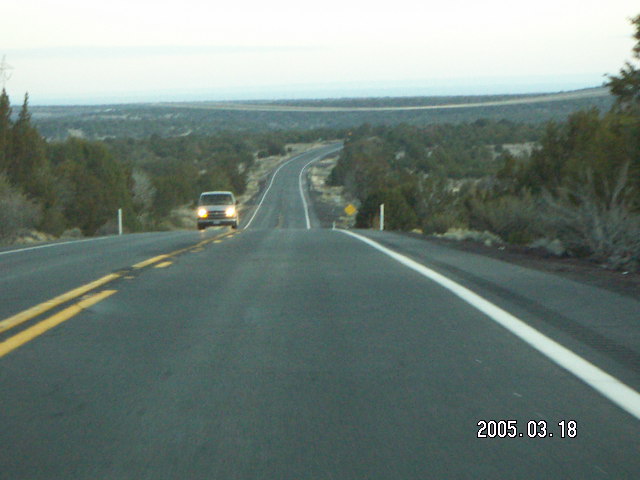
 Our four a.m. departure was uneventful
once I grabbed all the stuff I thought
I would need [2]
and tossed it the trunk of Greg's little red Honda.
As my analogue camera batteries had not been replaced
for a long time,
I put an extra set of batteries for it in my backpack.
Arizona Route 101 to Interstate-17 North
to I-40 West to U.S. Route 180 North
past Valle Airport
(40G)
and Grand Canyon Airport
(GCN)
to Bright Angel Lodge
and a shuttle bus took us to the South Kaibab trailhead.
Our four a.m. departure was uneventful
once I grabbed all the stuff I thought
I would need [2]
and tossed it the trunk of Greg's little red Honda.
As my analogue camera batteries had not been replaced
for a long time,
I put an extra set of batteries for it in my backpack.
Arizona Route 101 to Interstate-17 North
to I-40 West to U.S. Route 180 North
past Valle Airport
(40G)
and Grand Canyon Airport
(GCN)
to Bright Angel Lodge
and a shuttle bus took us to the South Kaibab trailhead.
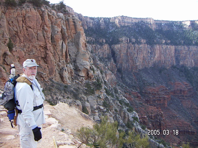
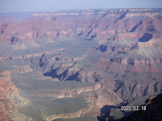
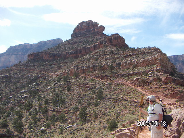
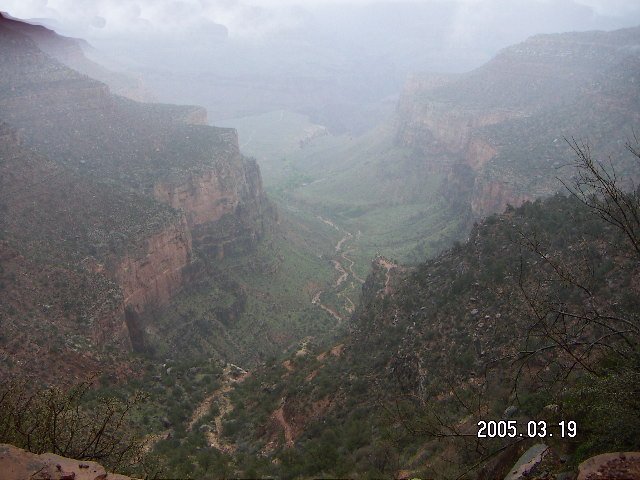
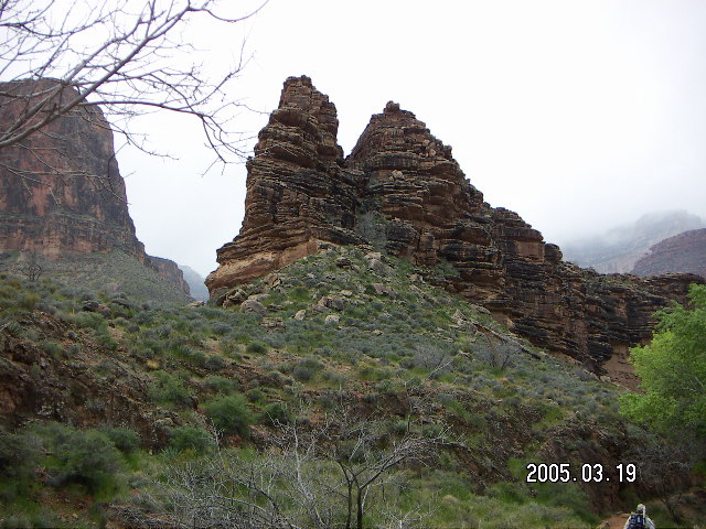
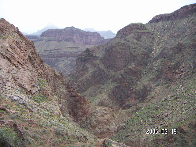
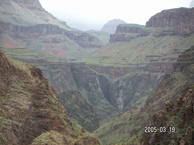
 The South Kaibab trail is about open space and wide vistas.
The enormity of the environment is thrust upon the hiker
descending along plateaus and wide-open switchbacks.
They say a picture is worth a thousand words
(or a JPEG file is worth 1024 words of text),
but neither words nor pictures convey the experience.
The Canyon seems to grow larger and more magnificent
as one progresses into it.
Another way of looking at it
is that the bottom seems further and further away
as one gets closer to it.
The South Kaibab trail is about open space and wide vistas.
The enormity of the environment is thrust upon the hiker
descending along plateaus and wide-open switchbacks.
They say a picture is worth a thousand words
(or a JPEG file is worth 1024 words of text),
but neither words nor pictures convey the experience.
The Canyon seems to grow larger and more magnificent
as one progresses into it.
Another way of looking at it
is that the bottom seems further and further away
as one gets closer to it.
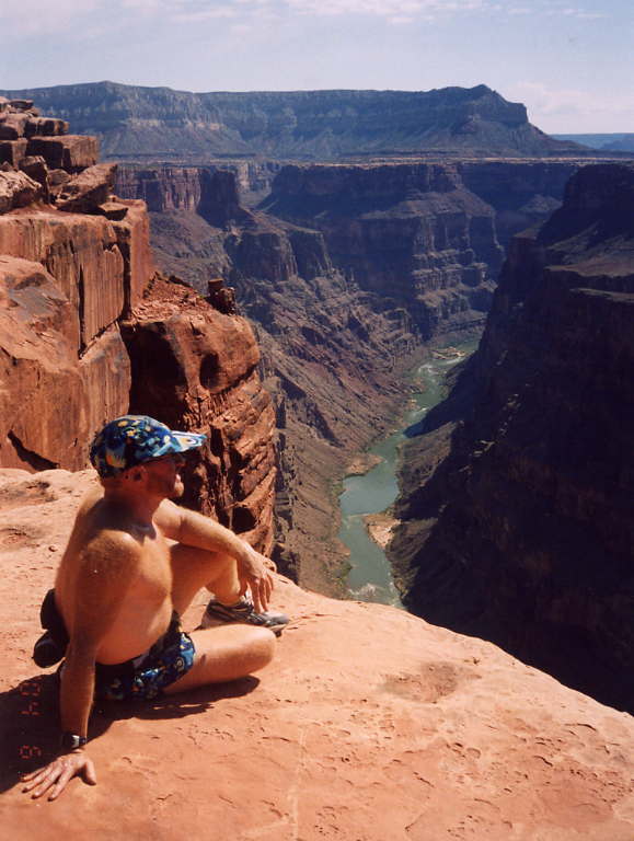
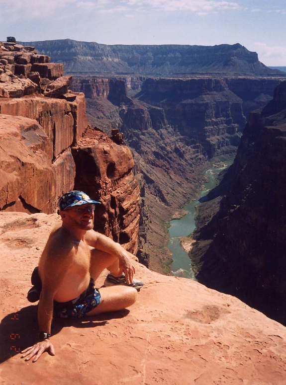
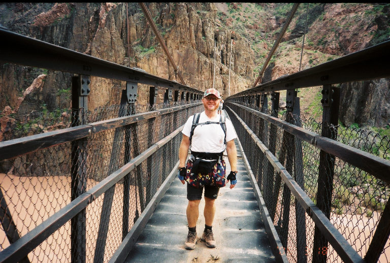
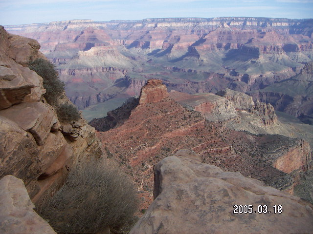
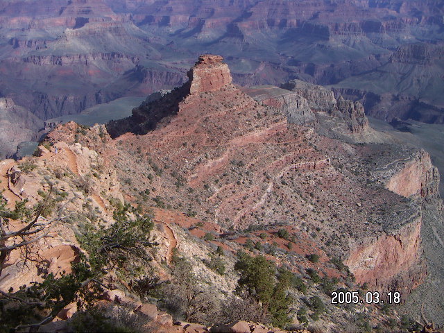
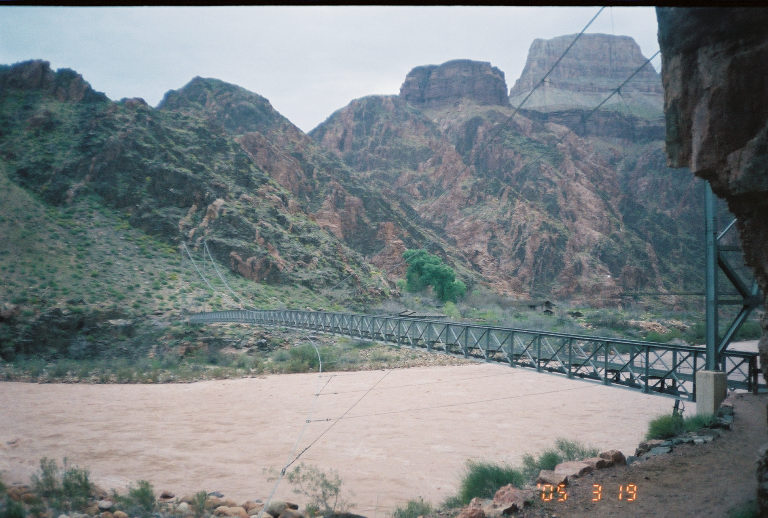
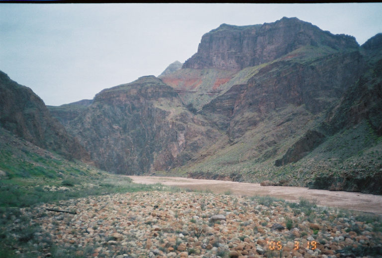
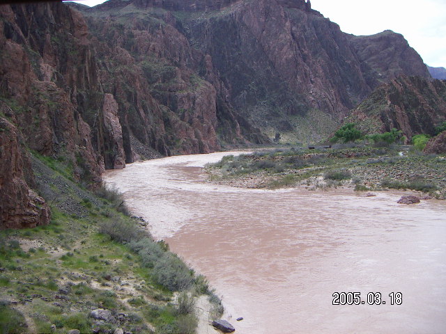
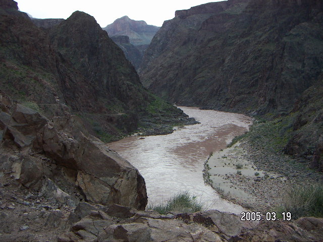
 We could see the river, the bridges across,
and Phantom Ranch from the top of the inner canyon.
Greg and I had been joined by Julian who hiked and chatted with us.
We ran into some geologists who were taking notes
and who remembered Greg from one of their previous trips.
Greg is a regular at the Grand Canyon
as this was his twenty-eighth hike to and from the bottom.
We could see the river, the bridges across,
and Phantom Ranch from the top of the inner canyon.
Greg and I had been joined by Julian who hiked and chatted with us.
We ran into some geologists who were taking notes
and who remembered Greg from one of their previous trips.
Greg is a regular at the Grand Canyon
as this was his twenty-eighth hike to and from the bottom.
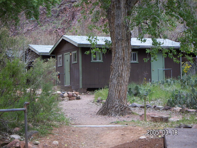 Dinner service at Phantom Ranch is steak at five
and beef stew at six-thirty, the same every night,
we had the stew.
Greg is a regular at Phantom Ranch
as this was his twenty-eighth time there.
I doubt many stay often enough to get bored by the food repetition.
Our dinner server, Annie,
told of her lifestyle working at the bottom of the Canyon.
Dinner service at Phantom Ranch is steak at five
and beef stew at six-thirty, the same every night,
we had the stew.
Greg is a regular at Phantom Ranch
as this was his twenty-eighth time there.
I doubt many stay often enough to get bored by the food repetition.
Our dinner server, Annie,
told of her lifestyle working at the bottom of the Canyon.

 We were awakened at five in the morning for five-thirty breakfast,
again the same menu every day.
We got our shit together, water and packs and cameras and film.
As luck would have it,
the DL-123A batteries in my point-and-shoot 35mm analogue Olympus
gave up the ghost first thing this morning and
I was glad I had the extra set of batteries for it.
We were awakened at five in the morning for five-thirty breakfast,
again the same menu every day.
We got our shit together, water and packs and cameras and film.
As luck would have it,
the DL-123A batteries in my point-and-shoot 35mm analogue Olympus
gave up the ghost first thing this morning and
I was glad I had the extra set of batteries for it.
 The morning was calm and overcast and forecast to get worse
as we climbed the Bright Angel trail to the south rim.
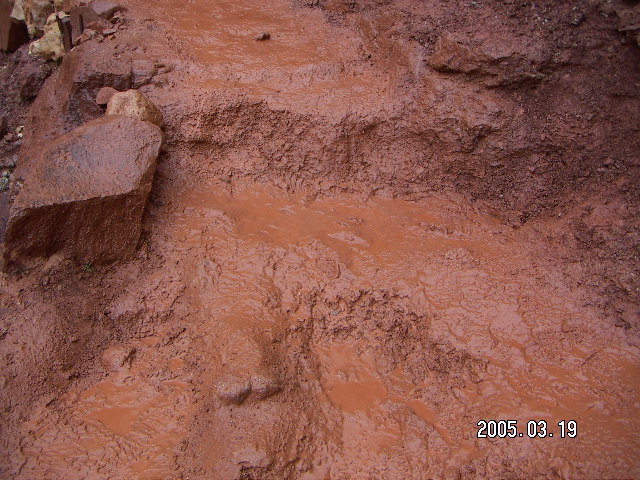
Damp air turned to drizzle and light rain,
rain turned to sleet and snow with no accumulation.
Along with the precipitation,
dirt trail turned to sloppy and occasionally-slippery mud.
The morning was calm and overcast and forecast to get worse
as we climbed the Bright Angel trail to the south rim.
Damp air turned to drizzle and light rain,
rain turned to sleet and snow with no accumulation.
Along with the precipitation,
dirt trail turned to sloppy and occasionally-slippery mud.
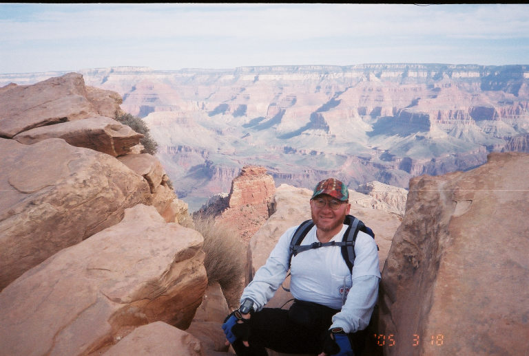
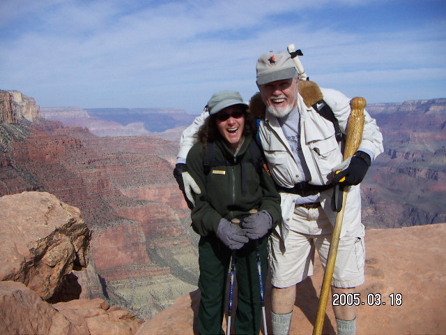
 The top was cloudy and gray, drizzly, snowy, and damp.
We took our got-to-the-top picture and
ambled, aching, to Greg's car for the drive home.
In our haste to begin our adventure,
Greg had left his lights on
and neither of us had enough energy for a push start.
(I know, I actually tried.)
We drove through snow in Flagstaff
and back into the clear evening
in Phoenix, the Valley of the Sun.
The top was cloudy and gray, drizzly, snowy, and damp.
We took our got-to-the-top picture and
ambled, aching, to Greg's car for the drive home.
In our haste to begin our adventure,
Greg had left his lights on
and neither of us had enough energy for a push start.
(I know, I actually tried.)
We drove through snow in Flagstaff
and back into the clear evening
in Phoenix, the Valley of the Sun.
4:25:11 Mountain Standard Time
(MST).
1323 visits to this web page.
cap
hiking shoes

water
energy bars
snack food (bagels)

digital camera + batteries
analogue camera + film
GPS + charger
cell phone
watch

wallet + money
underwear + slippers
headband
biking/hiking gloves
rain gear (light pancho)
sunscreen
petroleum jelly (Vasoline)
running/hiking glasses