|
|
|
|
CANYONLANDS and ARCHES NATIONAL PARKS
2004 November 23-26
|
|
|
|
|
Faced with the threat of losing my "extra" vacation days at work, I decided it was time for another Adam avaition adventure, this one to Moab, Utah, home of Canyonlands National Park, Dead Horse Point State Park, and Arches National Park. In 1985 May I did a three-day whirlwind tour of the American West, six national parks from Las Vegas, Nevada, to Boulder, Colorado. One of those was a two-hour peek at Arches, enough to know it was well worth coming back someday. 2004 November 24 made a good someday for Arches National Park. As for Canyonlands and Dead Horse Point, I figured they're worth a visit, too. I was not at all disappointed.
 Up front:
I'm a Type-A person who likes to plan things to the minute.
Things don't always go according to plan,
but I like to have a plan.
Alas, my aviation hobby is a Type-B activity
where things go the way the winds blow and the weather goes.
Last trip, Zion,
was planned out and things turned out quite different
thanks to a rockslide rather than the weather.
At work, one major project is wrapping up
while another is just getting started.
I got my management to agree to
a week of vacation "as soon as weather permits."
I was ready to go and the week of
November 21-26,
including the American Thanksgiving holiday,
looked good for travel.
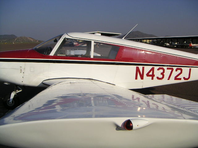
My airplane (Piper Cherokee PA28-140, N4372J)
was done with its annual inspection,
had been test flown locally in preparation for this journey,
and was ready to fly.
Up front:
I'm a Type-A person who likes to plan things to the minute.
Things don't always go according to plan,
but I like to have a plan.
Alas, my aviation hobby is a Type-B activity
where things go the way the winds blow and the weather goes.
Last trip, Zion,
was planned out and things turned out quite different
thanks to a rockslide rather than the weather.
At work, one major project is wrapping up
while another is just getting started.
I got my management to agree to
a week of vacation "as soon as weather permits."
I was ready to go and the week of
November 21-26,
including the American Thanksgiving holiday,
looked good for travel.
My airplane (Piper Cherokee PA28-140, N4372J)
was done with its annual inspection,
had been test flown locally in preparation for this journey,
and was ready to fly.
 The route of flight is pretty basic,
from Deer Valley Airport (DVT) in Phoenix to Flagstaff
(map),
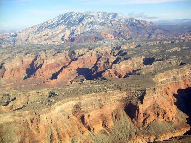
past Humphries Peak,
over the Painted Desert
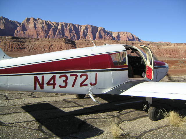
to a quick landing at
Marble Canyon (L41),
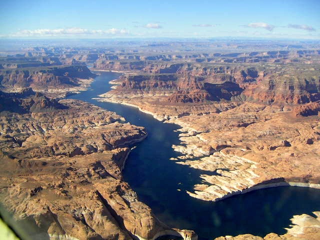
to Page,
along Lake Powell
(map),
over
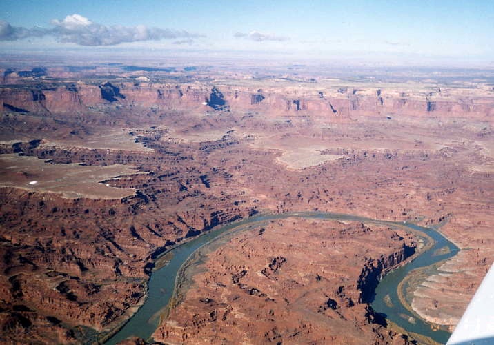
Canyonlands National Park,
left turn over Moab,
eighteen miles flying over U.S. Route 191,
and into
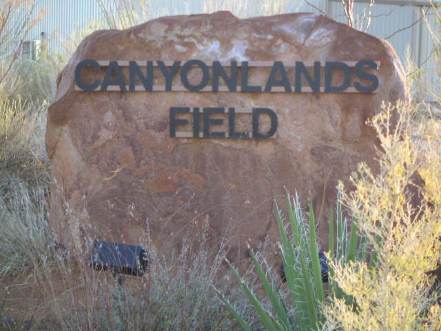
Canyonlands Airport
(CNY).
The route of flight is pretty basic,
from Deer Valley Airport (DVT) in Phoenix to Flagstaff
(map),
past Humphries Peak,
over the Painted Desert
to a quick landing at
Marble Canyon (L41),
to Page,
along Lake Powell
(map),
over
Canyonlands National Park,
left turn over Moab,
eighteen miles flying over U.S. Route 191,
and into
Canyonlands Airport
(CNY).
They say something about the best laid plans of mice and men.
I can't tell much about rodent anticipation of future events,
but I know that homo sapien plans are subject to change,
especially when they involve the weather as aviation does.
Phoenix has good weather almost all the time,
but Utah is often less cooperative,
so it pays to check their weather forecasts diligently.
Earlier weather forecasts for the week were encouraging
enough to make me pick that week for my Moab vacation.
Sunday and Monday both turned out to be awful the entire way
including rain and low clouds right here in Phoenix.
So much for Phoenix being the Valley of the Sun.
|
|
|

|
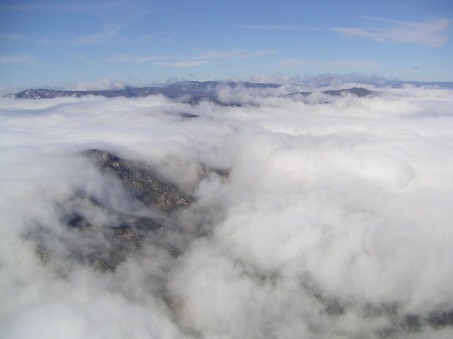 Tuesday morning was still grim with low clouds,
but the afternoon started to look better from Flagstaff on north.
There were still clouds from Phoenix to Sedona,
but their tops were low enough to fly over them
until I reached good, clear weather in Flagstaff.
The official term for low clouds in hilly country
is "mountain obscuration,"
but pilots also refer to these clouds as
"cumulus granite,"
puffy white clouds with nasty rocks in them,
not good to fly inside.
For the first hour,
there were clouds with enough holes in the clouds to see the ground
and then the weather was gloriously clear the rest of the way.
Tuesday morning was still grim with low clouds,
but the afternoon started to look better from Flagstaff on north.
There were still clouds from Phoenix to Sedona,
but their tops were low enough to fly over them
until I reached good, clear weather in Flagstaff.
The official term for low clouds in hilly country
is "mountain obscuration,"
but pilots also refer to these clouds as
"cumulus granite,"
puffy white clouds with nasty rocks in them,
not good to fly inside.
For the first hour,
there were clouds with enough holes in the clouds to see the ground
and then the weather was gloriously clear the rest of the way.
If any student pilot is thinking about giving up flying, it's too hard or there's too much stuff to study, then I hope the trips here convince some of them to persevere. There are lots of reasons to fly, but the view from a light airplane over the mountains of the western United States should be enough.
If you thought
Bryce Canyon
or Zion
were worth the effort to visit,
then add Canyonlands and Arches to your list.
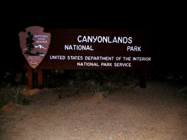
Check out the National Park Service web page for Canyonlands at
http://www.nps.gov/cany/.
I found several good web pages using
Google.
The
Canyonlands Natural History Association
has a
webcam
of a lovely view of the Colorado River.
My intention was to spend about four full days in Moab,
about two-thirds of that time in Canyonlands
and the rest in Arches with a visit to Dead Horse Point.
The weather had other plans and the Arches part of my trip
ended up getting cut to two hikes.
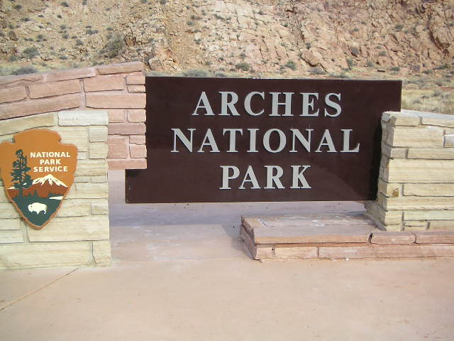
Check out the National Park Service web page for Arches at
http://www.nps.gov/arch/.
There is something about hiking that makes these parks special.
I found out that hiking is neither running nor walking.
Being a runner, I enjoy a serious advantage over most other people
in that I take longer to get tired,
but the muscles that keep me running,
even on trails like
Lost Dog Wash,
are not the muscles that keep feet going and going and going
along trails, on slickrock, and over tricky-footing hills.
Figure on some fatigue in the enjoyment of the scenery.
I ran about one-third of the distance I covered on foot
to reduce the hiking-fatigue factor.
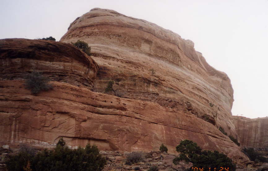
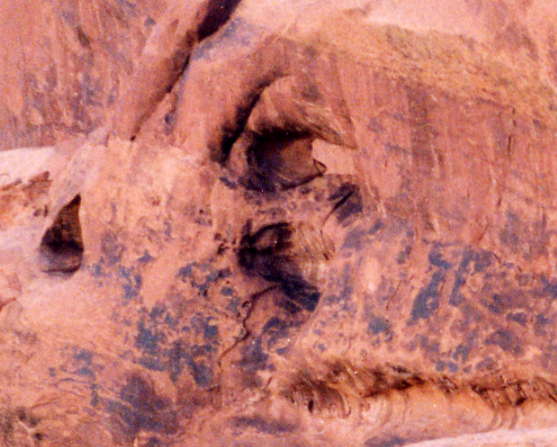
The story on the park signs goes something like this.
Back in ancient times
when men were men, women were scarce, and horses were nervous,
cowboys used to herd horses onto this narrow piece of land
so they could block off the inlet,
capture the animals, and domesticate them.
Depending on which sign you read,
either they left the barricade in place
or some of the equines never figured out how to leave,
so they died,
hence the name of the park.
I can picture television's
Mr. Ed
having a few choice words to Wilbur about the name of this park.
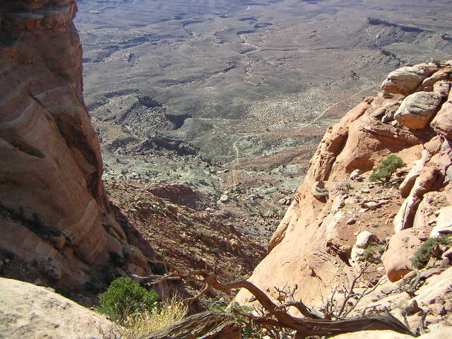
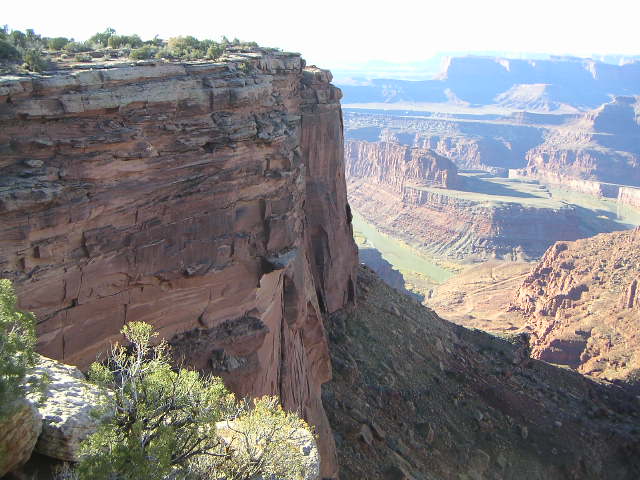
The irony is these horses died of thirst
within sight of the Colorado River
just 600 meters (2000 feet) below.
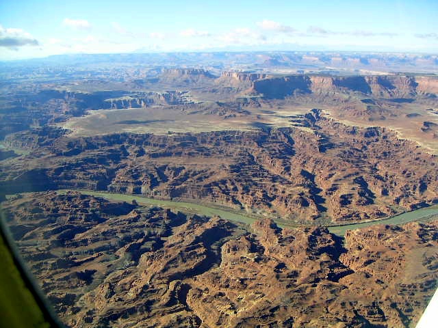
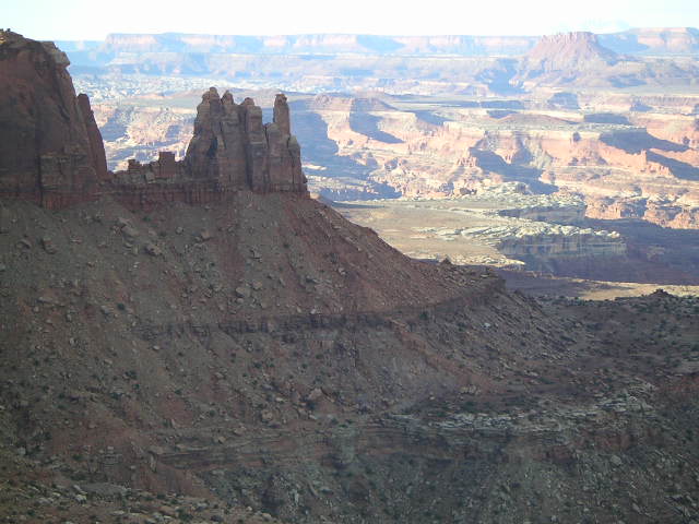
For me,
this scenery is the quintessential essence of aviation,
the reason to fly.
I enjoyed my flight back in 1989
from the New Jersey shore to Chicago
over amber waves of grain across the fruited plain,
but, myself, I'm partial to purple mountain majesties.
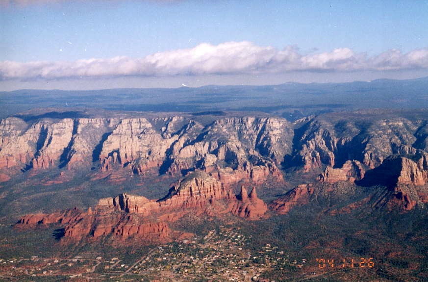
I love the Appalachians and the Rockies,
but the red rocks of Sedona
and the twisted landscape of south Utah
have just as much appeal.
One can experience America from an automobile
and the nine-hour drive from Phoenix to Moab is pretty,
but the Painted Desert is all the more wonderful from above
where so many colors are visible at once.
Is this a trip I would take again?
Absolutely.
In fact, I feel I ought to take it again
because there is still the Needles part of Canyonlands to hike
and all those trails at Arches I didn't see because
the weather knocked two days off the beginning of my trip
and a day off the end.
If a two-and-a-half day trip was fun,
then a five day trip should be amazingly wonderful
and nowhere near long enough to be bored
or tired of the scenery.
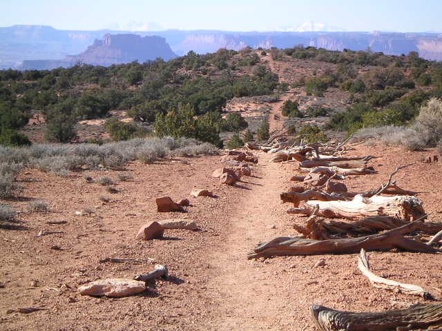
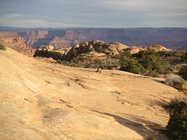
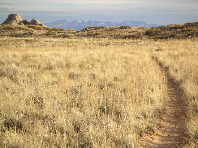
 The
Neck Spring
(more pictures)
trail at Shafer Canyon Overlook
was my dawn hike on the first day,
a 9.3 Km (5.8 mile) loop with some ups and downs
and lots of small canyons.
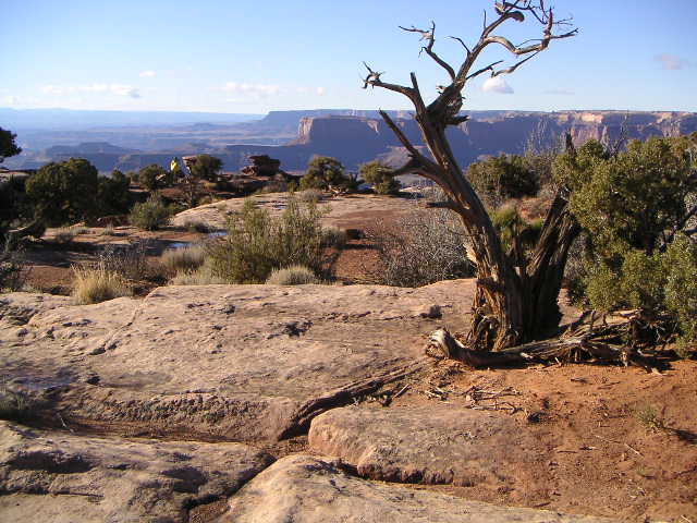
The great, big canyon views would come later.
The Island in the Sky part of the park
is attached to the rest of the plateau by a 12-meter (40-foot)
connection called the Neck.
So this part of the park is really the
Peninsula in the Sky,
at least until the Neck erodes away,
but that name doesn't sound as good as
Island in the Sky, does it?
The
Neck Spring
(more pictures)
trail at Shafer Canyon Overlook
was my dawn hike on the first day,
a 9.3 Km (5.8 mile) loop with some ups and downs
and lots of small canyons.
The great, big canyon views would come later.
The Island in the Sky part of the park
is attached to the rest of the plateau by a 12-meter (40-foot)
connection called the Neck.
So this part of the park is really the
Peninsula in the Sky,
at least until the Neck erodes away,
but that name doesn't sound as good as
Island in the Sky, does it?

 Next was a run to
Murphy Point,
a tremendous vista view,
3 Km (1.8 miles) each way,
with an extra 2 Km (1.2 miles) to get to the top
of the real-hill hiking trail.
There are eight kilometers (five miles)
of dirt-road footwork required
to see the views and to begin the decent.
I did just a little bit of the descent
after I decided it's okay to be a "wuss"
and not to do the terrible, steep, scary descents.
If I weren't a
runner,
then I probably would have passed on Murphy Point
rather than invest the time
to cover the level ground to the views.
Next was a run to
Murphy Point,
a tremendous vista view,
3 Km (1.8 miles) each way,
with an extra 2 Km (1.2 miles) to get to the top
of the real-hill hiking trail.
There are eight kilometers (five miles)
of dirt-road footwork required
to see the views and to begin the decent.
I did just a little bit of the descent
after I decided it's okay to be a "wuss"
and not to do the terrible, steep, scary descents.
If I weren't a
runner,
then I probably would have passed on Murphy Point
rather than invest the time
to cover the level ground to the views.
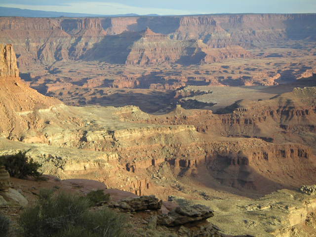
My next stop was
Buck Canyon Overlook
(more pictures),
no hike, no effort, just a short walk to the viewpoint.
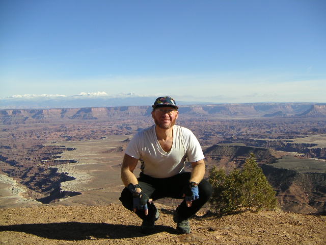
Except for Bonnie in the Visitor Center,
this is the first time I saw another person since I entered the park.
(That's how I got pictures of
myself
at this viewpoint.)
This view is wonderful, fantastic, breathtaking, and all that,
well worth the trip.
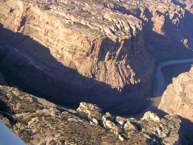
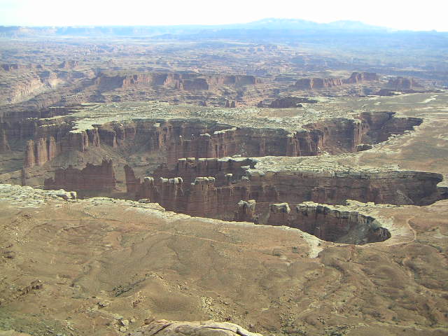
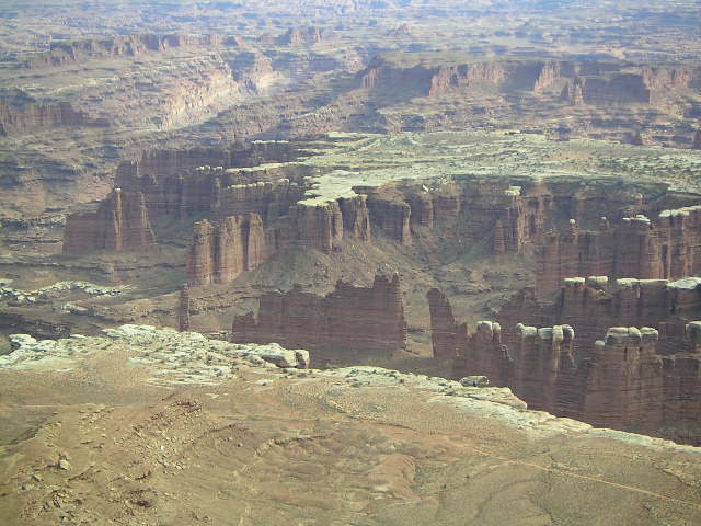
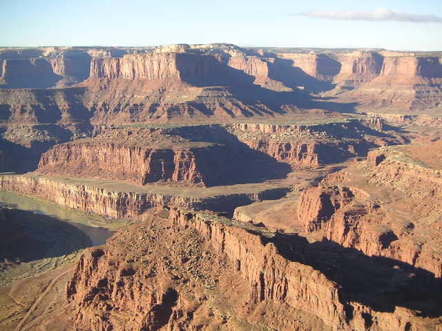
Seeing Buck Canyon from the
air
after the ground view was even more amazing.
Canyonlands National Park started lovely
and was becoming more and more wonderful with each view.
From here I went to
Arches National Park
for the rest of the day
but I came back the next day later in the afternoon
to see Buck Canyon in better light.
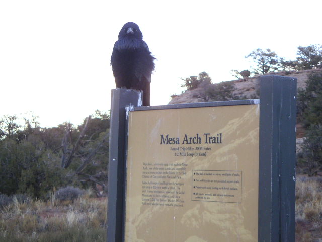
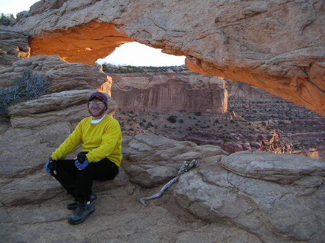 The next dawn was at
Mesa Arch
(more pictures),
recommended for first light in one of the park brochures.
They weren't kidding.
The morning light created a yellow-orange glow
on the underside of the arch,
a wonderful way to start the day
in such a strange and wonderful place.
(One book I saw said visitors should view Utah
with one eye closed so it only looks half as strange.)
I'm partial to sunrise as my favorite time of the day,
a crescendo of light, color, warmth, and joy.
Dawn at Mesa Arch met all my warm and joyous expectations.
The next dawn was at
Mesa Arch
(more pictures),
recommended for first light in one of the park brochures.
They weren't kidding.
The morning light created a yellow-orange glow
on the underside of the arch,
a wonderful way to start the day
in such a strange and wonderful place.
(One book I saw said visitors should view Utah
with one eye closed so it only looks half as strange.)
I'm partial to sunrise as my favorite time of the day,
a crescendo of light, color, warmth, and joy.
Dawn at Mesa Arch met all my warm and joyous expectations.
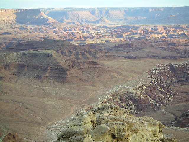
 The
Grand View Overlook
(more pictures)
had some great morning views to the west,
the Green River side,
but I found the afternoon view to the east,
the Colorado River side,
even more spectacular.
There is a 1.6 Km (one mile) walk
from the west side to the east side of the southern tip
of the Island in the Sky.
I counted five distinct levels,
the island level at the top,
one red-rock level down,
the prominent white-rim level,
a brown-rock level under that,
and the Colorado River itself at the bottom.
The
Grand View Overlook
(more pictures)
had some great morning views to the west,
the Green River side,
but I found the afternoon view to the east,
the Colorado River side,
even more spectacular.
There is a 1.6 Km (one mile) walk
from the west side to the east side of the southern tip
of the Island in the Sky.
I counted five distinct levels,
the island level at the top,
one red-rock level down,
the prominent white-rim level,
a brown-rock level under that,
and the Colorado River itself at the bottom.
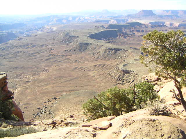
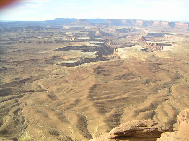
 Green River Overlook
(more pictures)
is a great morning view and a terrific sunset overlook
in Canyonlands National Park.
The morning view was vast, spectacular, and overwhelming
(I'm running out of vast, spectacular, and overwhelming
adjectives, aren't I?)
More than the east, Colorado River side,
the west, Green River views are great, big spaces
with far-away rock formations and unearthly vistas.
I don't know why I find the variety of vast vistas
so visually appealing,
but I do and,
judging from the popularity of this park,
I'm not the only one who feels this way.
Green River Overlook
(more pictures)
is a great morning view and a terrific sunset overlook
in Canyonlands National Park.
The morning view was vast, spectacular, and overwhelming
(I'm running out of vast, spectacular, and overwhelming
adjectives, aren't I?)
More than the east, Colorado River side,
the west, Green River views are great, big spaces
with far-away rock formations and unearthly vistas.
I don't know why I find the variety of vast vistas
so visually appealing,
but I do and,
judging from the popularity of this park,
I'm not the only one who feels this way.

 The
book
I was reading
(Exploring Canyonland & Arches National Parks,
a Hiking and Backcountry Driving Guide by Bill Schneider)
warned that
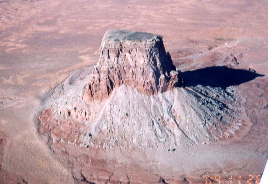
Aztec Butte
was a short, tough climb.
It was right,
my newfangled hiking shoes were not enough to climb
the slickrock on Aztec Butte.
I was able to get partway up,
high enough for a good view,
and then I had to walk down before I found myself falling down.
There is another butte, smaller, less challenging,
and I climbed that one.
That one had some living quarters between rock layers
that I guess belonged to some primitive people who lived there.
Since there wasn't any antenna on top,
I have to guess these people had cable television,
so it wasn't too primitive.
The
book
I was reading
(Exploring Canyonland & Arches National Parks,
a Hiking and Backcountry Driving Guide by Bill Schneider)
warned that
Aztec Butte
was a short, tough climb.
It was right,
my newfangled hiking shoes were not enough to climb
the slickrock on Aztec Butte.
I was able to get partway up,
high enough for a good view,
and then I had to walk down before I found myself falling down.
There is another butte, smaller, less challenging,
and I climbed that one.
That one had some living quarters between rock layers
that I guess belonged to some primitive people who lived there.
Since there wasn't any antenna on top,
I have to guess these people had cable television,
so it wasn't too primitive.
 With my feet still sore from previous efforts,
I decided to stick to the easy, "wussy" hikes
rather than doing any big, scary climbs or descents.
I did the
Whale Rock
hike,
a fairly easy slickrock climb with chains on the tougher parts,
and
Upheaval Dome Overlook,
a view of Upheaval Dome from above while
The Syncline trail goes in and around the dome itself.
Upheaval Dome isn't a dome, actually,
but a collapsed dome which could be a salt formation
that dissolved over the centuries
or could be a meteor strike.
I'm not enough of a geologist to find it that exciting
and the view, even from the overlook trails,
did not give me a true sense of its collapsed-dome structure.
With my feet still sore from previous efforts,
I decided to stick to the easy, "wussy" hikes
rather than doing any big, scary climbs or descents.
I did the
Whale Rock
hike,
a fairly easy slickrock climb with chains on the tougher parts,
and
Upheaval Dome Overlook,
a view of Upheaval Dome from above while
The Syncline trail goes in and around the dome itself.
Upheaval Dome isn't a dome, actually,
but a collapsed dome which could be a salt formation
that dissolved over the centuries
or could be a meteor strike.
I'm not enough of a geologist to find it that exciting
and the view, even from the overlook trails,
did not give me a true sense of its collapsed-dome structure.
 By this point in my hiking adventure my feet were getting sore
and my legs were getting tired.
I was considering my next hike from
street parking in Moab to the nearest pub
when I told myself that running was sufficiently different
that the parts of my legs that were weary from hiking
would not be a problem on an 8 Km (five mile) run
on level ground on the
Lathrop trail.
Well, it turned out to be true!
Trotting along at a gentle pace along the sandy trail in the grass,
I found myself invigorated with renewed energy,
enthusiastic once more.
There were some slow-down-to-a-walk stretches of slickrock
and I found the combined mental effort of navigating
from
rock cairn
to rock cairn and running on slickrock
to be more than I had available, so I decided to walk those areas.
Once I got to the descent part of the trail,
the hiking was slower and the views were terrific.
I came back much faster
as I decided to try to make sunset
at Green River Overlook.
By this point in my hiking adventure my feet were getting sore
and my legs were getting tired.
I was considering my next hike from
street parking in Moab to the nearest pub
when I told myself that running was sufficiently different
that the parts of my legs that were weary from hiking
would not be a problem on an 8 Km (five mile) run
on level ground on the
Lathrop trail.
Well, it turned out to be true!
Trotting along at a gentle pace along the sandy trail in the grass,
I found myself invigorated with renewed energy,
enthusiastic once more.
There were some slow-down-to-a-walk stretches of slickrock
and I found the combined mental effort of navigating
from
rock cairn
to rock cairn and running on slickrock
to be more than I had available, so I decided to walk those areas.
Once I got to the descent part of the trail,
the hiking was slower and the views were terrific.
I came back much faster
as I decided to try to make sunset
at Green River Overlook.
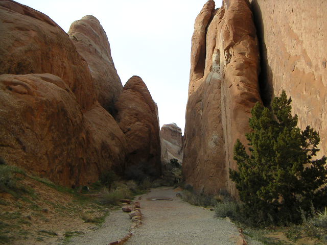
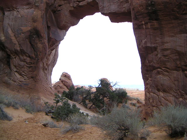
 The great, big, long, tough hike in Arches is
Devil's Garden
(more pictures).
The regular trail is an easy mile
followed by a mile of hiking along slickrock and over a rock fin
with a view of
Double-O Arch
(close-up)
at the end of the trail,
worth every bit of effort.
The rock formations alone are worth the hike
and the arches add a sense of wonder to the experience.
The name is apt for the strange shapes
not to mention that I was tired and had a devil of a time
getting up and down some of the slickrock.
There is also a longer, meaner, tougher, nastier, harder trail
called the primitive trail for the Devil's Garden.
The great, big, long, tough hike in Arches is
Devil's Garden
(more pictures).
The regular trail is an easy mile
followed by a mile of hiking along slickrock and over a rock fin
with a view of
Double-O Arch
(close-up)
at the end of the trail,
worth every bit of effort.
The rock formations alone are worth the hike
and the arches add a sense of wonder to the experience.
The name is apt for the strange shapes
not to mention that I was tired and had a devil of a time
getting up and down some of the slickrock.
There is also a longer, meaner, tougher, nastier, harder trail
called the primitive trail for the Devil's Garden.
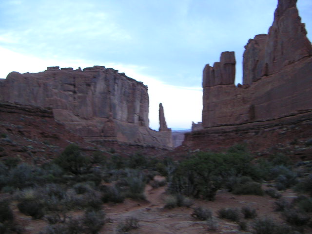 Inspired by its similarity to the tall buildings
of New York City,
this vertical-rock hike is called the
Park Avenue
trail
(more pictures).
It's not a killer hike,
just a gentle descent with, of course,
a gentle ascent on the way back.
The rock shapes are interesting enough
and the combination of all these seriously-vertical formations
is quite inspiring on a clear-dawn morning.
I did this hike when I was already shagged-and-fagged
from other, hillier hikes,
so it was a nice end to my visit
to these two National Parks.
Inspired by its similarity to the tall buildings
of New York City,
this vertical-rock hike is called the
Park Avenue
trail
(more pictures).
It's not a killer hike,
just a gentle descent with, of course,
a gentle ascent on the way back.
The rock shapes are interesting enough
and the combination of all these seriously-vertical formations
is quite inspiring on a clear-dawn morning.
I did this hike when I was already shagged-and-fagged
from other, hillier hikes,
so it was a nice end to my visit
to these two National Parks.
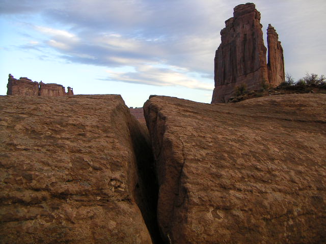
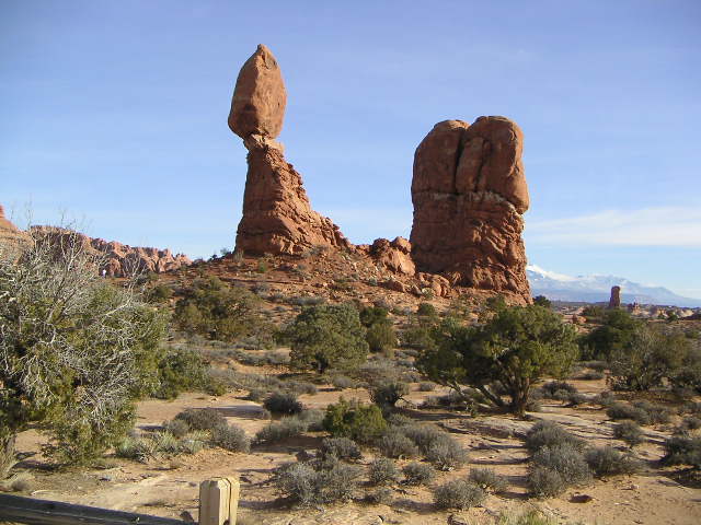 There is plenty of
other stuff
at Arches National Park,
many more arches, Petrified Sand Dunes,
and the Balanced Rock.
Next time I plan to have more time to see them and to hike them.
There is plenty of
other stuff
at Arches National Park,
many more arches, Petrified Sand Dunes,
and the Balanced Rock.
Next time I plan to have more time to see them and to hike them.
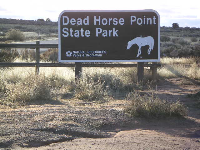
 You gotta see
Dead Horse Point
(more pictures)
before you go home from Moab.
It's the other side of the Colorado River views
from the Island in the Sky.
There is a four-mile trail that goes to many pretty views
but the narrowing weather window
sent me to the airport for my trip home
before I had a chance to hike it.
Utah's Dead Horse Point is a must-see state park,
even if it does cost an extra seven bucks (U.S. $7.00)
beyond whatever you paid for Canyonlands and Arches.
The view is breathtaking and it was a wonderful coda
for the symphony of my trip.
You gotta see
Dead Horse Point
(more pictures)
before you go home from Moab.
It's the other side of the Colorado River views
from the Island in the Sky.
There is a four-mile trail that goes to many pretty views
but the narrowing weather window
sent me to the airport for my trip home
before I had a chance to hike it.
Utah's Dead Horse Point is a must-see state park,
even if it does cost an extra seven bucks (U.S. $7.00)
beyond whatever you paid for Canyonlands and Arches.
The view is breathtaking and it was a wonderful coda
for the symphony of my trip.

Alas, the once-cheerful forecasts from The Weather Channel
were getting
bleak
as the weekend neared,
four days of rain, snow, and low clouds,
so I figured I better get out while the getting was good.
I fly by Visual Flight Rules (VFR)
which means I can't fly where I can't see,
flying in clouds is a no-no.
Besides, who would want to be
flying back home
over all this incredible
scenery
(more pictures)
seeing nothing out the window but white cloud?

 While hiking and running along the Utah trails,
I wore a
Garmin Forerunner 201
Global Positioning System (GPS) gizmo on my wrist.
It's really for runners rather than hikers,
but it has a map display so you can't get too lost
and it keeps track of distance.
Only one trail, the narrowest part of Devil's Garden
at Arches National Park,
gave me any trouble with inadequate GPS signal from the sky.
It took about half an hour before I stopped looking at it
every few seconds because it was so cool
and used it to get a sense of how far I had gone
and how far I had to go,
in both horizontal and vertical dimensions.
While hiking and running along the Utah trails,
I wore a
Garmin Forerunner 201
Global Positioning System (GPS) gizmo on my wrist.
It's really for runners rather than hikers,
but it has a map display so you can't get too lost
and it keeps track of distance.
Only one trail, the narrowest part of Devil's Garden
at Arches National Park,
gave me any trouble with inadequate GPS signal from the sky.
It took about half an hour before I stopped looking at it
every few seconds because it was so cool
and used it to get a sense of how far I had gone
and how far I had to go,
in both horizontal and vertical dimensions.
8:44:32 Mountain Standard Time
(MST).
1593 visits to this web page.