|
|
|
|
|
| ||
|
|
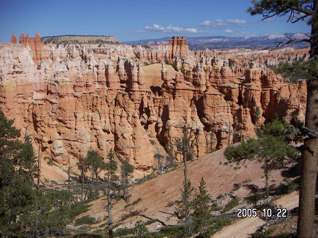
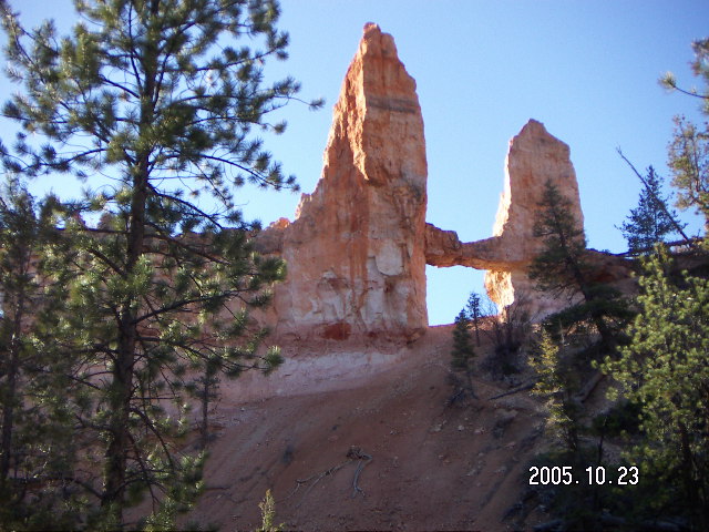
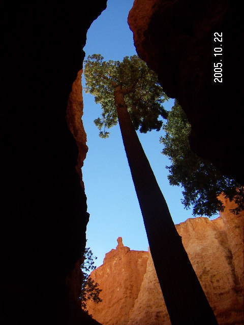
2005 October 22-23
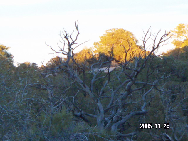
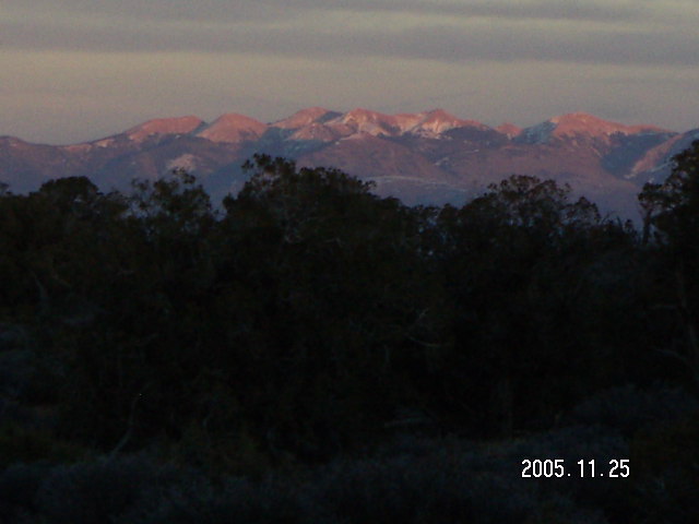
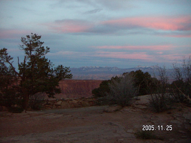
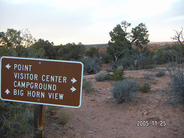
2005 November 23-27
2005 December 24-26
|
|
|
|
|
|
|
| ||
|
|
|
 If you know me or love flying in northern Arizona and southern Utah,
then read the
flying part of this page.
If you want to read about southern Utah's national parks,
then read the
parks part of this page,
or check out my
other National Park trip pages,
Otherwise, you can enjoy the pictures
of three fantastic trips and four U.S. National Parks
without putting up with
any of the web-log blather of my stories.
I won't mind.
If you know me or love flying in northern Arizona and southern Utah,
then read the
flying part of this page.
If you want to read about southern Utah's national parks,
then read the
parks part of this page,
or check out my
other National Park trip pages,
Otherwise, you can enjoy the pictures
of three fantastic trips and four U.S. National Parks
without putting up with
any of the web-log blather of my stories.
I won't mind.

|
|
| |
|
|
| |
|
|
|
 One of those items on my aviation wish list
has been flying to Bryce Canyon National Park
and the fantasy scenario has been
going there for the weekend.
One of the promises of general aviation in general,
and airplane ownership in particular,
is the spontaneity of travel.
I went to
Tuweep
for the day,
maybe I can go to
Bryce Canyon
for the weekend,
a true Saturday-Sunday, two-day,
no-days-off-from-work, non-holiday weekend trip.
October is the best time,
after the crowds and before the snow.
One of those items on my aviation wish list
has been flying to Bryce Canyon National Park
and the fantasy scenario has been
going there for the weekend.
One of the promises of general aviation in general,
and airplane ownership in particular,
is the spontaneity of travel.
I went to
Tuweep
for the day,
maybe I can go to
Bryce Canyon
for the weekend,
a true Saturday-Sunday, two-day,
no-days-off-from-work, non-holiday weekend trip.
October is the best time,
after the crowds and before the snow.
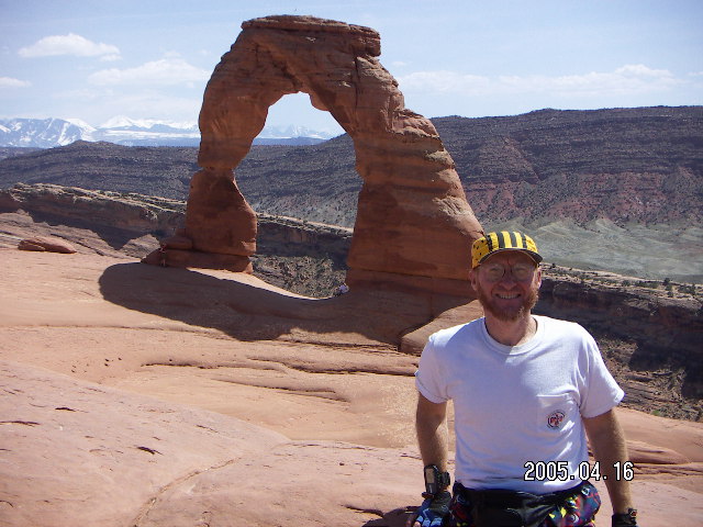
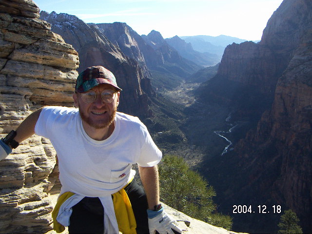
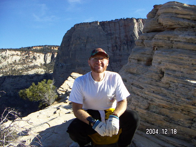
Zion National Park has two more-than-half-day hikes challenging enough that I would prefer not to do either of them right before flying home, so that would make it a three-day weekend trip. The ideal time for Zion is early November for fall foliage, but December is early enough to beat the winter weather. In any given year there are four chances out of seven that Christmas (and New Year's Day) will make a three-day weekend available for the trip. Wouldn't you know it? 2005 was one of those years.
 Canyonlands and Arches National Parks demand more time
because the flight is just enough longer than the other two
and the hikes are more major.
The fantasy for this adventure includes
a side trip to Telluride,
a spectacular airport I have not visited since 1987.
This is an American-Thanksgiving-weekend trip and
I would have to take Wednesday off for the flight
because nobody is going to be around to rent me a car on Thursday.
That leaves full hiking days on Thursday and Saturday
with Friday for my Colorado side trip and a half day of hiking.
Canyonlands and Arches National Parks demand more time
because the flight is just enough longer than the other two
and the hikes are more major.
The fantasy for this adventure includes
a side trip to Telluride,
a spectacular airport I have not visited since 1987.
This is an American-Thanksgiving-weekend trip and
I would have to take Wednesday off for the flight
because nobody is going to be around to rent me a car on Thursday.
That leaves full hiking days on Thursday and Saturday
with Friday for my Colorado side trip and a half day of hiking.
Sometimes your wishes come true even if you tell them. Fantasy became reality for me in autumn of 2005, the weather was cooperative, my airplane was running well, and I was able to hike and run all the places I wanted to go.
From a weather standpoint,
Utah is noticeably less friendly than Arizona.
There is more weather in the form of mountain-obscuring clouds,
rain, and snow.
Also the weather is less predictable in Utah than other places,
a Tuesday forecast of good weekend weather is less reliable there.
So even if I get there on my original schedule
with good weather,
there is a realistic chance
of a change of return-trip plans.
Last year's American-Thanksgiving-weekend trip to Moab
turned into two and a half days
with weather-delayed arrival
and departure hastened by gloomy forecasts.
Even if weather cooperates,
there is always the issue of airplane reliability.
My bird was built in 1967,
old enough to be in the stage where things have to be maintained
in addition to scheduling its annual-inspection.
I have a terrific mechanic who has kept me flying
almost every weekend I want to fly
(and that's most of them around here).
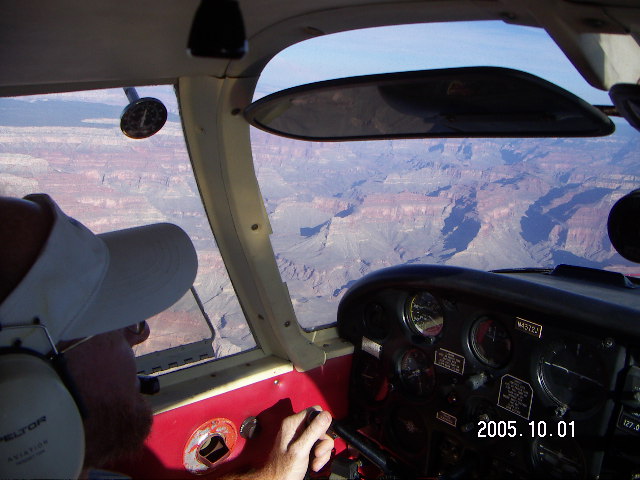
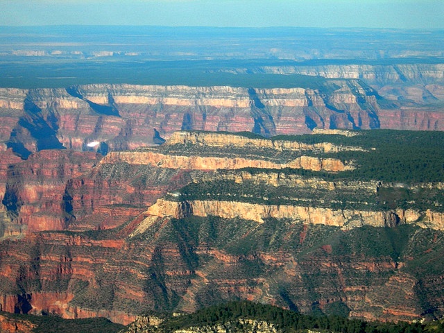
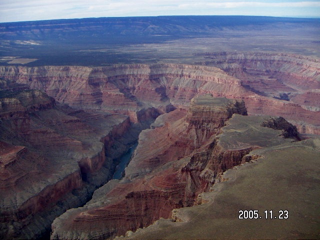
My trips took me over
three different parts of the Grand Canyon.
(Last year's trip to Zion took me
over the far western end and Lake Mead
as I took a detour to Mesquite over Saint George,
but I didn't do that this year.)
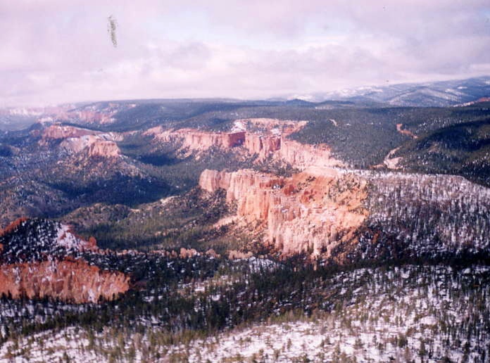
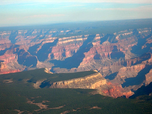
To Bryce Canyon I flew over the main canyon area (Dragon)
right at the break of dawn,
perhaps too early as almost everything below the rim
was in shadow.
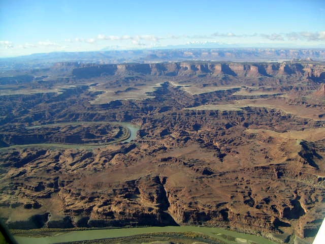
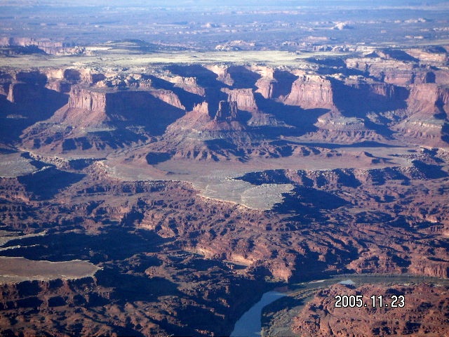
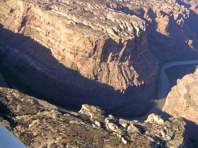
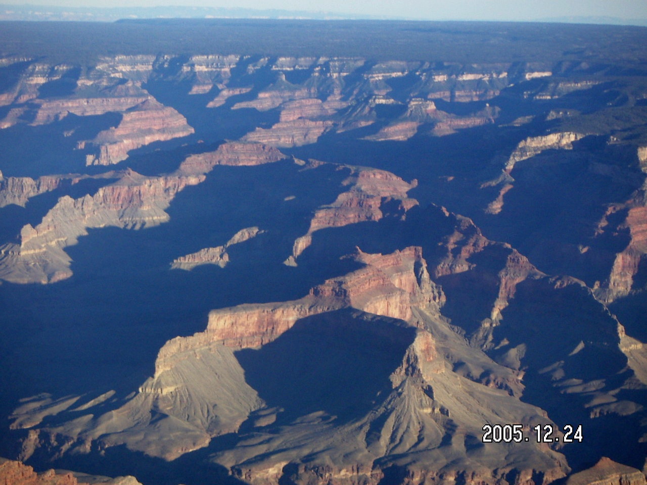
To Moab I flew over Marble Canyon at the east end.
And to Zion I flew west of the Supai and Kaibab canyons (Tuckup).
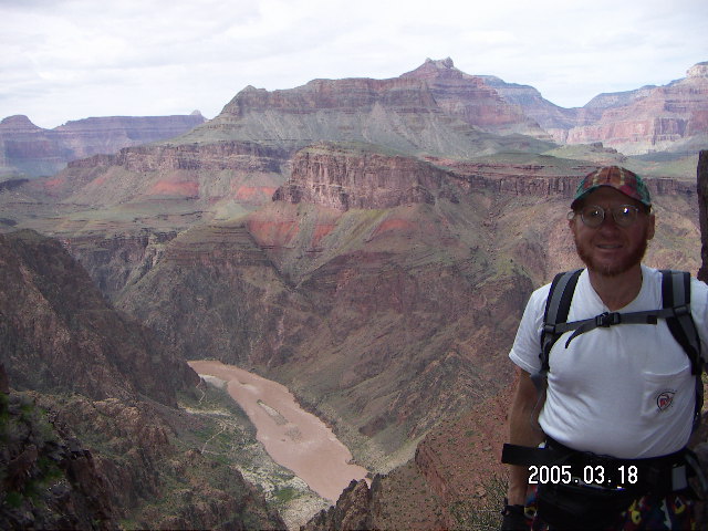
Having hiked
down to Phantom Ranch at the bottom
and, of course, back up to the rim
gives me a better perspective of the magnitude
of the aptly-named Grand Canyon.
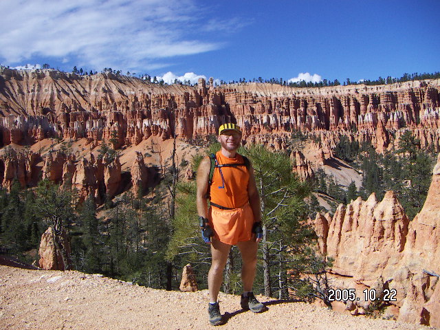
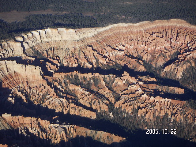
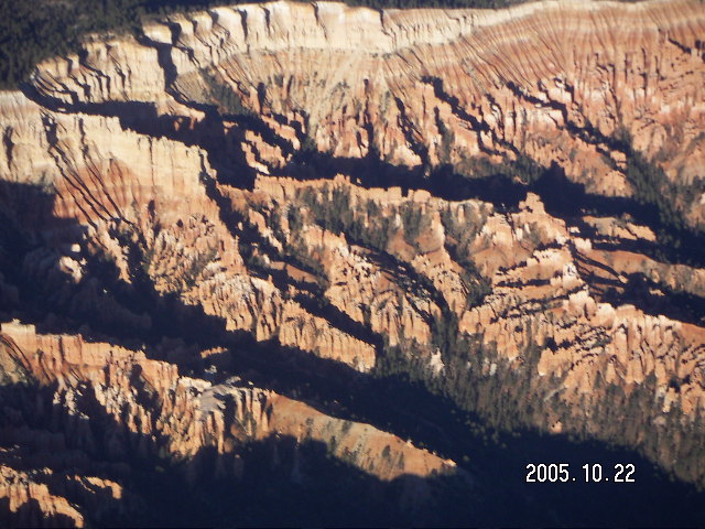
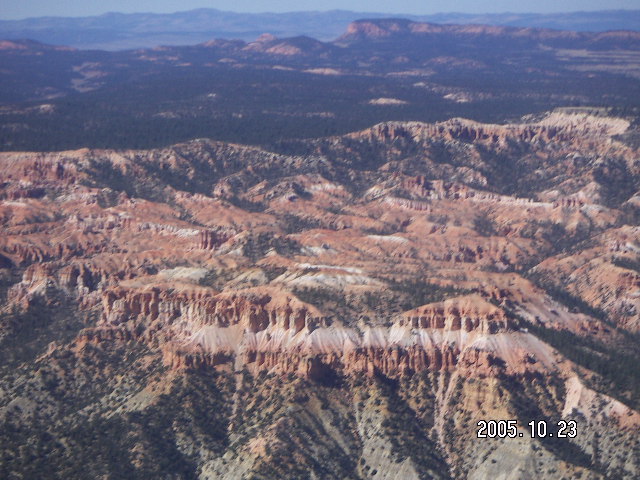
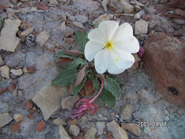
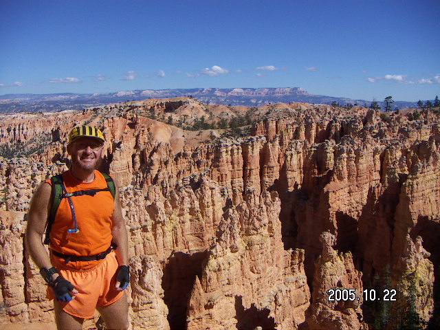
As vast as Bryce Canyon seems from the ground
with its seemingly-endless arrays of "hoodoos,"
the entire park is about 30 Km (20 miles) long
and 5 Km (three miles) wide,
not enough to be a landscape from the air.
As neat as flying over may be,
and it's very neat,
hiking is the better way to see Bryce's beauty.
I left BCE
2005 October 23, the next day, Sunday afternoon
in time to find an unforecast row of thunderstorm cells
just south of the south rim of the Grand Canyon.
These were small storms with a clear view of unrestricted sunshine
to the south, so I flew west to Seligman
where I saw a large-enough space between two of them
to stay in clear skies to Bagdad, Arizona.
Once I saw the row of storms,
Plan B was landing in Seligman and waiting.
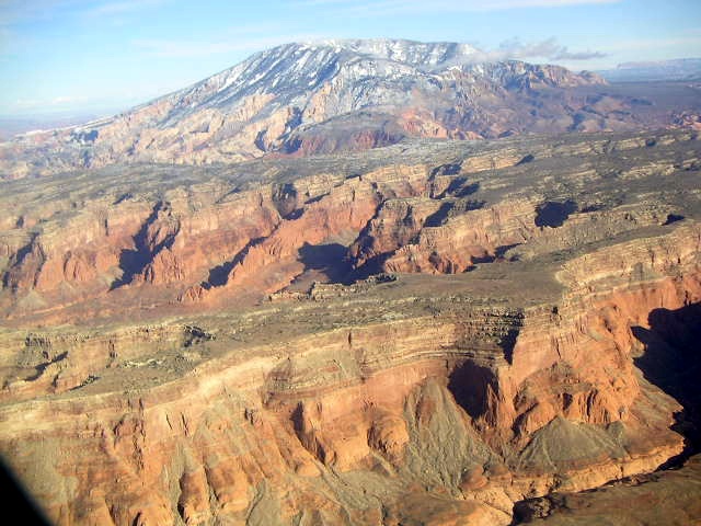
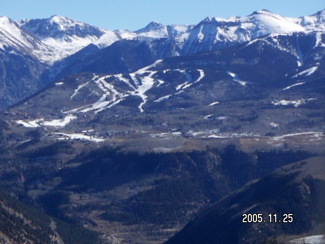
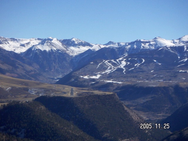
As Colorado communities,
Telluride and Aspen
(ASE)
are famous for their wonderful white powder.
They also have a lot of snow for the upscale ski crowd.
As pilot destinations,
both Telluride and Aspen are high airports
surrounded by incredible scenery considerably higher.
The airport at Telluride is on a 9000' mesa over a 6000' canyon
surrounded on three sides by 13000' mountains.
The approach from the west does not require climbing any higher
than the traffic-pattern altitude of 10500'.
Without losing its beauty and wonder,
an extra 1200 flight hours
and 1900 landings take-offs and landings
made TEX a lot less scary for me.
My little altitude-computer slide rule
indicated I should be able to get out of TEX
using less than half the runway.
(I used the other half to get more airspeed
in what we call "ground effect" before climbing out.)
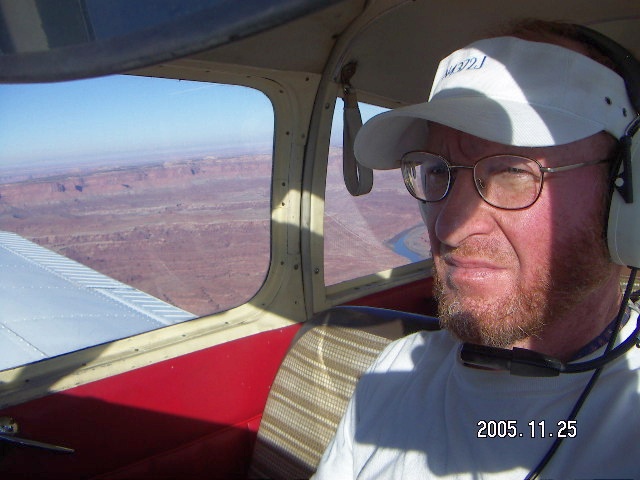
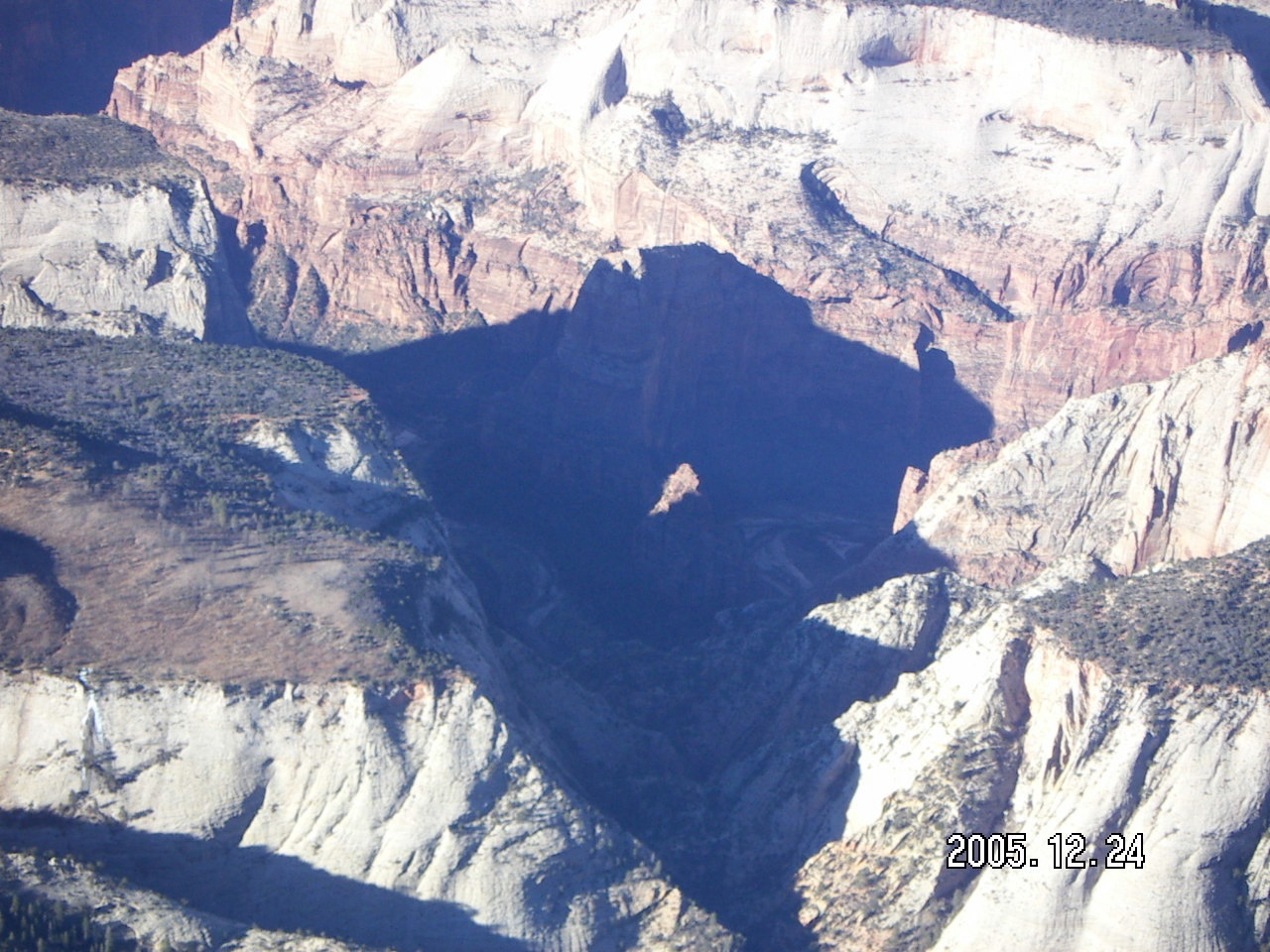
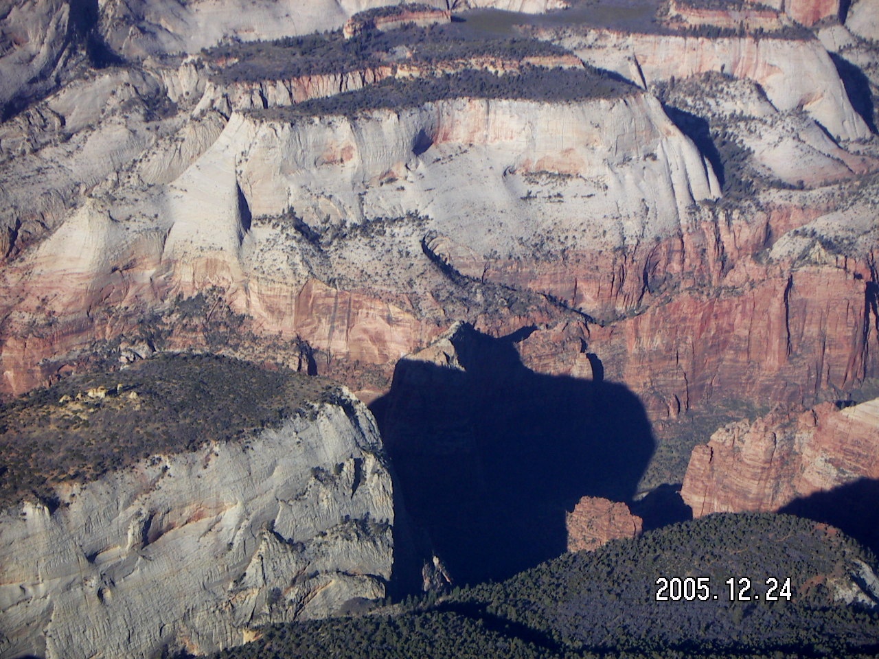
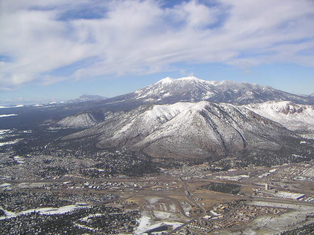
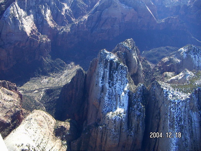
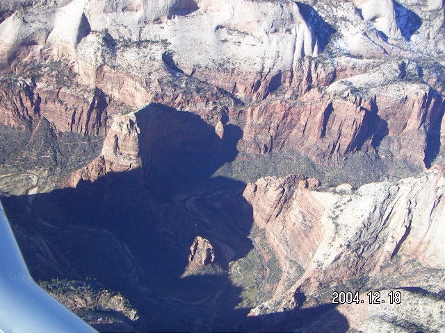
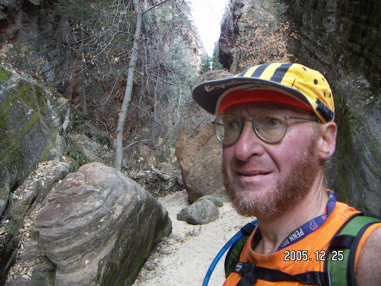
From DVT to KNB on 2005 December 24
I decided to take a westerly detour
to take some pictures of Zion from the air.
Even several hours after sunrise at 9:30 in the morning
Angel's Landing was in deep shadow.
Coming home on 2005 December 26
I wasn't feeling so hot, not actually sick
but lousy enough that I would not have gone out anywhere
were I already home.
Weather was moderately cooperative for the trip home,
good enough to fly home but bumpy and getting cloudier,
so I wasn't going to hang around until later in the afternoon.
Still, there is a special majesty to the southern-Utah parks.
When I lived back east
(that includes anything east of New Mexico for this discussion),
visiting this area was a
Great Big Trip.
Now I live in Phoenix with an airplane,
so I can plan short trips
and enjoy these places over multiple visits.
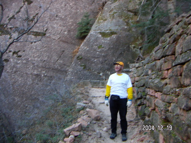
I have been to Bryce Canyon
before.
These hikes offer few vista views,
mostly intimate encounters with strange shapes
and exotic colors in the rock formations.
By the next day, I'm ready for another serious hike
and the Fairyland loop fits the bill
from Fairyland Point to Sunrise Point
and back on the rim trail,
or the other way around,
about 13 Km (eight miles).
On other trips when I had more time,
I hiked a short way on the Hat Shop trail,
which goes a very long way,
all the way to the south end of the park.
This trail has fewer rock formations and more vista views.
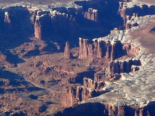
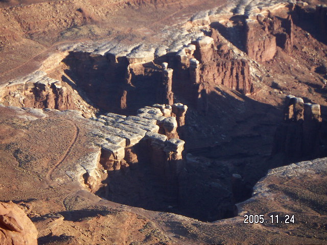
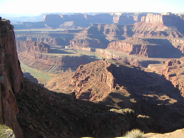
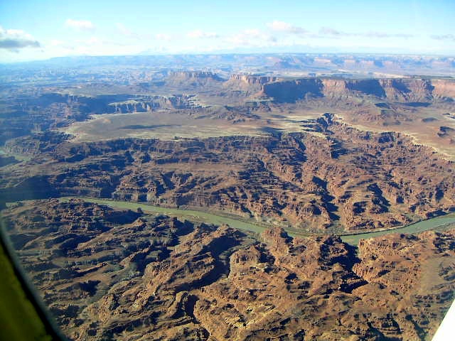
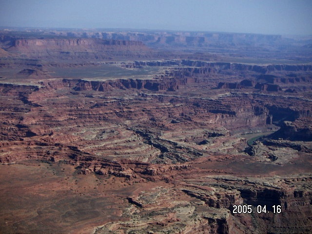
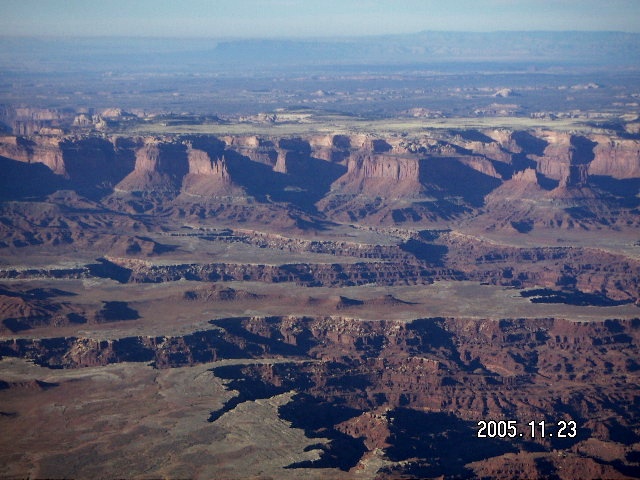
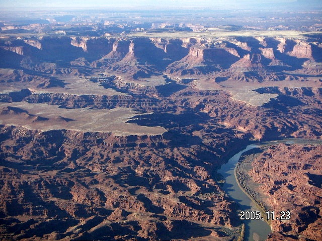
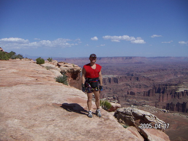
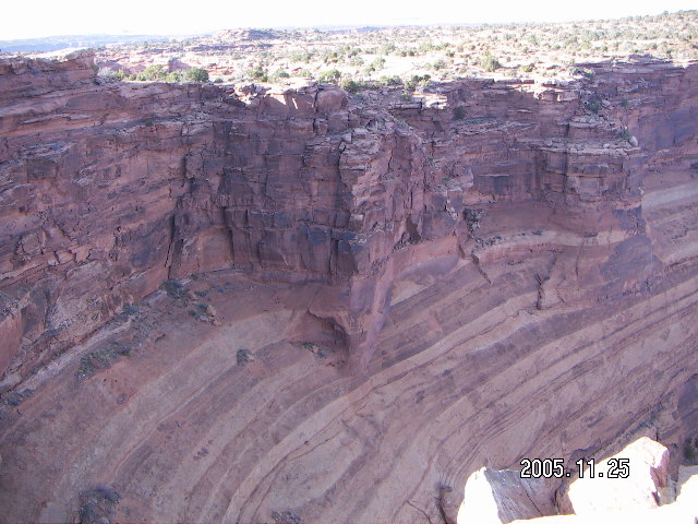
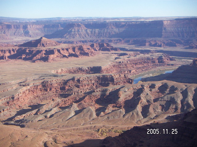
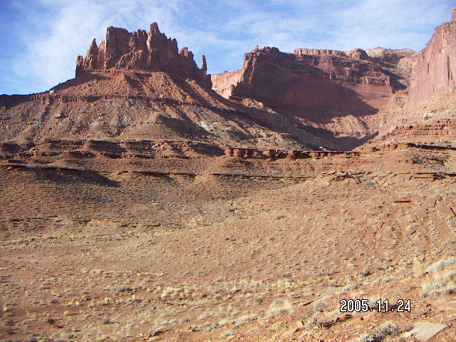
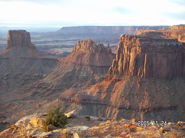
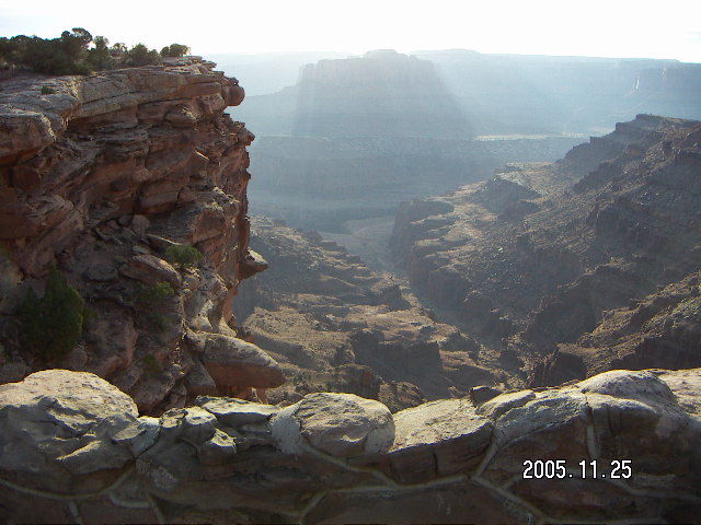
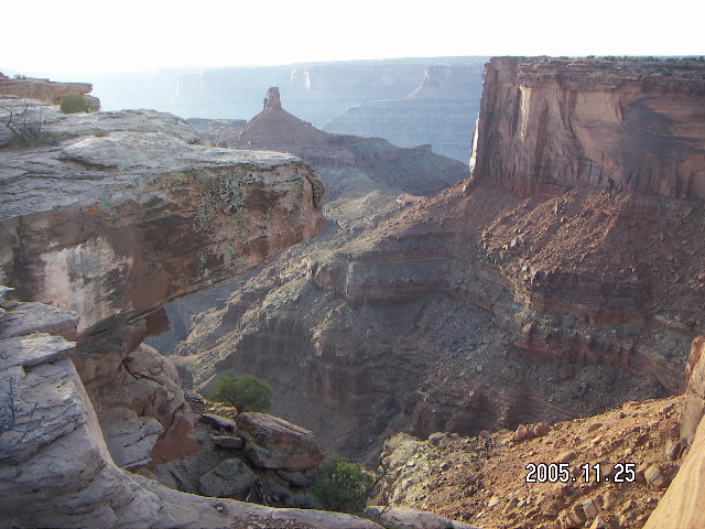
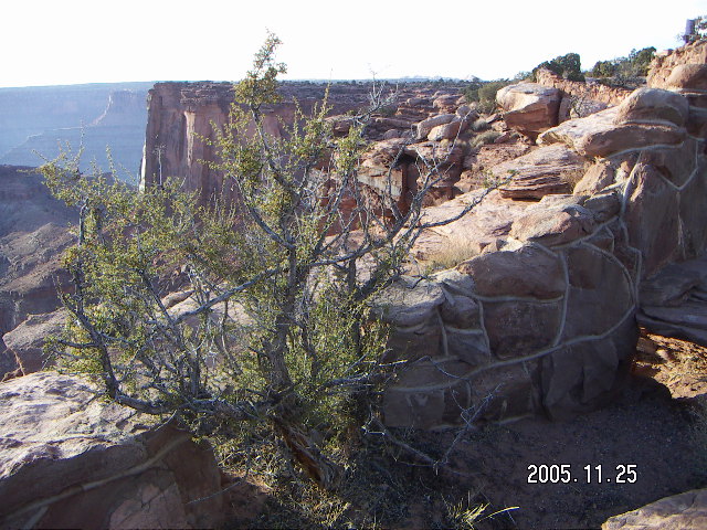
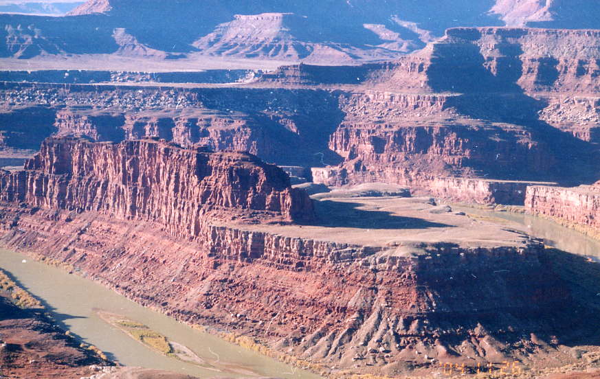
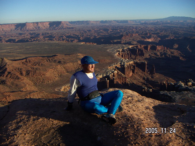
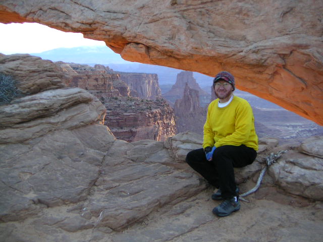
The views from the road at Canyonlands are spectacular,
layer upon layer of different rock formations going off
into the distance.
The White Rim divides the upper and lower layers.
I have stopped and taken oodles of pictures at Canyonlands on
other National Park trips.
As I recall some time later,
the trip from the trail head
within the Island in the Sky
to the Colorado River
breaks down as follows;
Even with sufficient water
I was pretty darned tired when I ran the last two miles
back to the trailhead
and I confined myself to flat, easy, vista-view hikes
for the rest of the day.
The White Rim viewpoint let me see much of the route
I had traveled earlier in the day
as well as Dead Horse Point
where I would hike later.
I have been to Dead Horse Point
before.
Dead Horse Point State Park
curves around to provide views in several directions,
a constantly changing vista along the hike.
Most of the way is close enough to the edge
for spectacular views of the Colorado River
and Canyonland's Island in the Sky.
There's a US $7.00 fee
not associated in the U.S. National-Parks,
so a Golden-Eagle card doesn't cover it.
Fork over the seven bucks and enjoy the view.
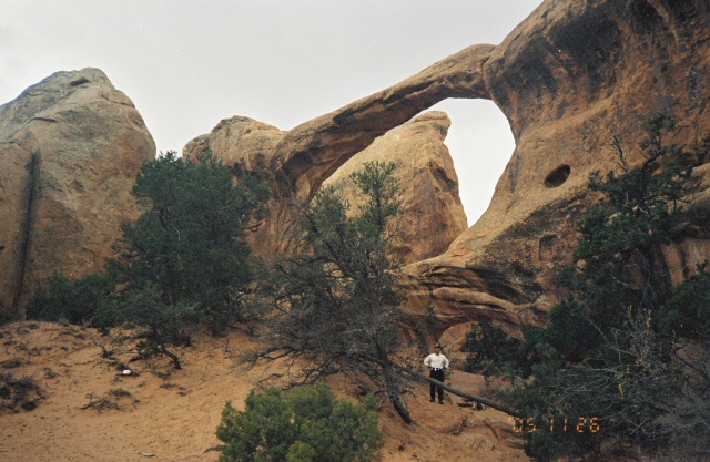
After I got done with the Devil's Garden,
the Primitive Loop, and Dark Angel,
I did some hiking in the same area
to see Broken Arch and Sand Dune Arch.
I still haven't gotten a chance to do
the ranger-guided hike through Fiery Furnace.
With its less-demanding hikes and spectacular rock formations,
Arches is a terrific way to end a wonderful weekend
in a fantastic place.
My usual motel was closed for Christmas weekend,
so I decided to spend a little extra
and to stay in the park
at Zion Lodge.
They had a reasonable promotion price for the weekend,
so I didn't pay that much extra for the privilege.
These parks are a joy to visit,
being in the presence of their beauty is a privilege.
I remember when they were far and distance places.
These trips are a special joy to me.
Making three of them in one season like this
is like showing off to myself.
If I met myself of twenty years ago in a time machine
and said,
"Hey, I got to enjoy Bryce Canyon,
Canyonlands, Dead Horse Point, Arches,
and Zion in a single fall season
with only a single day off from work,"
then that would be serious showing off.
Who gets to have that much fun?
The answer is me, myself,
living here in the Valley of the Sun
(Scottsdale, Arizona) with an airplane.
Flying to the Utah National Parks from Phoenix


Flying to the Utah National Parks from Phoenix
 Arizona is aviation heaven,
especially for those of us who like flying in the mountains.
The weather is usually perfect,
the air is usually smooth,
the scenary is varied and fantastic,
and the altitudes are manageable even in a modest airplane
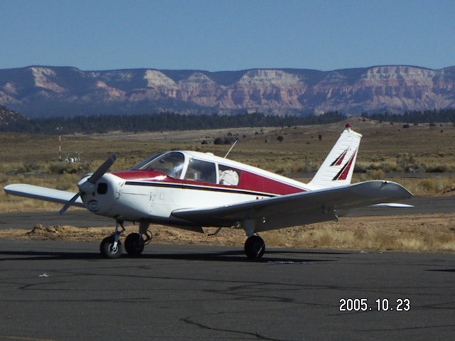
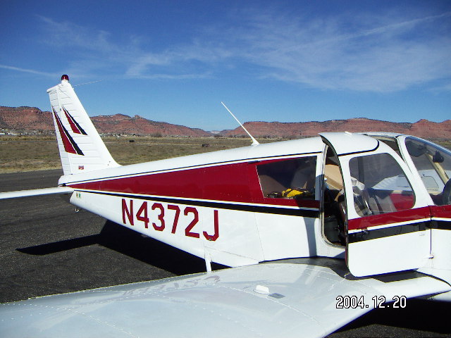
like my Piper Cherokee 140.
Arizona is aviation heaven,
especially for those of us who like flying in the mountains.
The weather is usually perfect,
the air is usually smooth,
the scenary is varied and fantastic,
and the altitudes are manageable even in a modest airplane
like my Piper Cherokee 140.
 Good flying weather is not enough, however.
I also require good hiking conditions to make the trip worthwhile.
Good weather for flying is generally good for hiking,
but snow, mud, and rock slides are exceptions.
In 2004 the high-country snow came early
and covered Bryce Canyon's lovely trails.
A dusting of snow makes the lovely views all the more magical,
but can make trails slippery and muddy.
Good flying weather is not enough, however.
I also require good hiking conditions to make the trip worthwhile.
Good weather for flying is generally good for hiking,
but snow, mud, and rock slides are exceptions.
In 2004 the high-country snow came early
and covered Bryce Canyon's lovely trails.
A dusting of snow makes the lovely views all the more magical,
but can make trails slippery and muddy.
 The three-trip plan was simple:
Bryce the first cooperative weekend in October,
Moab over American Thanksgiving,
and Zion over Christmas.
The three-trip plan was simple:
Bryce the first cooperative weekend in October,
Moab over American Thanksgiving,
and Zion over Christmas.
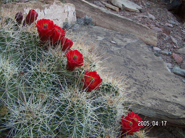
 This is magnificent country,
beautiful to drive through and
even more beautiful from the air.
There are geologists who study the forces that shaped this land
while the rest of us speculate about wind, water, and time.
This is magnificent country,
beautiful to drive through and
even more beautiful from the air.
There are geologists who study the forces that shaped this land
while the rest of us speculate about wind, water, and time.
Flying to Bryce Canyon


Flying to Bryce Canyon
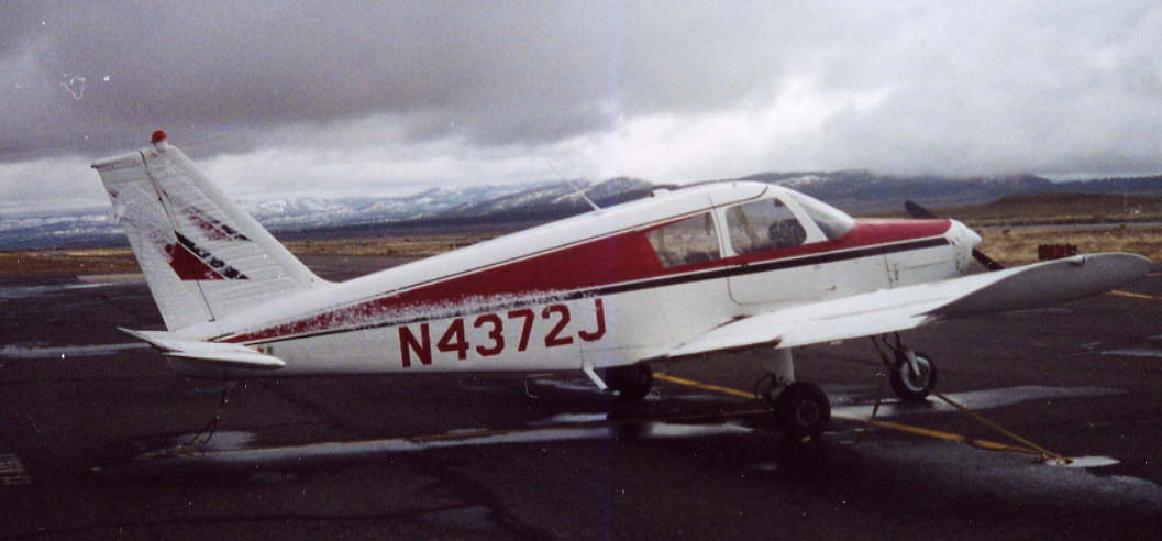 I left Deer Valley Airport
(DVT)
2005 October 22, Saturday morning at oh-dark-hundred
in time to see sunrise at the Grand Canyon.
(Even with a partial moon it was dark along the way.)
For most mountain areas sunrise and sunset are the perfect times,
the Kodak moments,
as the long shadows highlight mountain contours.
Dawn really isn't the perfect moment for Grand Canyon viewing
as the canyon below the rim is still in darkness,
maybe an hour later would be better,
but it still is a wonderful way to start the day.
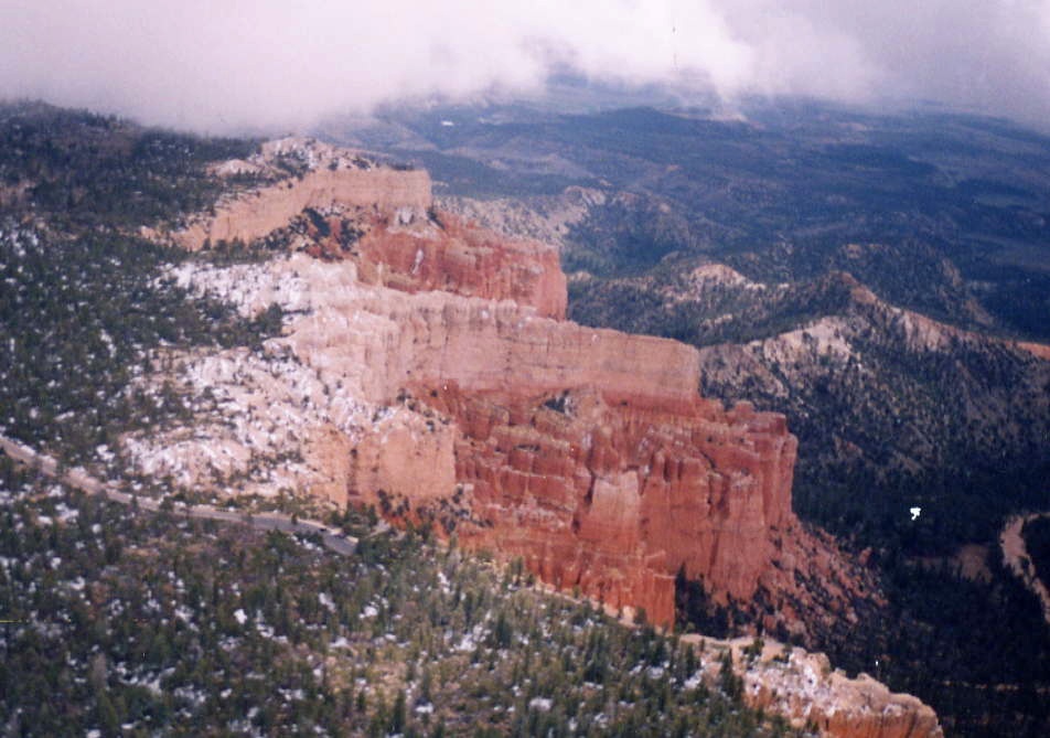
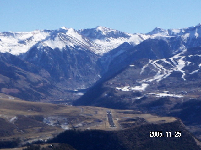
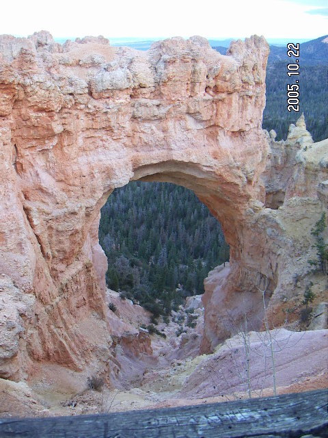
I reached Bryce Canyon at the perfect time,
although it seems any time I can see Bryce Canyon
in the sunshine is the perfect time.
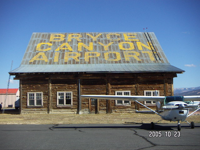
It took about two and half hours to reach Bryce Canyon Airport
(BCE)
I left Deer Valley Airport
(DVT)
2005 October 22, Saturday morning at oh-dark-hundred
in time to see sunrise at the Grand Canyon.
(Even with a partial moon it was dark along the way.)
For most mountain areas sunrise and sunset are the perfect times,
the Kodak moments,
as the long shadows highlight mountain contours.
Dawn really isn't the perfect moment for Grand Canyon viewing
as the canyon below the rim is still in darkness,
maybe an hour later would be better,
but it still is a wonderful way to start the day.
I reached Bryce Canyon at the perfect time,
although it seems any time I can see Bryce Canyon
in the sunshine is the perfect time.
It took about two and half hours to reach Bryce Canyon Airport
(BCE)
 In the past
I have taken the helicopter rides from Ruby's Inn
and that is a wonderful way to see Bryce Canyon from the air.
I like my flying low and slow,
to participate in the landscape
rather than to see it from far away,
and the helicopter can fly very low and very slow.
As an aviator and a hiker
I recommend it.
In the past
I have taken the helicopter rides from Ruby's Inn
and that is a wonderful way to see Bryce Canyon from the air.
I like my flying low and slow,
to participate in the landscape
rather than to see it from far away,
and the helicopter can fly very low and very slow.
As an aviator and a hiker
I recommend it.
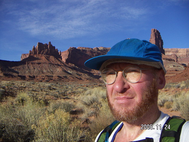
Flying to Moab


Flying to Moab
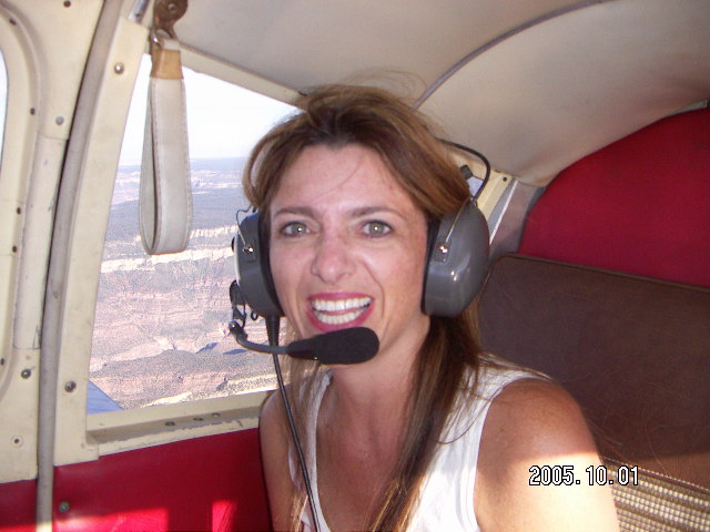
 While the flight from DVT to Moab
(CNY)
isn't really that much further than DVT-to-BCE,
it is enough further,
the hikes at Canyonlands, Arches, and Dead Horse Point
are enough bigger,
and the driving distances are enough longer
that the trip merits more than two or even three days.
I had a friend visiting from the Bay area
for American Thanksgiving weekend
and he was coming in a couple of days early,
so we went up for a short mountain flight
2005 November 23, Wednesday morning,
and then I left for the magnificent journey.
As I have
said
elsewhere
the flight goes over Sedona, Flagstaff, the Painted Desert,
the east end of the Grand Canyon,
Lake Powell, and Canyonlands.
With perfect weather this was the perfect aviation journey.
While the flight from DVT to Moab
(CNY)
isn't really that much further than DVT-to-BCE,
it is enough further,
the hikes at Canyonlands, Arches, and Dead Horse Point
are enough bigger,
and the driving distances are enough longer
that the trip merits more than two or even three days.
I had a friend visiting from the Bay area
for American Thanksgiving weekend
and he was coming in a couple of days early,
so we went up for a short mountain flight
2005 November 23, Wednesday morning,
and then I left for the magnificent journey.
As I have
said
elsewhere
the flight goes over Sedona, Flagstaff, the Painted Desert,
the east end of the Grand Canyon,
Lake Powell, and Canyonlands.
With perfect weather this was the perfect aviation journey.
 Saturday had a scare,
forecast of bad weather in the area through Sunday morning,
which turned into a breezy afternoon with a few clouds
lower than I planned to fly home.
The weather cleared by
2005 November 27, Sunday, for my flight home.
I took a dog-leg east over the Green River side
of Canyonlands National Park
for a different set of fantastic views.
Saturday had a scare,
forecast of bad weather in the area through Sunday morning,
which turned into a breezy afternoon with a few clouds
lower than I planned to fly home.
The weather cleared by
2005 November 27, Sunday, for my flight home.
I took a dog-leg east over the Green River side
of Canyonlands National Park
for a different set of fantastic views.
Flying to Telluride


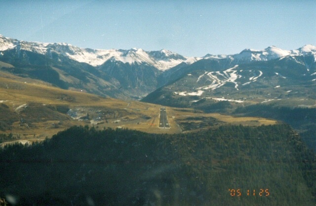

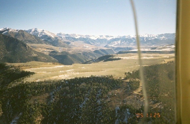
Flying to Telluride
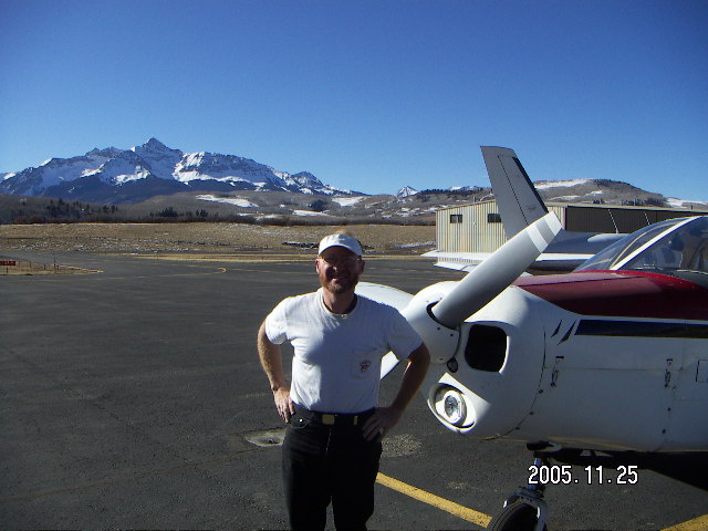
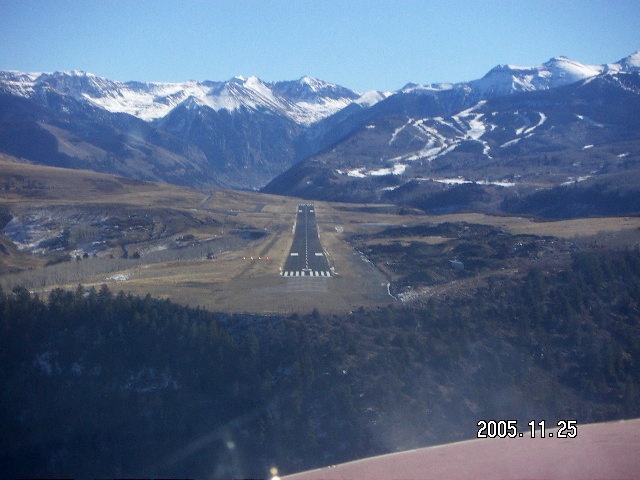 My first trip to Telluride
(TEX)
was in a Piper Comanche (PA24-180) from Denver
on 1988 February 13
when I had 200 hours of flight time.
The mountains in southwest Colorado were scary
and Telluride (2800m, 9100', 725mb)
is the second highest airport in the United States.
(I'm pretty sure Leadville
(LVX,
3000m, 10000', 700mb)
is the only U.S. airport higher than TEX.)
My first trip to Telluride
(TEX)
was in a Piper Comanche (PA24-180) from Denver
on 1988 February 13
when I had 200 hours of flight time.
The mountains in southwest Colorado were scary
and Telluride (2800m, 9100', 725mb)
is the second highest airport in the United States.
(I'm pretty sure Leadville
(LVX,
3000m, 10000', 700mb)
is the only U.S. airport higher than TEX.)
 Given a cool, calm, clear day,
even my underpowered Cherokee 140
can land and take-off at TEX.
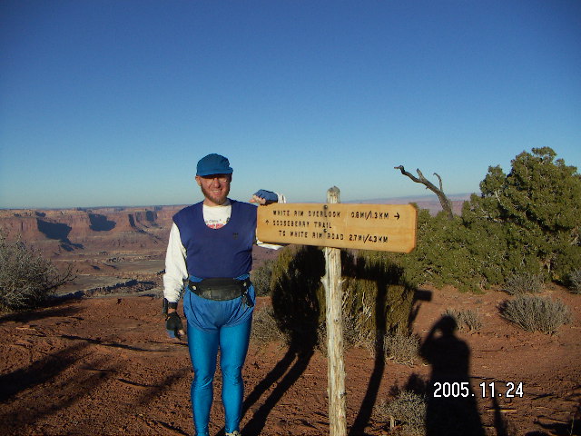
2005 November 25, Friday,
was such a cool, calm, clear day
with wonderful weather forecasts for the entire area all day.
Other than breathtaking scenery,
the trip was uneventful.
The folks at TEX have an attitude about their altitude
and I bought an appropriate T-shirt that says
"Some fly at 9078', we land."
Given a cool, calm, clear day,
even my underpowered Cherokee 140
can land and take-off at TEX.
2005 November 25, Friday,
was such a cool, calm, clear day
with wonderful weather forecasts for the entire area all day.
Other than breathtaking scenery,
the trip was uneventful.
The folks at TEX have an attitude about their altitude
and I bought an appropriate T-shirt that says
"Some fly at 9078', we land."
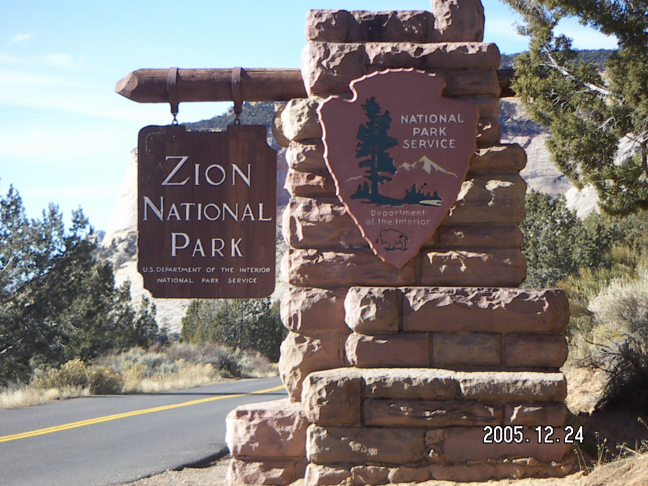
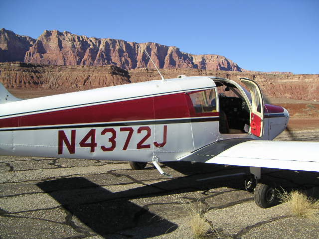
Flying to Kanab
Flying to Kanab
 My airplane was due for its annual inspection in 2005 December
and I hoped it would be ready in time for a Christmas-weekend trip
to Kanab
(KNB)
for a weekend at Zion National Park.
I was thrice blessed,
the annual inspection went well and was done in time,
the weather was good for the whole weekend for flying,
and the trails were all good for hiking, no rockslides, no snow.
My airplane was due for its annual inspection in 2005 December
and I hoped it would be ready in time for a Christmas-weekend trip
to Kanab
(KNB)
for a weekend at Zion National Park.
I was thrice blessed,
the annual inspection went well and was done in time,
the weather was good for the whole weekend for flying,
and the trails were all good for hiking, no rockslides, no snow.
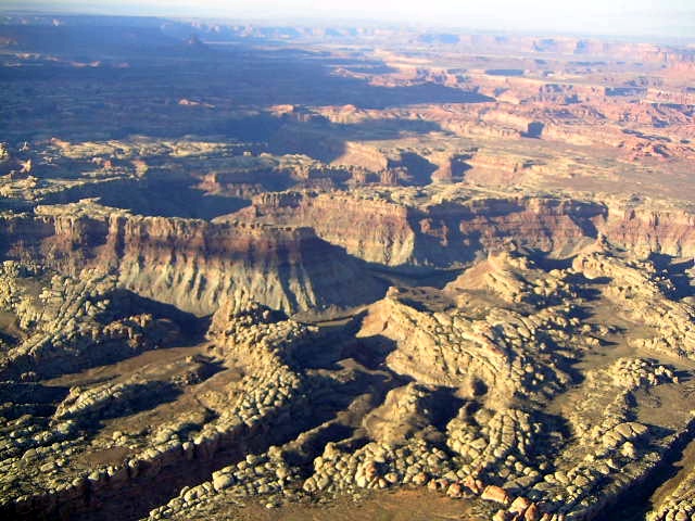
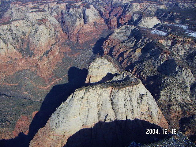
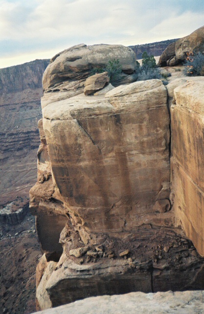
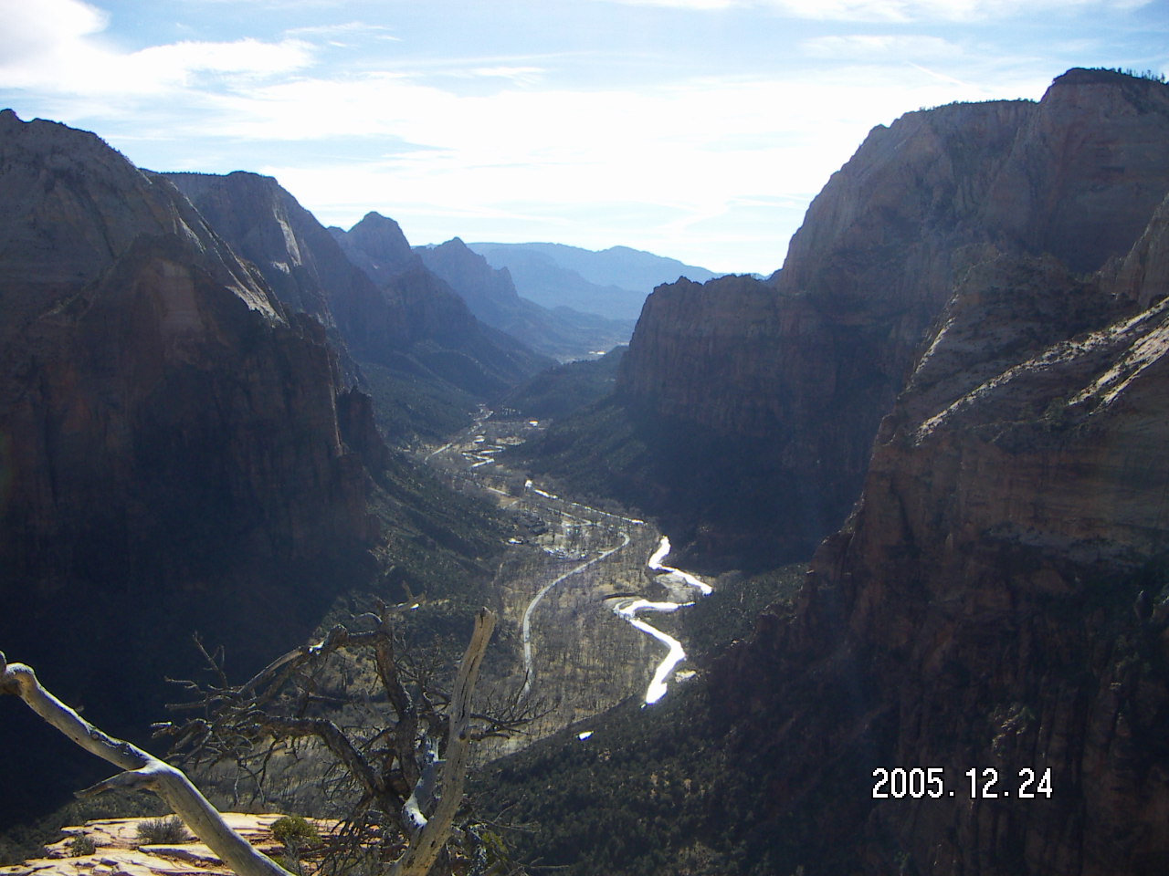
 Flying over Zion is less spectacular than hiking it,
but it puts the park into perspective.
It's a small canyon cut into a large plateau,
a groove in the boundary between low country and high country.
Seeing how all the pieces fit together from the air
makes hiking more interesting to me.
Flying over Zion is less spectacular than hiking it,
but it puts the park into perspective.
It's a small canyon cut into a large plateau,
a groove in the boundary between low country and high country.
Seeing how all the pieces fit together from the air
makes hiking more interesting to me.
Hiking the Utah National Parks


Hiking the Utah National Parks
I grew up back east where people walk for exercise
when they're too old or tired to run
and too clumsy to play tennis or golf.
I still
run and race
after all these years,
so recreational walking isn't a part of my life.
When paths become trails and familiar scenery becomes remote vistas,
walking becomes hiking
and takes on new meaning.
 The City of Scottsdale has decided
to make hiking in the Sonoran desert
an important part of living here
through the
McDowell Sonoran Conservancy
and its growing networks of wonderful trails.
Arizona has a large network of hiking opportunities
from the Grand Canyon to lesser-known trails
hidden in the mountain ranges throughout the state.
The City of Scottsdale has decided
to make hiking in the Sonoran desert
an important part of living here
through the
McDowell Sonoran Conservancy
and its growing networks of wonderful trails.
Arizona has a large network of hiking opportunities
from the Grand Canyon to lesser-known trails
hidden in the mountain ranges throughout the state.
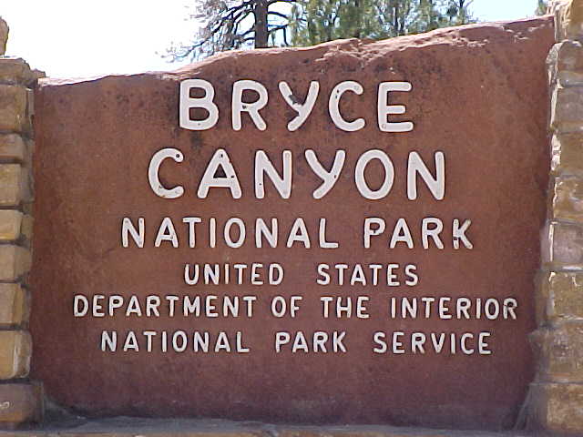
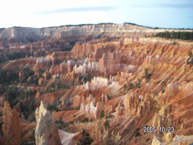
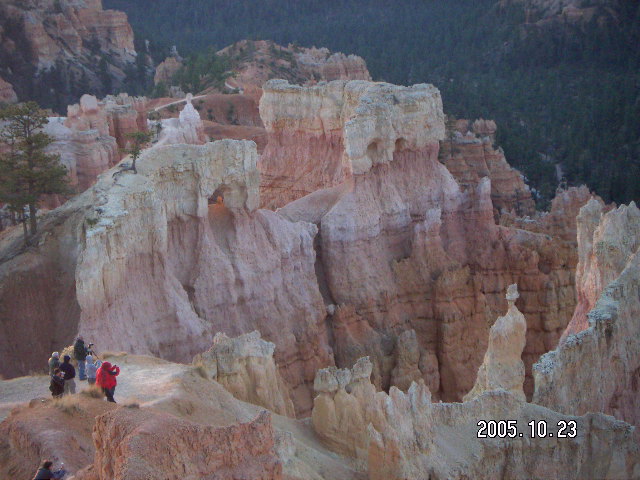
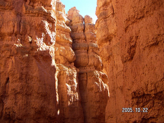
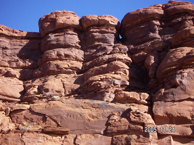
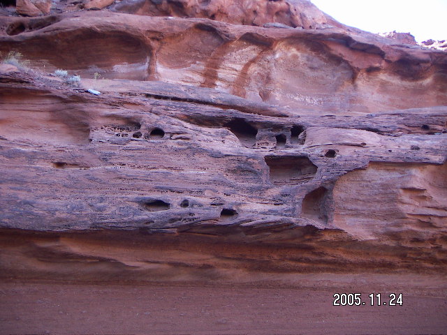
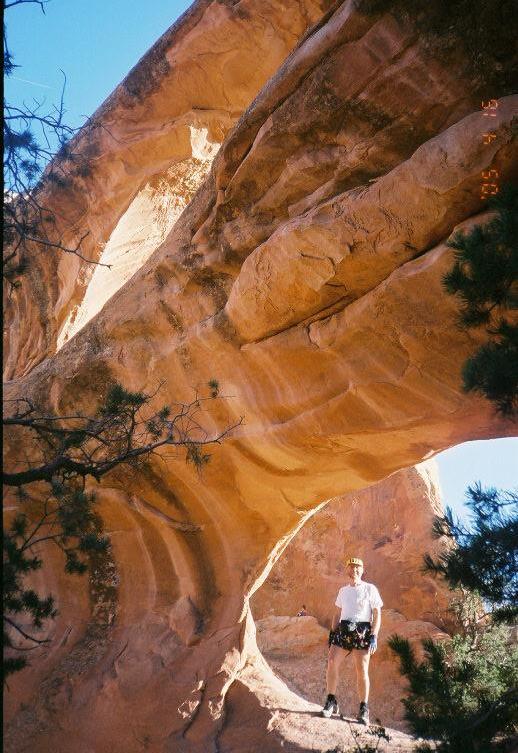
Bryce Canyon


Bryce Canyon
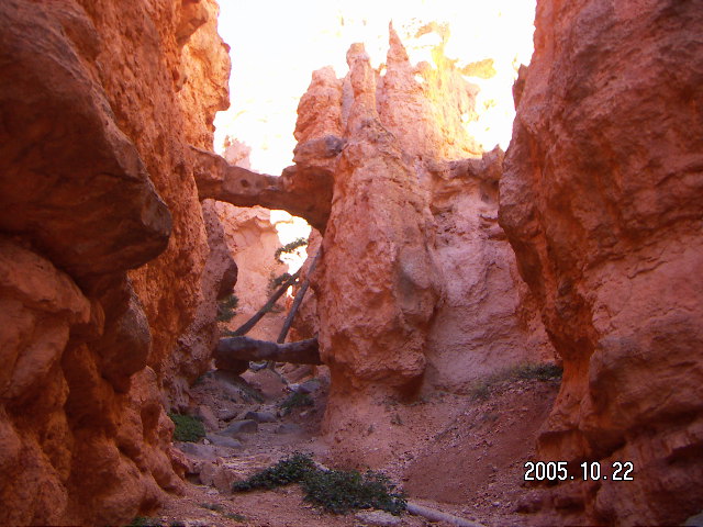
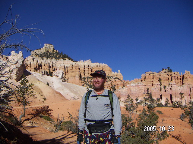
 Bryce Canyon is a long, narrow park
with a rim trail and a network of trails under its rim.
(It isn't really a canyon,
just a rim on one side,
the edge of a plateau.)
My usual big Bryce hike
starts at Sunrise Point
down to the Queen's Garden,
goes around the Navajo and Peekaboo loops
to Sunset Point and Bryce Point,
and comes back from the Queen's Garden
to Sunrise Point,
about 20 Km (12 miles).
Bryce Canyon is a long, narrow park
with a rim trail and a network of trails under its rim.
(It isn't really a canyon,
just a rim on one side,
the edge of a plateau.)
My usual big Bryce hike
starts at Sunrise Point
down to the Queen's Garden,
goes around the Navajo and Peekaboo loops
to Sunset Point and Bryce Point,
and comes back from the Queen's Garden
to Sunrise Point,
about 20 Km (12 miles).
 After the big Bryce hike
I'm usually ready for a drive where I can sit for a while,
so I drive all the way to the south end of the park,
Rainbow Point with its vast vistas,
do the easy Bristlecone hike,
and stop at all the viewpoints
on the right side of the road
coming back north.
The road north follows the rim and the viewpoints face east,
so they're all on the right side.
After the big Bryce hike
I'm usually ready for a drive where I can sit for a while,
so I drive all the way to the south end of the park,
Rainbow Point with its vast vistas,
do the easy Bristlecone hike,
and stop at all the viewpoints
on the right side of the road
coming back north.
The road north follows the rim and the viewpoints face east,
so they're all on the right side.
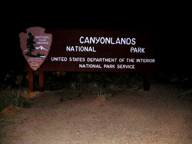
Canyonlands


Canyonlands
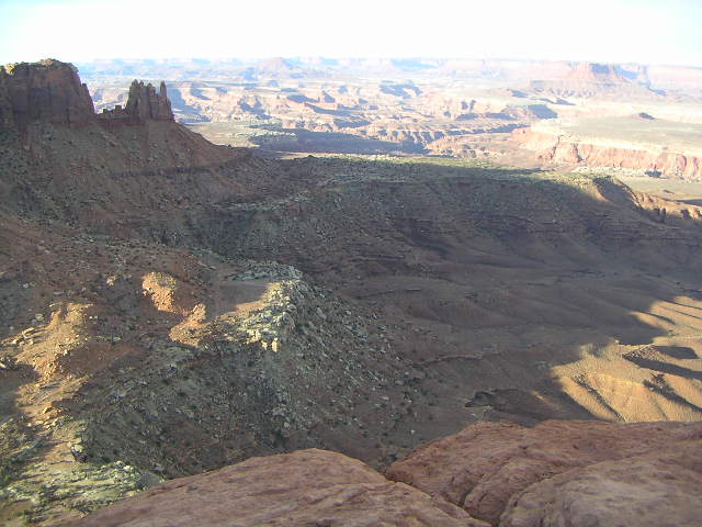
 Canyonlands is the most remote of the parks on this list of four.
It has a long "driveway" in that the road to Canyonlands
from the highway is twenty-five miles long
and the trails are long and not well traveled.
The isolation heightens the sense of adventure,
but I would rather be at Bryce, Zion, or Arches
if I were to turn an ankle or have back problems while hiking.
Canyonlands is the most remote of the parks on this list of four.
It has a long "driveway" in that the road to Canyonlands
from the highway is twenty-five miles long
and the trails are long and not well traveled.
The isolation heightens the sense of adventure,
but I would rather be at Bryce, Zion, or Arches
if I were to turn an ankle or have back problems while hiking.
 The goal this trip was to do the Lathrop trail
without the
dehydration issues
I had the
first time
I did this hike.
It's a Great Big Effort,
twenty miles down to the Colorado River and back
down 800 meters (2500 feet) and back up,
the full distance and half the elevation change
of the Grand Canyon rim-to-rim.
The other hikes I looked at
had more steep, scary dropoffs on their trails
and did not cross the White Rim.
The goal this trip was to do the Lathrop trail
without the
dehydration issues
I had the
first time
I did this hike.
It's a Great Big Effort,
twenty miles down to the Colorado River and back
down 800 meters (2500 feet) and back up,
the full distance and half the elevation change
of the Grand Canyon rim-to-rim.
The other hikes I looked at
had more steep, scary dropoffs on their trails
and did not cross the White Rim.
 For a non-runner,
the twenty-mile (32-Km) Lathrop round-trip is long
as there is a steep, rocky mile
that takes me about an hour each way.
Running twelve of the twenty miles (20/32 Km)
the total journey takes me about eight hours
including about half an hour just sitting by myself
enjoying the scenery
one of the picnic tables at the Colorado River,
and psyching myself for the long uphill trip back.
For a non-runner,
the twenty-mile (32-Km) Lathrop round-trip is long
as there is a steep, rocky mile
that takes me about an hour each way.
Running twelve of the twenty miles (20/32 Km)
the total journey takes me about eight hours
including about half an hour just sitting by myself
enjoying the scenery
one of the picnic tables at the Colorado River,
and psyching myself for the long uphill trip back.
trail head
2.0 Km,
1.3 miles,
flat sandy trail in grass
2.0 Km,
1.2 miles,
slick rock and trail
Island rim
1.5 km
1.0 mile,
gentle rocky descent
1.5 km
1.0 mile,
steep rocky descent
1.5 km
1.0 mile,
easy trail around canyons
1.0 Km,
0.5 mile,
trail in wash
White Rim
6.5 km
4.0 miles,
jeep road down to river
Colorado River
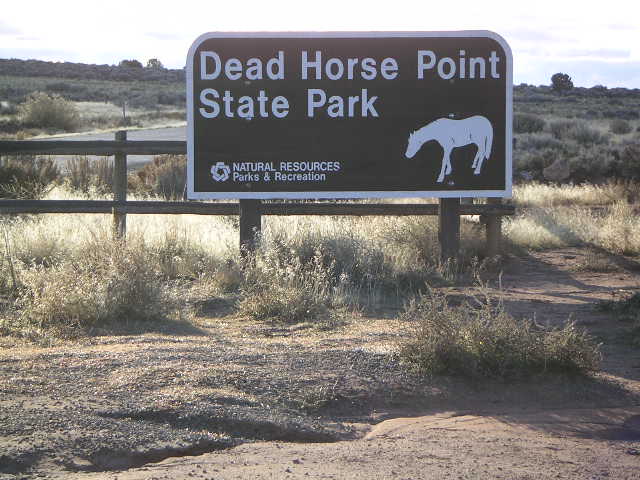
Dead Horse Point
Dead Horse Point
 When I got back from my Telluride flight,
I decided I would hike the main loop at
Dead Horse Point.
There was enough time to hike the full loop
before sunset,
but not the out-and-back trails along the way,
so they will have to wait for another visit.
When I got back from my Telluride flight,
I decided I would hike the main loop at
Dead Horse Point.
There was enough time to hike the full loop
before sunset,
but not the out-and-back trails along the way,
so they will have to wait for another visit.
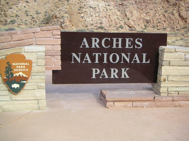
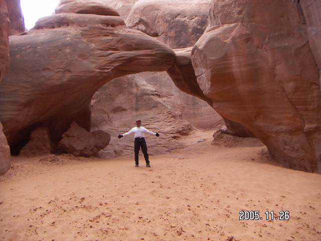
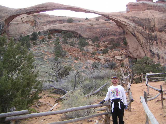
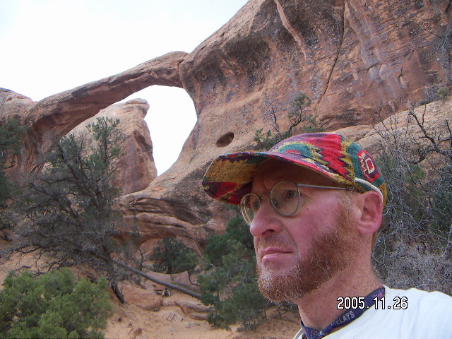
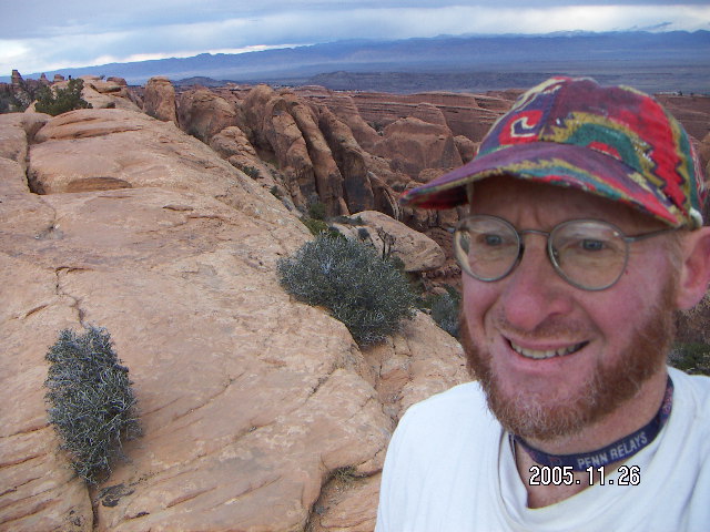
Arches

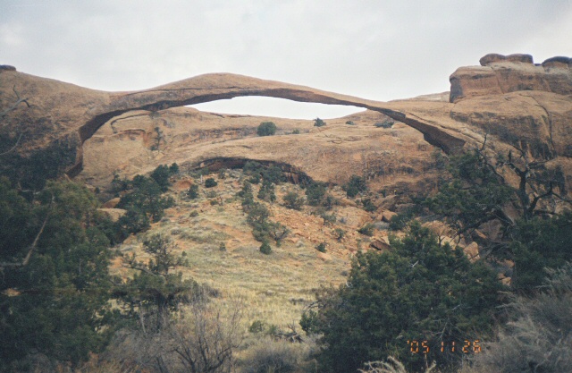
Arches
 In contrast to Canyonlands with its long driveway
and long, desolate hikes,
Arches is easily accessible.
The entrance is right off the main highway north of Moab
and most of the hikes are only a mile or two
from the road to some spectacular formation.
As I have done the short hikes in past visits,
I concentrated on the long hike at the far end of the park,
the roughly-eight-mile trip to the Devil's Garden
along both the regular trail and the Primitive Trail
with a journey to Dark Angel,
a free-standing column at the end of the Devil's Garden trail.
In contrast to Canyonlands with its long driveway
and long, desolate hikes,
Arches is easily accessible.
The entrance is right off the main highway north of Moab
and most of the hikes are only a mile or two
from the road to some spectacular formation.
As I have done the short hikes in past visits,
I concentrated on the long hike at the far end of the park,
the roughly-eight-mile trip to the Devil's Garden
along both the regular trail and the Primitive Trail
with a journey to Dark Angel,
a free-standing column at the end of the Devil's Garden trail.
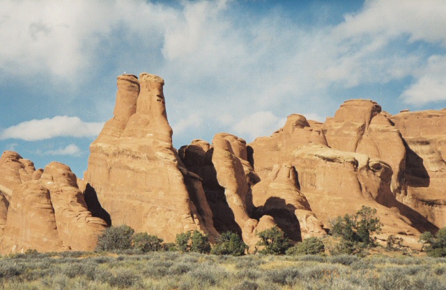
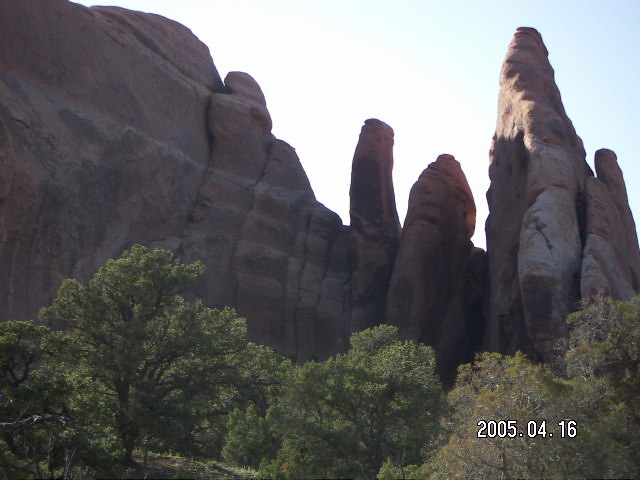
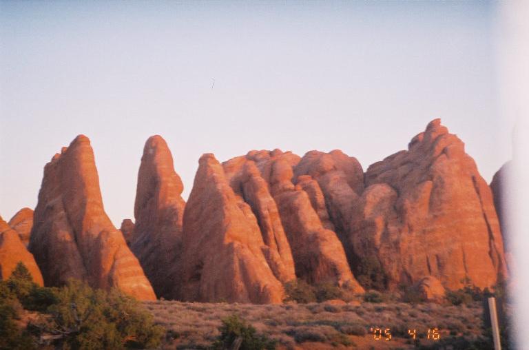
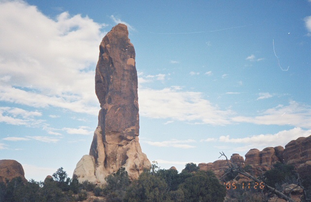
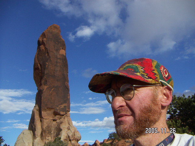
 The arches at Arches are not the most interesting feature to me.
I find the strange and wonderful shapes of the rocks,
the fins and columns,
draw my eye even more strongly.
One wag said you should look at Utah with one eye closed
so it only looks half as strange.
The arches at Arches are not the most interesting feature to me.
I find the strange and wonderful shapes of the rocks,
the fins and columns,
draw my eye even more strongly.
One wag said you should look at Utah with one eye closed
so it only looks half as strange.
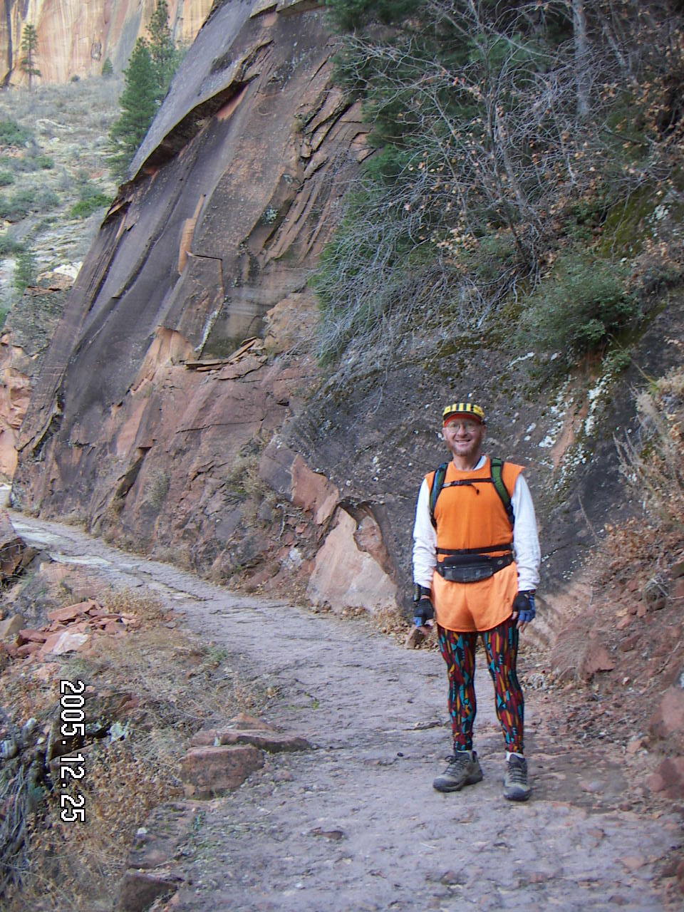
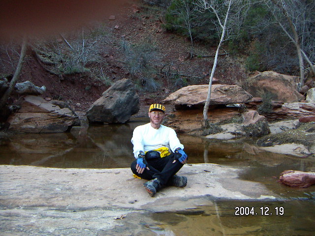
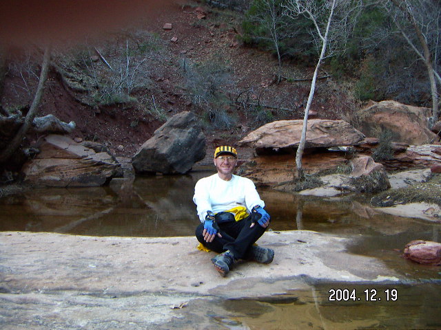
Zion
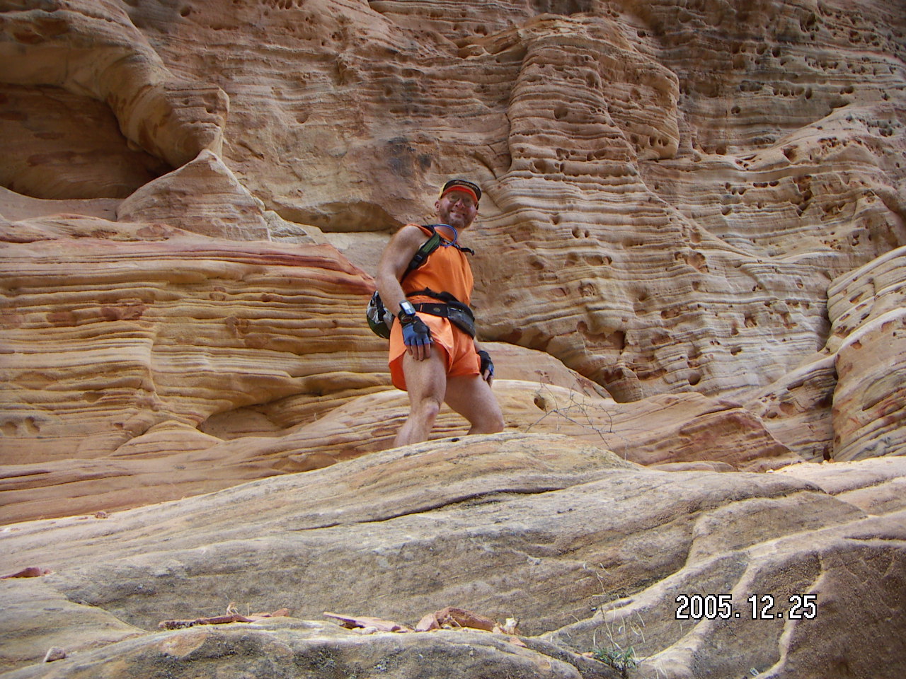


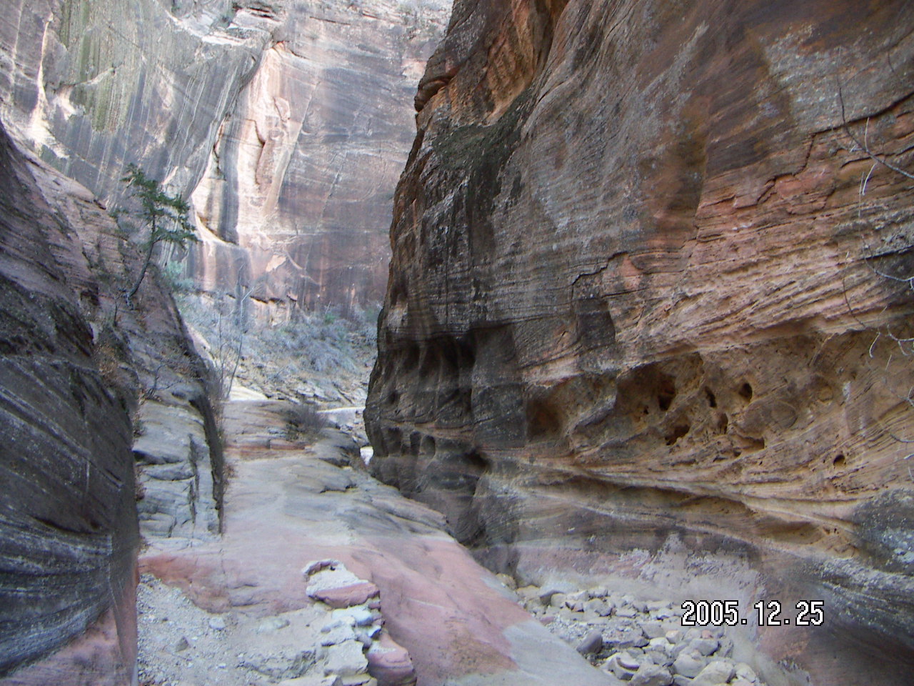

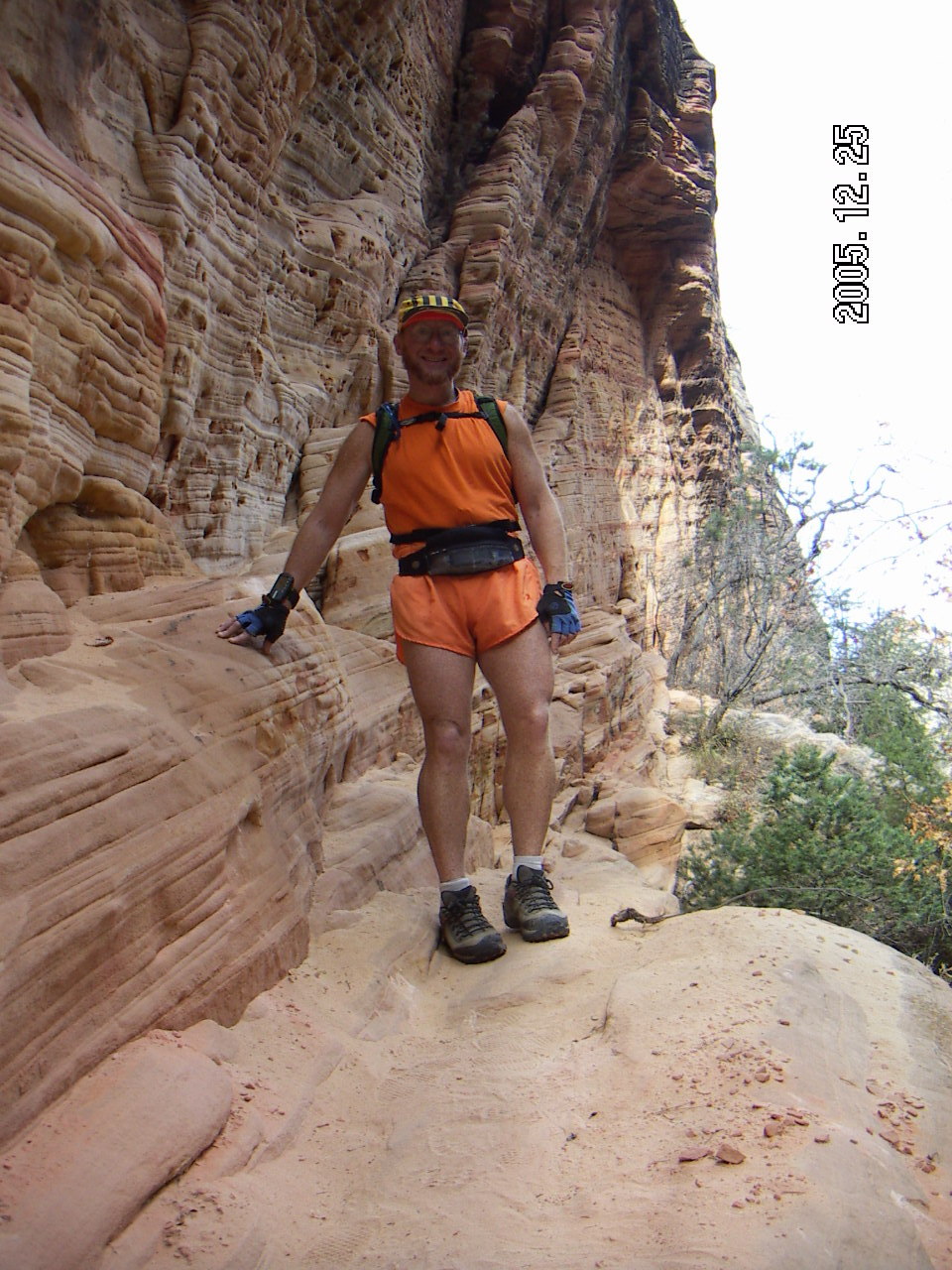
Zion
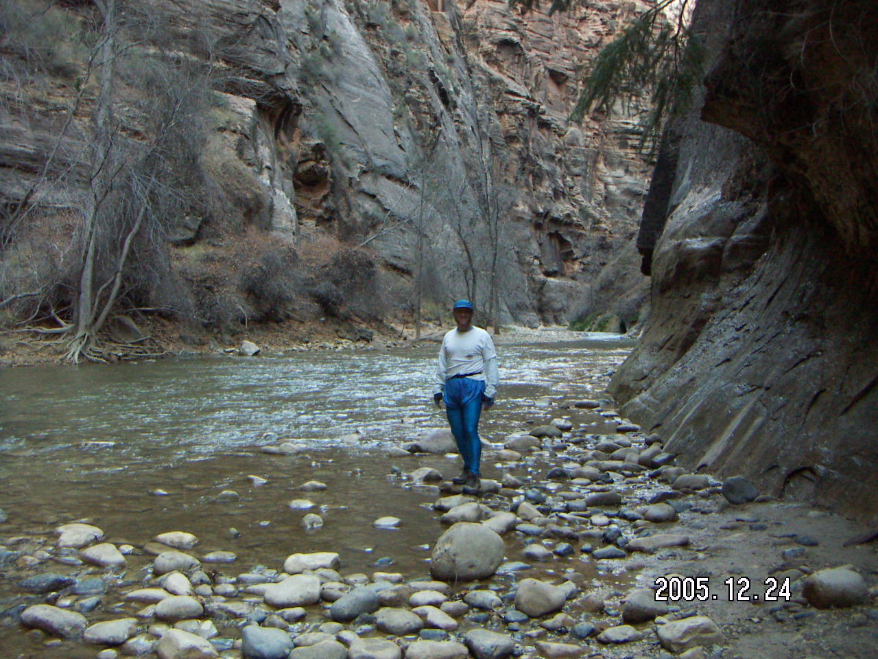
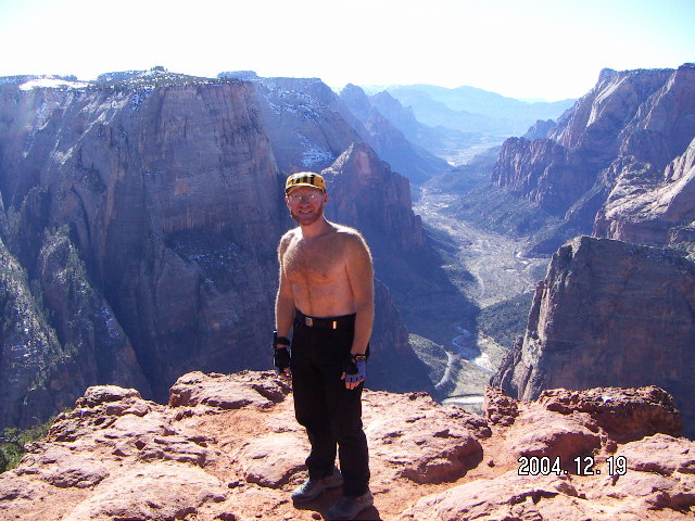
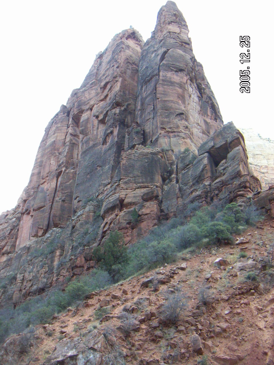 Zion National Park has lots of hiking,
including several challenging day hikes.
A younger version of me
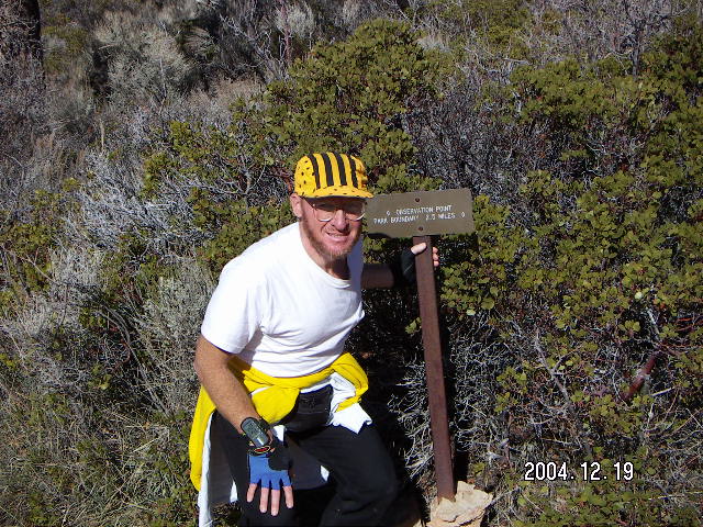
was able to do hikes to Observation Point
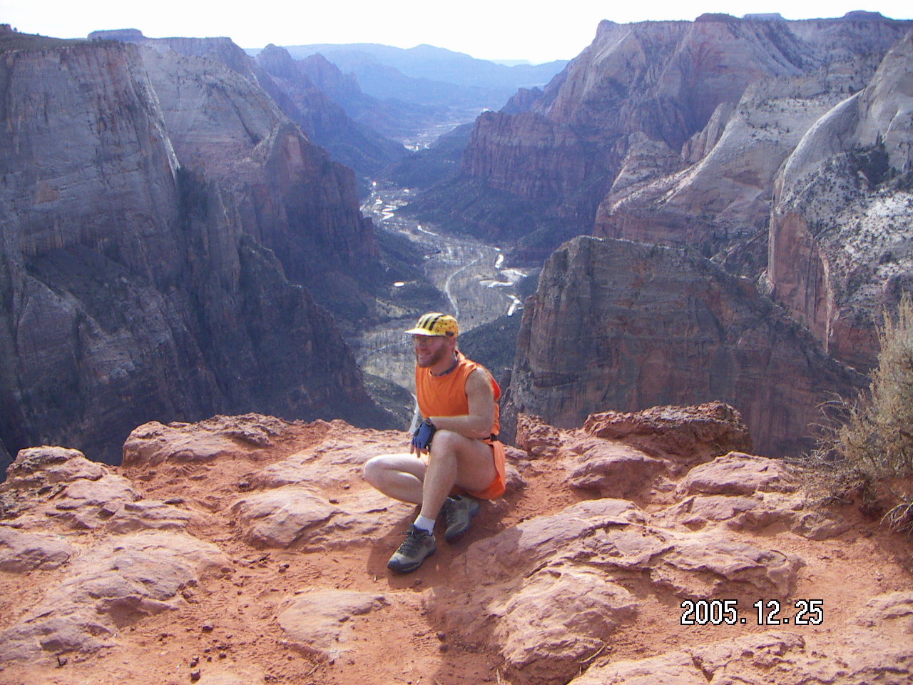
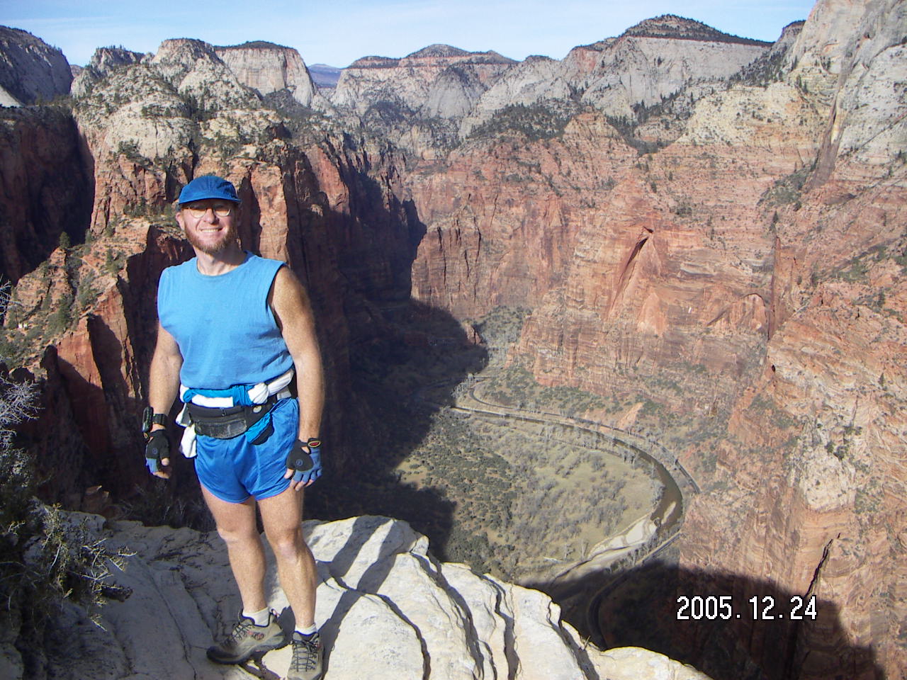
and Angel's Landing in one day.
Now I do them on separate days,
and not the day I'm flying home,
so that makes Zion a three-day weekend.
Zion National Park has lots of hiking,
including several challenging day hikes.
A younger version of me
was able to do hikes to Observation Point
and Angel's Landing in one day.
Now I do them on separate days,
and not the day I'm flying home,
so that makes Zion a three-day weekend.
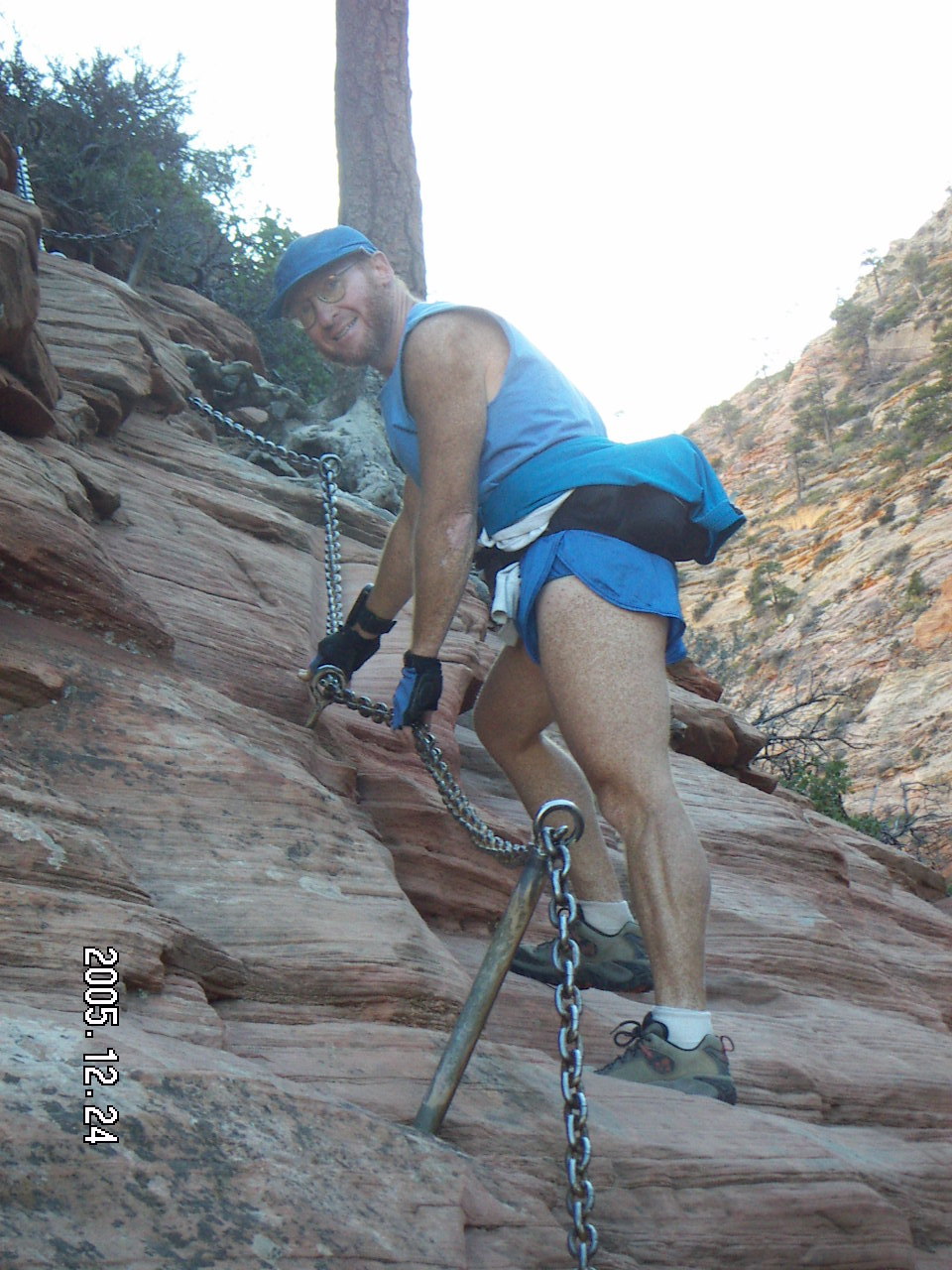
 With all the times I've hiked these trails,
I still don't have a clear mental picture
of the three-dimensional structure of the views I see.
The trails go in and out of canyons
some of which are on rocks that hang out over other trails.
For the acrophobic crowd,
there are several don't-look-down places along these hikes.
With all the times I've hiked these trails,
I still don't have a clear mental picture
of the three-dimensional structure of the views I see.
The trails go in and out of canyons
some of which are on rocks that hang out over other trails.
For the acrophobic crowd,
there are several don't-look-down places along these hikes.
Reality
Reality
 A friend in my office from South Africa
says he saw pictures as a young athlete
of people hiking in and running near the Grand Canyon.
Now he's working just a few hours' drive from it.
A friend in my office from South Africa
says he saw pictures as a young athlete
of people hiking in and running near the Grand Canyon.
Now he's working just a few hours' drive from it.

19:06:59 Mountain Standard Time
(MST).
1431 visits to this web page.