|
|
| |||
|
| ||||
|

|
|
(and Birthday Celebration)
back to ZION NATIONAL PARK
2004 December 18-20
|
|
|
| |||
|
|
| ||||
|
|
|
|
 My previous trip to Zion,
2004 October 29-31
with my neighbor
Greg,
was a bit of a disappointment.
Greg was anything but a disappointment,
good hiker and great company,
and we were well matched in what challenges we would face.
The east side of the park,
Hidden Canyon and Observation Point were closed
by a rock slide
and my running shoes and bare hands
were ill-equipped for Angel's Landing
with its sandy, slippery rock and chains against the rocks.
(I would rather blame my equipment
than my own lack of courage.
It saves me having to admit that I "wussed out.")
My flying trips in 2004 to
other parks
have been very satisfying.
My previous trip to Zion,
2004 October 29-31
with my neighbor
Greg,
was a bit of a disappointment.
Greg was anything but a disappointment,
good hiker and great company,
and we were well matched in what challenges we would face.
The east side of the park,
Hidden Canyon and Observation Point were closed
by a rock slide
and my running shoes and bare hands
were ill-equipped for Angel's Landing
with its sandy, slippery rock and chains against the rocks.
(I would rather blame my equipment
than my own lack of courage.
It saves me having to admit that I "wussed out.")
My flying trips in 2004 to
other parks
have been very satisfying.
 So another trip to Zion was called for:
First, to see the east-side trails and,
second, to have a "rematch"
hiking Angel's Landing armed with hiking shoes and gloves.
Besides the male-ego, testosterone thing
of conquering my fear of heights,
the view from the top is absolutely spectacular.
(Comedian
Stephen Wright
once quipped,
"Some people are afraid of heights. Not me, I'm afraid of widths."
He must have had Angel's Landing in mind
where parts of the path are a half meter wide
with hundreds of meters drop on both sides.)
The National Park Service maintains a
web page
for Zion National Park
with a map and guide for
winter visiting.
So another trip to Zion was called for:
First, to see the east-side trails and,
second, to have a "rematch"
hiking Angel's Landing armed with hiking shoes and gloves.
Besides the male-ego, testosterone thing
of conquering my fear of heights,
the view from the top is absolutely spectacular.
(Comedian
Stephen Wright
once quipped,
"Some people are afraid of heights. Not me, I'm afraid of widths."
He must have had Angel's Landing in mind
where parts of the path are a half meter wide
with hundreds of meters drop on both sides.)
The National Park Service maintains a
web page
for Zion National Park
with a map and guide for
winter visiting.
The flight plan?
Head north Saturday morning, cross the Canyon,
land at
Kanab (KNB),
get back Monday,
and fly south to
Deer Valley
(DVT).
Everything else could be figured out as I went along.
Remember the airline commercials of yesteryear?
They would show some guy smiling at the beach hollering over the surf,
"Getting there is half the fun."
Even before airport-security metal-detectors
and the cattle-car mentality of airport check-ins,
airline travel was still something we endured
rather than
cherished.
If getting there was half the fun,
then you must have been going someplace pretty awful.
With my early departure from Deer Valley (DVT),
I couldn't think of any reason why not.
So I headed northwest to the west end of the Grand Canyon
(photo array)
and landed at
Mesquite (67L).
After takeoff I flew over the portion of
Interstate 15 that runs along the Virgin River in Arizona
(photo array).
After flying over St. George and Hurricane in Utah,
I got to fly over Zion National Park itself
on my way to Kanab.
Flying
over Zion National Park
(photo array)
was nearly a religious experience.
There is a generally magical quality in aviation,
seeing the familiar from an unfamiliar viewpoint,
"Oh, look! There's my house."
Then there is a realization of the relative sizes of things,
things seen on the ground are often seen out of proportion,
"I never realized the park was so small
and the shopping mall was so huge."
Even after flying 1288 hours
and landing in 314 airports
in 38 states and two provinces,
this magic has not gone away for me.
In the mountains of the southwest United States
the magic is Ever-So-Much-More-So.
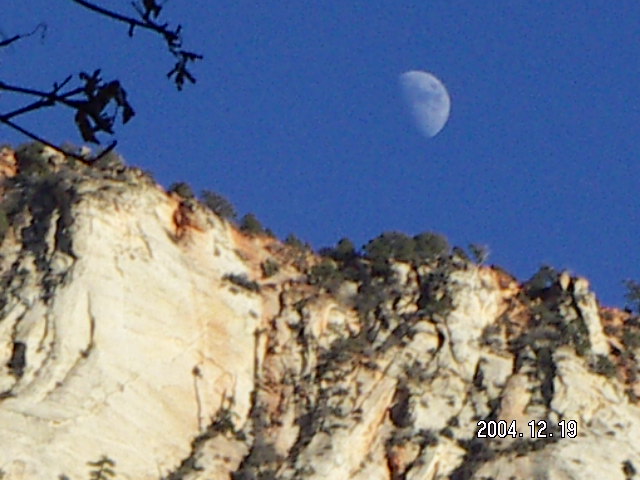
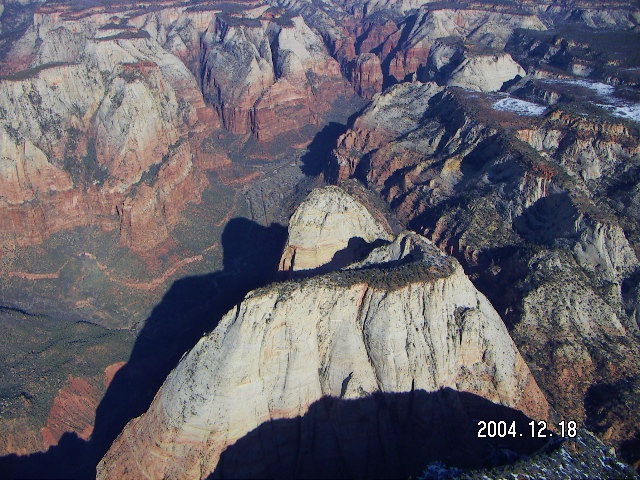
My picture from hiking Zion National Park
is one of a large canyon surrounded by mountains.
In the back of my mind,
I knew that those mountains were really part of a plateau,
but that lived in the back of my mind.
From the air, Zion is a small canyon
cut into a large plateau
that ends between Springdale and Rockville, Utah,
a green groove in the brown-rock landscape.
The magic continued as I found my favorite places.
Angel's Landing looks so small and narrow from the air,
a knife-edge rock surrounded by higher and broader places
including Observation Point.
Checkerboard Mesa is part of a large network of hillsides.
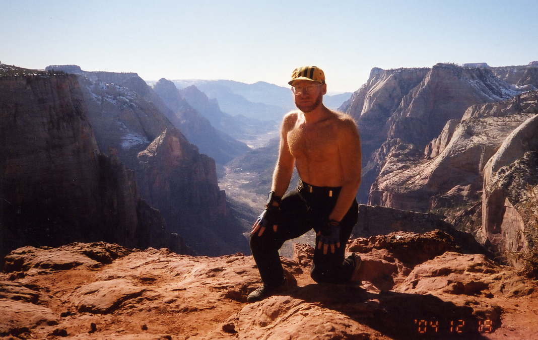
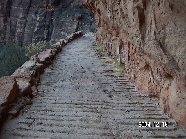
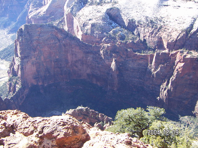
The climb to the top of Angel's Landing
is another half mile (800 meters)
of climbing over and around rocks
on a narrow path
with a 500-meter (1600-foot) drop on the left
and a 200-meter (700-foot) drop on the right.
The National Park Service was nice enough
to help those of us who aren't nimble climbers
by scooping out steps in the rocks
and installing chains to hang onto.
Even so, the climb is long, difficult, and scary,
at least for me.
(I'm told there are rock-climber types
who actually climb the sheer face of the side in two days
taking a night-nap halfway up while hanging on a rope.
Yeesh!)
Coming down is easier, actually,
for two reasons.
First, most obviously, there isn't a choice of turning back, and
second, there are no surprises as I have already seen the tough spots
and done them in the other direction.
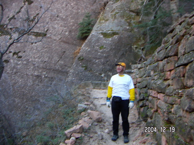
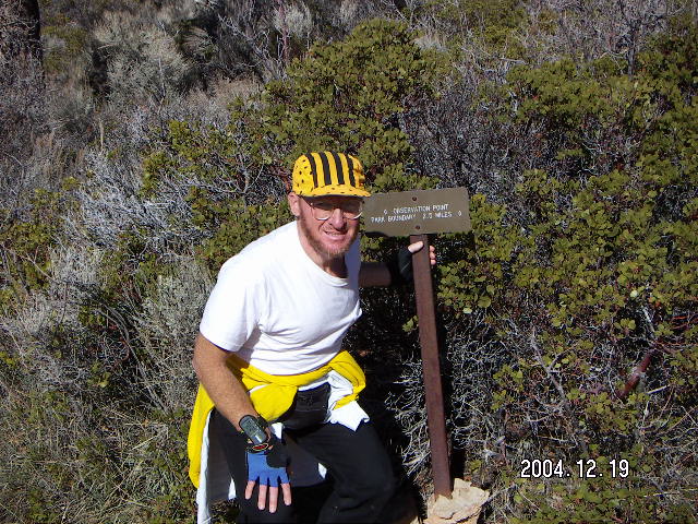
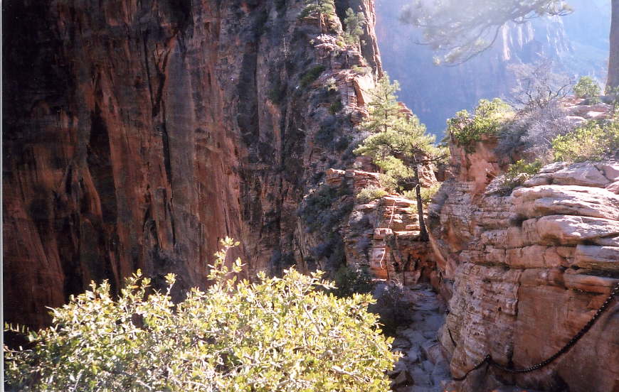
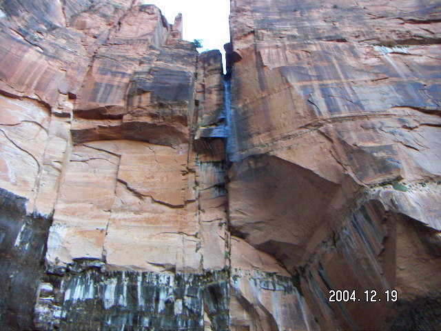
Along the way to Observation Point
is a side journey to Hidden Canyon
(photo array).
This is a wonderful trail in its own right
and should not be thought of as a pleasant diversion on another hike.
(When I was a youngster
I thought Backgammon was named because it was on the back
of the checker/chess-board and, later,
found out it is an interesting game in itself.)
After a series of common switchback trails cut into the rock hillside,
the Hidden Canyon trail turns right,
goes up sandy switchbacks,
crosses a usually-dry creek bed,
climbs around a scary, chain-assisted ledge,
and goes into a lovely canyon nestled partway up in the rock face.
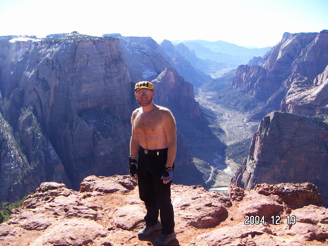
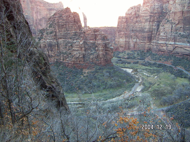
The end of the trail is a view
aptly named Observation Point,
not quite 360° but more than 180°,
enough to keep me going from one side to the other
just looking down at varying angles at the canyon below
(photo array).
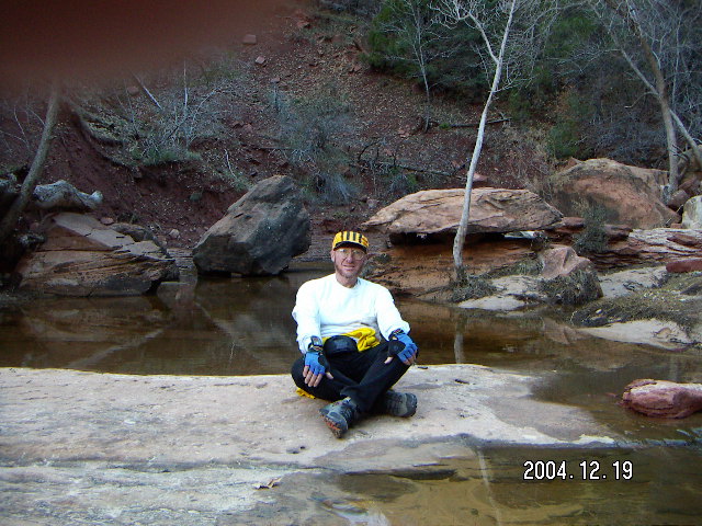
That view was a nice present for my
birthday,
don't you think?
One advantage of going in the off season,
risking snow, and braving the cold
is that the normally-crowded spots
are still reasonably quiet and serene.
I remember one time visiting Zion on Easter weekend
and the cacophony of wall-to-wall families
yelling and splashing in the Emerald Ponds
was too much to bear.
The second half of December offers smaller crowds
of more-serious visitors
more interested in quiet serenity
than a place to let their kids blow off steam.
These beautiful settings deserve some time
and I recommend finding quiet time there,
perhaps early in the morning before the crowds,
perhaps in the off-season as I did.
I used my
Garmin Forerunner 201
Global Positioning System (GPS)
while I was hiking and running the trails.
The steep canyon walls of Zion made it unable to pick up a signal
much of the time,
so it wasn't as useful as it was at Canyonlands
or during my regular morning runs in Scottsdale,
but it gave elevations and some distance information.
Toys don't make the trip,
not wrist-GPS-trackers nor digital cameras nor even airplanes,
but they do make it more fun.
Here's to my next Zion trip.
 Living in Arizona has serious advantages
for a pilot and runner.
not to mention somebody who likes mountains
and enjoys hiking trails with vista views.
I got up 2004 December 16,
Thursday morning,
Beethoven's birthday according to
the "Peanuts" comic strip,
and decided to spend my birthday,
December 19,
at Zion.
I had Monday off
(another use-it-or-lose-it vacation day at work)
for a three-day weekend.
Once I confirmed with the folks at the park
that all the trails were open,
it took less than an hour to make the requisite calls
for rental car, hotel, and ensuring full tanks in my airplane.
Living in Arizona has serious advantages
for a pilot and runner.
not to mention somebody who likes mountains
and enjoys hiking trails with vista views.
I got up 2004 December 16,
Thursday morning,
Beethoven's birthday according to
the "Peanuts" comic strip,
and decided to spend my birthday,
December 19,
at Zion.
I had Monday off
(another use-it-or-lose-it vacation day at work)
for a three-day weekend.
Once I confirmed with the folks at the park
that all the trails were open,
it took less than an hour to make the requisite calls
for rental car, hotel, and ensuring full tanks in my airplane.
 When I got near Prescott,
I remembered that one of these days
I had planned to detour to Mesquite, Nevada,
to increment my aviation states from 37 to 38
and to see the breathtaking Arizona stretch of Interstate 15
along the Virgin River
from above in a light airplane.
I asked myself, "Why not make today one of these days?"
When I got near Prescott,
I remembered that one of these days
I had planned to detour to Mesquite, Nevada,
to increment my aviation states from 37 to 38
and to see the breathtaking Arizona stretch of Interstate 15
along the Virgin River
from above in a light airplane.
I asked myself, "Why not make today one of these days?"
 So what is the Zion-from-the-air revelation?
What did I see from the air that isn't what I expected?
So what is the Zion-from-the-air revelation?
What did I see from the air that isn't what I expected?
 Landing at
Kanab (KNB),
I noticed a significant pull to the left on taxiing to the ramp
and suspected a flat tire.
When I got out of my airplane and looked at its left main tire,
my suspicions were confirmed.
As no mechanic is on duty at a small airport on the weekend,
the guys there suggested leaving it until my Monday departure.
"There's no point in putting air in it now,
it's just going to leak back out,"
no point in worrying about it over the weekend.
They had a point.
It wasn't going get any better or any worse
sitting on the ground for two days,
but I did buy one of those fix-a-flat spray cans
when I was in the town of Kanab
so I could use it Monday before takeoff.
Landing at
Kanab (KNB),
I noticed a significant pull to the left on taxiing to the ramp
and suspected a flat tire.
When I got out of my airplane and looked at its left main tire,
my suspicions were confirmed.
As no mechanic is on duty at a small airport on the weekend,
the guys there suggested leaving it until my Monday departure.
"There's no point in putting air in it now,
it's just going to leak back out,"
no point in worrying about it over the weekend.
They had a point.
It wasn't going get any better or any worse
sitting on the ground for two days,
but I did buy one of those fix-a-flat spray cans
when I was in the town of Kanab
so I could use it Monday before takeoff.
 Then I noticed that my rental car waiting for me
also had a flat tire.
The airport crowd had a good laugh at this.
(It would have been much worse had I
done a bad touchdown and "bounced it in" on landing
before the two flat tires.)
This wasn't a good start for my Zion-vacation weekend.
At least the rental-car problem was easy to fix
as the folks at Speedy car rental in Kanab
had another car for me to use
while they removed the nail and patched the tire.
Fortunately,
bad things did not come in threes (as the saying goes)
and the rest of the weekend was wonderful,
free of mechanical woes.
Then I noticed that my rental car waiting for me
also had a flat tire.
The airport crowd had a good laugh at this.
(It would have been much worse had I
done a bad touchdown and "bounced it in" on landing
before the two flat tires.)
This wasn't a good start for my Zion-vacation weekend.
At least the rental-car problem was easy to fix
as the folks at Speedy car rental in Kanab
had another car for me to use
while they removed the nail and patched the tire.
Fortunately,
bad things did not come in threes (as the saying goes)
and the rest of the weekend was wonderful,
free of mechanical woes.
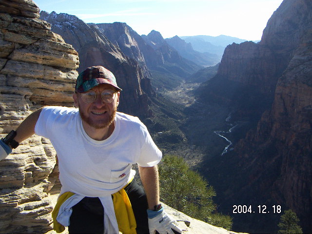
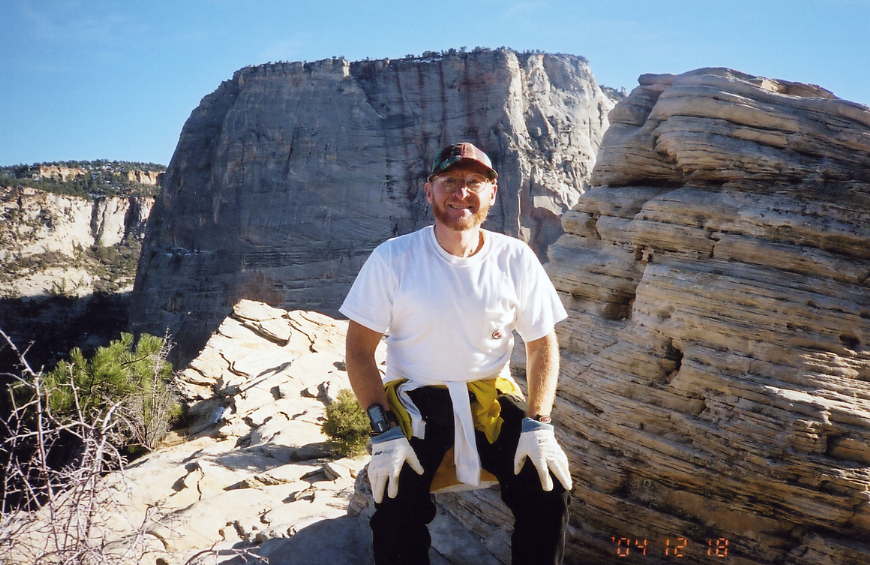
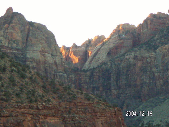
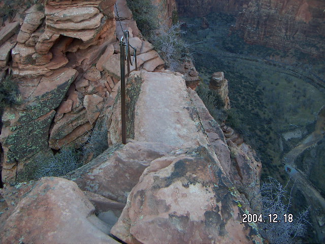 The hike
to Angel's Landing
(photo array)
is a noticeable uphill climb
with views of the Virgin River,
steep, high rocks,
and a lovely side canyon with trees and a brook
ending with a series of small switchbacks
known as Walter's Wiggles.
There is wildlife to be seen along the way
(photo array).
The hike
to Angel's Landing
(photo array)
is a noticeable uphill climb
with views of the Virgin River,
steep, high rocks,
and a lovely side canyon with trees and a brook
ending with a series of small switchbacks
known as Walter's Wiggles.
There is wildlife to be seen along the way
(photo array).
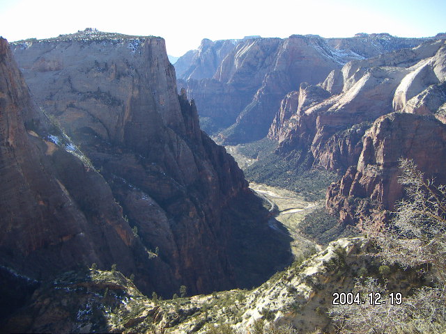
 The views along the way are wonderful.
Never mind the usual advice for the fearful,
"don't look down,"
the best of Angel's Landing
is the opportunity to look up, down, and all around
along the way to the top.
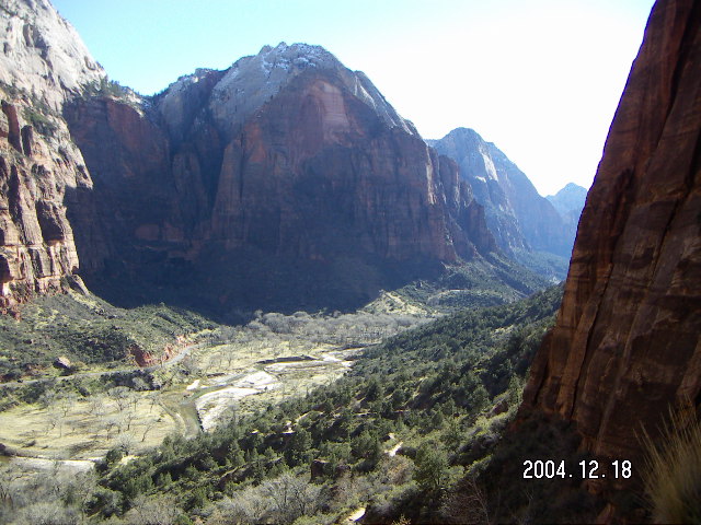
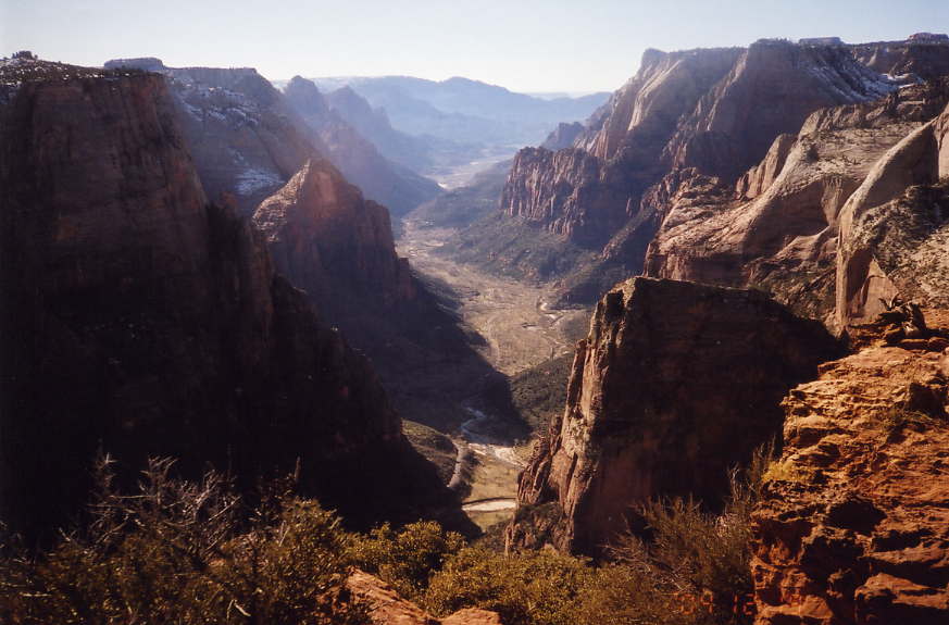
The view at the top is stunning, of course,
with a panoramic view of the river and the road below
and the plateaus above
(photo array).
Angel's Landing may be high above the bottom,
but it's still significantly below the canyon tops on either side.
The views along the way are wonderful.
Never mind the usual advice for the fearful,
"don't look down,"
the best of Angel's Landing
is the opportunity to look up, down, and all around
along the way to the top.
The view at the top is stunning, of course,
with a panoramic view of the river and the road below
and the plateaus above
(photo array).
Angel's Landing may be high above the bottom,
but it's still significantly below the canyon tops on either side.


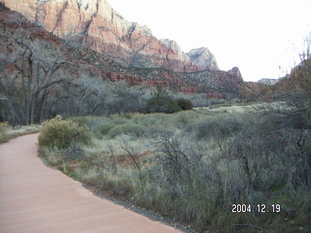 The Pa'rus trail is a paved path running along the Virgin River
(photo array),
a perfect spot for a morning run to greet my day.
The round trip is 5.8 Km (3.6 miles)
of rushing-river tranquility and majestic mountain views.
This was definitely the right way to start my
birthday.
The Pa'rus trail is a paved path running along the Virgin River
(photo array),
a perfect spot for a morning run to greet my day.
The round trip is 5.8 Km (3.6 miles)
of rushing-river tranquility and majestic mountain views.
This was definitely the right way to start my
birthday.
 Zion's Great Big Climb is the
650 meter (2150 foot) ascent from the road
by the Virgin River
to Observation Point.
This 7-Km (four-mile) hike
goes up switchbacks along rock faces and through lovely canyons.
Zion's Great Big Climb is the
650 meter (2150 foot) ascent from the road
by the Virgin River
to Observation Point.
This 7-Km (four-mile) hike
goes up switchbacks along rock faces and through lovely canyons.
 Turning left instead of right at the junction
goes up through Echo Canyon
to Observation Point
(photo array).
For a few climbing kilometers the views are stunning and more stunning
and then there is a walk of about one kilometer (0.6 miles)
with little elevation change
through woods and meadows with glimpses on the left side
of the panoramic view to come.
Turning left instead of right at the junction
goes up through Echo Canyon
to Observation Point
(photo array).
For a few climbing kilometers the views are stunning and more stunning
and then there is a walk of about one kilometer (0.6 miles)
with little elevation change
through woods and meadows with glimpses on the left side
of the panoramic view to come.
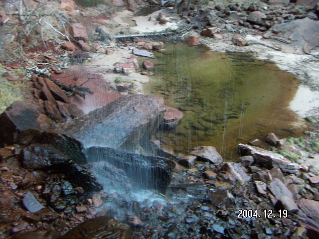 There are three levels of Emerald Ponds at Zion,
Lower, Middle, and Upper,
all formed by water cascading down from high waterfalls,
a truly lovely sight
(photo array).
The hikes to the three ponds levels are progressively harder
going from an easy walk to the Lower,
a few hills to the Middle,
and climbing uphill over rough rocks to the Upper.
There are three levels of Emerald Ponds at Zion,
Lower, Middle, and Upper,
all formed by water cascading down from high waterfalls,
a truly lovely sight
(photo array).
The hikes to the three ponds levels are progressively harder
going from an easy walk to the Lower,
a few hills to the Middle,
and climbing uphill over rough rocks to the Upper.
 My morning-after-birthday run was 6 Km (four miles)
on the Watchman trail,
about one third of which consisted of rocks too rugged
for this ragged rascal to run around,
so I ended up mixing running and hiking
as the sunlight worked its way down the rocky canyon walls
(photo array).
One reason I try to run some of the trails
is that I'm a runner, I enjoy running,
and I find running a pleasant way to enjoy a place.
The other reason is that hiking and running use different muscles
and I cover more trail without more hiking effort by running
where terrain and footing make it practical.
My morning-after-birthday run was 6 Km (four miles)
on the Watchman trail,
about one third of which consisted of rocks too rugged
for this ragged rascal to run around,
so I ended up mixing running and hiking
as the sunlight worked its way down the rocky canyon walls
(photo array).
One reason I try to run some of the trails
is that I'm a runner, I enjoy running,
and I find running a pleasant way to enjoy a place.
The other reason is that hiking and running use different muscles
and I cover more trail without more hiking effort by running
where terrain and footing make it practical.
 On my way out of the park to Kanab Airport,
I decided to take a stroll on the East Rim trail.
This trail starts at the highway on the plateau surrounding the canyon,
goes a long way,
and ends up at Observation Point,
but I did not have enough time
and my legs no longer had enough energy
for such an effort.
So I went 2 Km (1.2 miles) in and back out
(photo array).
Even with patches of snow,
the walk was not challenging
and the scenery was still quite scenic.
I would imagine the views become more magnificent
as one ventures deeper into the wilderness.
This would be a great morning run,
but I already did one on the Watchman trail.
On my way out of the park to Kanab Airport,
I decided to take a stroll on the East Rim trail.
This trail starts at the highway on the plateau surrounding the canyon,
goes a long way,
and ends up at Observation Point,
but I did not have enough time
and my legs no longer had enough energy
for such an effort.
So I went 2 Km (1.2 miles) in and back out
(photo array).
Even with patches of snow,
the walk was not challenging
and the scenery was still quite scenic.
I would imagine the views become more magnificent
as one ventures deeper into the wilderness.
This would be a great morning run,
but I already did one on the Watchman trail.
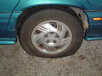
 My trip back to Deer Valley (DVT)
had only one a priori wrinkle,
the flat tire from Saturday.
I sprayed the fix-a-flat can into the tire
which gave me enough air to get to the gas pump
where the compressed-air hose was located.
From there, the folks at Kanab Airport (KNB)
figured out that the valve was leaking at the stem
and we could tape it to one side to minimize the leak.
It only had to hold for two-and-a-half hours
and one landing.
Once it was on the ground at DVT I could let my mechanic fix it.
As you can see in the picture, taken after landing at DVT,
the yellow-tape repair held up very well.
My trip back to Deer Valley (DVT)
had only one a priori wrinkle,
the flat tire from Saturday.
I sprayed the fix-a-flat can into the tire
which gave me enough air to get to the gas pump
where the compressed-air hose was located.
From there, the folks at Kanab Airport (KNB)
figured out that the valve was leaking at the stem
and we could tape it to one side to minimize the leak.
It only had to hold for two-and-a-half hours
and one landing.
Once it was on the ground at DVT I could let my mechanic fix it.
As you can see in the picture, taken after landing at DVT,
the yellow-tape repair held up very well.
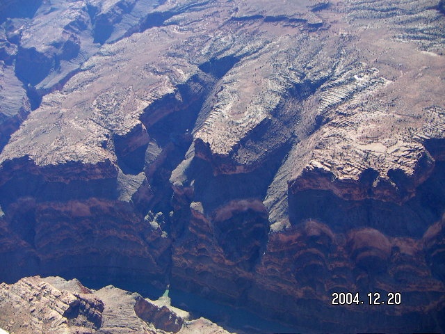 The flight was otherwise uneventful,
or at least as uneventful as any flight
over the Grand Canyon could be
(photo array).
It was a thrill the first time I rented an airplane
and flew over it in 1988 January,
it was a thrill when I flew my own bird over it in 2003 October,
it was a thrill this time,
and it was a thrill all the other times, too.
One of these
days
I'll have to hike to the bottom and back up.
At least it's only one hill on the way out (yuk, yuk, yuk).
The flight was otherwise uneventful,
or at least as uneventful as any flight
over the Grand Canyon could be
(photo array).
It was a thrill the first time I rented an airplane
and flew over it in 1988 January,
it was a thrill when I flew my own bird over it in 2003 October,
it was a thrill this time,
and it was a thrill all the other times, too.
One of these
days
I'll have to hike to the bottom and back up.
At least it's only one hill on the way out (yuk, yuk, yuk).
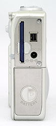 My new toy for this trip is a
Minolta Dimage X31
camera with enough memory to take oodles of pictures,
about 1600 at the resolution I use for these web snapshots.
Unlike my analogue camera that goes about a year
between battery changes,
this "puppy" draws enough juice to require two sets
of Nickel Metal Hydride AA batteries
with recharging every night.
My new toy for this trip is a
Minolta Dimage X31
camera with enough memory to take oodles of pictures,
about 1600 at the resolution I use for these web snapshots.
Unlike my analogue camera that goes about a year
between battery changes,
this "puppy" draws enough juice to require two sets
of Nickel Metal Hydride AA batteries
with recharging every night.
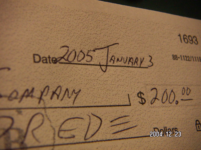 How many cheques are you going to write next month
before you remember to put the year 2005 on them
instead of 2004?
How many cheques are you going to write next month
before you remember to put the year 2005 on them
instead of 2004?
13:33:22 Mountain Standard Time
(MST).
2169 visits to this web page.